

MAPS
A map is an essential tool of a geographer. Map is a representation of the earth as a whole or a part of the earth drawn on a flat surface according to a given scale. It can show continents, countries, cities and even a local area are drawn with specific details.
TYPES OF MAPS
As each map is unique in its design, content and construction. On the basis of certain common features maps can be classified into several types.
✓On the basis of Scale
✓On the basis of Content
Each divided into two types
On the basis of Scale
✓Large Scale
✓Small Scale
On the basis of Content
✓Physical
✓Cultural
Maps on the basis of content
Physical maps are divided into four types. They are
✓Relief maps
✓Geological maps
✓Climatic maps
✓Soil maps
Cultural maps are divided into five types. They are
✓Political maps
✓Population maps
✓Economic maps
✓Transportation maps
✓Thematic maps
Physical maps
Physical maps show natural features such as relief, geology, soils, drainage, elements weather and vegetation.
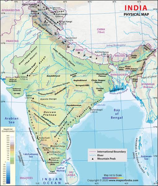
Relief maps
Relief maps show general topography like mountains valleys, plains, plateaus and rivers.

Geological maps
Geological maps are drawn to show geological structures, rocks and minerals.

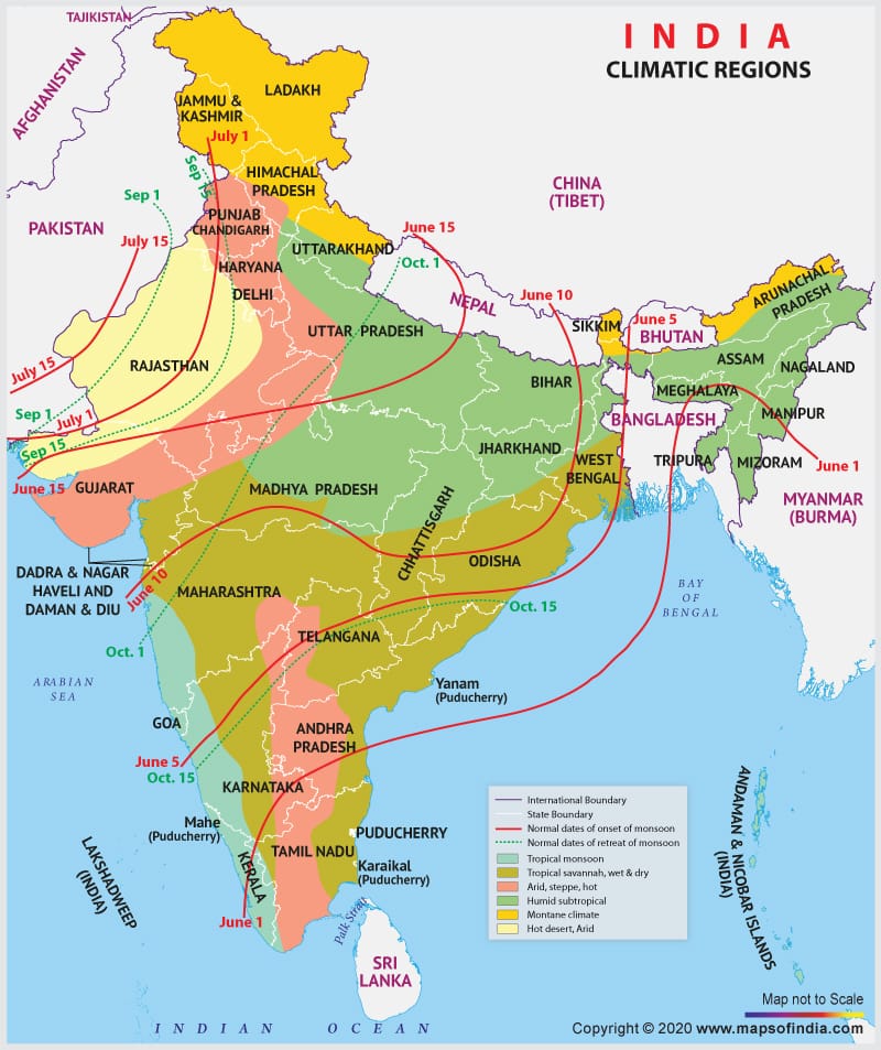
Climatic maps
Climatic maps show the distribution of temperature, rainfall, clouds, relative humidity, direction and velocity of winds and other elements of weather.
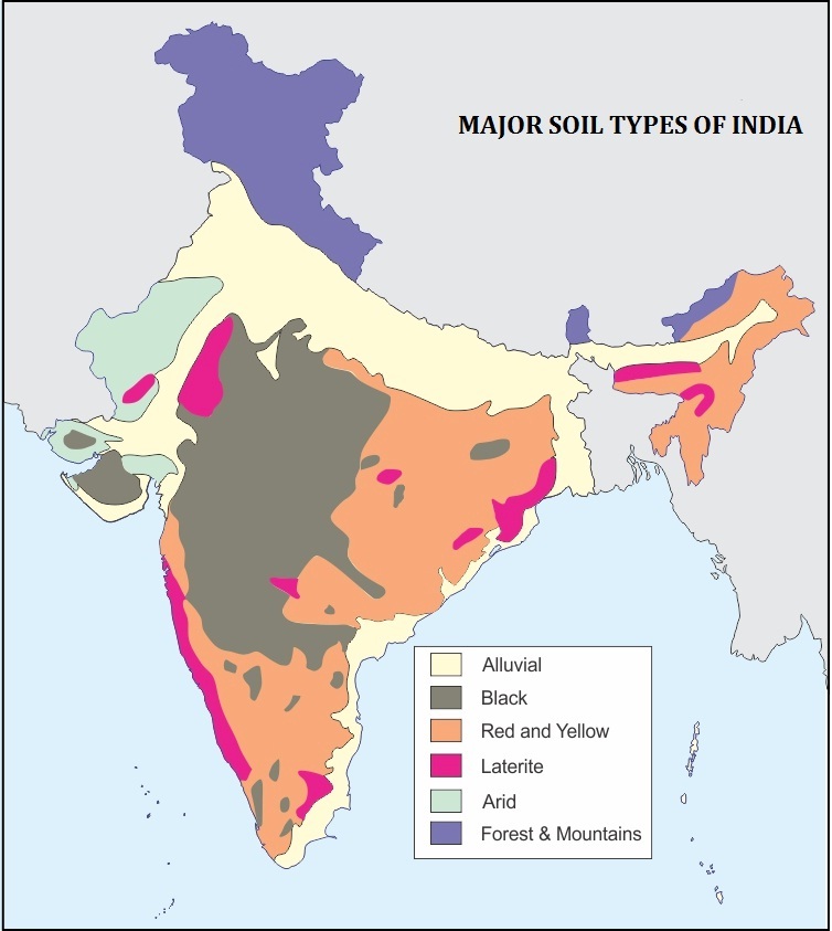
Soil maps
Soil maps which are drawn to show the distribution of different types of soil and their properties.
Cultural maps
Cultural maps which shows the man-made features are called cultural maps.

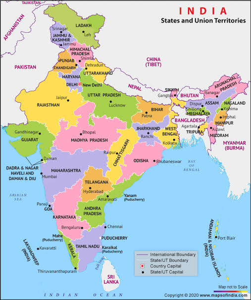
Political maps
Political maps show the administrative divisions of a country, state or district. These maps facilitate the administration in planning and management of the concerned administrative units.
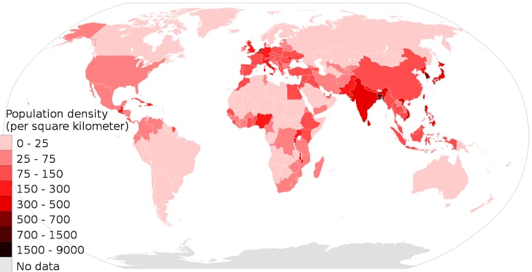
Population maps
Population maps show the distribution, density and growth of population, occupation structure and literacy.
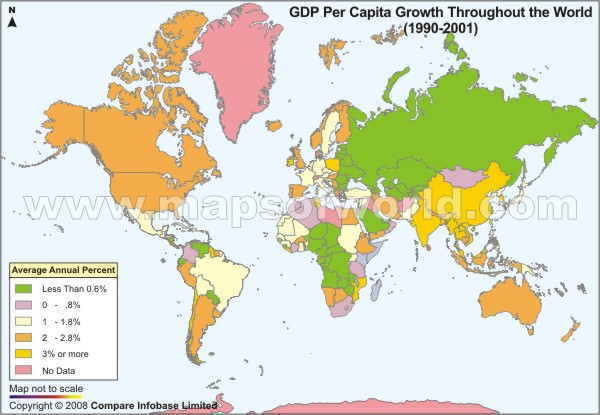
Economic maps
Economic maps depict the production and distribution of different types of crops and minerals, location of industries, trade routes and flow of commodities.
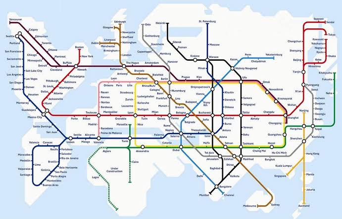
Transportation maps
Transportation maps show roads, railway lines and the location of railway station, airports and seaports, etc.,
Thematic maps
Thematic maps represent the distribution of a particular feature or theme and its spatial variation.


You must be logged in to post a comment.