

Author: Admin
Track2Training for students. Learn more on https://track2training.com
What is Procedure For Preparation Of Master Plan
What is Procedure For Preparation Of Master Plan
Disposal of Nazul Land as per Delhi Development Act 1957
Disposal of Nazul Land
3. Purposes for which Nazul land may be allotted. – Authority may allot Nazul land for public utilities, community facilities, open spaces, parks, playgrounds, residential purposes, industrial and commercial uses and such other purposes as may be specified from time to time by the Central Government by notification.

4. Persons to whom Nazul land may be allotted. – [(1)] The Authority may, in conformity with the plans, and subject to the other provisions of these rules, allot Nazul land to individuals, [body of persons, firms, companies], public and private institutions, co-operative house building societies, other co-operative societies of individuals, co-operative societies of industrialists and to the departments of the Central Government, State Governments and the Union territories.
(i) health facilities;
(ii) education or higher education facilities;
(iii) socio cultural and community facilities;
(iv) sports facilities:
Provided that nothing in this sub-rule shall affect the allotment of land to the Central Government, a State Government, a Union territory, any local body, autonomous bodies or organisations owned by the Central Government:
Provided further that the land allotted under this sub-rule shall be utilised in accordance with the use specified in the allotment, and as per the norms of the Master Plan for the said use.]
[5. Rules of premium for allotment of nazul land to certain institutions. – Subject to the provision of sub-rule (2) of rule 4, the Authority may allot nazul land to –
(a) Central Government or State Government or Union territory Administration;
(b) autonomous body constituted by Central Government or State Government or Union territory Administration or partly by the Central Government and partly by one or more State Governments or Union territory Administrations;
(c) social or charitable institutions, eligible under rule 20;
(d) political organisations recognised by the Election Commission of India, or
(e) local bodies, for remunerative, semi-remunerative or un-remunerative purposes, at the premia and ground rent at such rates as the Central Government may determine from time to time:
Provided that use of land allotted under this rule shall be governed by the Master Plan norms, and the conditions subject to which such allotment is made.]
6. Allotment of Nazul land at pre-determined rates. – Subject to the other provisions of these rules, the Authority shall allot Nazul land at the pre-determined rates in the following cases namely:-
(i) to individuals whose land has been acquired for planned development of Delhi after the 1st day of January,1961, and which forms part of Nazul land:
PROVIDED that if an individual is to be allotted a residential plot, the size of such plot may be determined by the Administrator after taking into consideration the area and the value of the land acquired from him and the location and the value of the plot to be allotted;
(ii) to individuals in the low income group or the middle income group other than specified in clause (i) –
(a) who are tenants in a building in any area in respect of which a slum clearance order is made under the Slum Areas Act;
(b) who, in any slum area or the other congested area, own any plot of land measuring less than 67 square metres or own any building in any slum area or other congested area;
(iii) to individuals, other than those specified in clauses (i) and (ii), who are in the low income group or the middle income group, by draw of lots to be conducted under the supervision of the Land Allotment Advisory Committee;
(iv) to individuals belonging to Scheduled Castes and Scheduled Tribes or who are widows of defence personnel killed in action, or ex-servicemen, physically handicapped individuals subject to the provisions of rule 13;
(v) to industrialists or owners and occupiers of warehouses who are required to shift their industries and warehouses from non-conforming areas to conforming area under the Master Plan, or whose land is acquired or is proposed to be acquired under the Act:
PROVIDED that the size of such industrial plot shall be determined with reference to the requirement of the industry or warehouses set up or to be set up in accordance with the plants and such industrialists and owners of warehouses have the capacity to establish and run such industries or warehouses and on the condition that the land allotted at pre-determined rates shall not, in any case, exceed the size of the land which has been, if any, acquired from such industrialist or owners and occupiers of warehouses and which form part of Nazul land:
PROVIDED FURTHER that in making such allotment, the Authority shall be advised by the Land Allotment Advisory Committee;
|
OLD LAW ▼ |
8. Manner of allotment. – [Save as otherwise provided in sub-rule (2) of rule 4, rules 5, and 6, allotment of nazul land for any other purpose shall be made on payment of such premium as may be determined either by auction or by tender in accordance with the provisions of Chapter III or Chapter IV, as the case may be, of these rules.]
9. Allotment to owners in slum clearance areas. – Where a person who owns and resides in any building in any area in respect of which a slum clearance order is made under the Slum Areas Act, or whose land is acquired under that Act, applies for allotment of Nazul land for a residential purpose in lieu of his land cleared of building in accordance with the slum clearance order, or acquired under that Act, he may, subject to the minimum size of the plot of land being 67 square metres, allotted Nazul land for that purpose not exceeding 111.48 square metres without any charge:
PROVIDED that such person-
(a) belongs to a low income group or middle income group;
(b) accepts the allotment without the compensation payable under the said Act;
(c) does not claim to redevelop the land cleared of such building in accordance with that slum clearance order;
(d) has given up possession of such land or the land which has been acquired, to the competent authority under the said Act; and
(e) where the size of his land as aforesaid is less than 57 square metres, agrees to pay for the extra land at the pre-determined rates applicable to a person in the low income group or the middle income group to which he belongs.
10. Allotment of tenants in slum areas. – Where an individual who is a tenant in a building in any area in respect of which a slum clearance order is made under the Slum Areas Act, applies for allotment of Nazul land for a residential purpose/he may be allotted a plot of 67 square metres of Nazul land for that purpose on pre-determined rates:
PROVIDED that such individual-
(a) belongs to low income group or a middle income group;
(b) has given possession of the building occupied by him to the competent authority under the Slum Areas Act;
(c) does not choose to shift to any house in any slum clearance scheme;
(d) does not choose to be replaced in occupation of that building under the Slum Areas Act.
11. Allotment to owners of dangerous building in slum areas. – Where an individual who owns in any slum area or any other congested area, a plot of land measuring less than 67 square metres, or a house which is declared to be unfit for human habitation under the provisions of the Slum Areas Act, or any other law, is not permitted to re-build or re-develop under the Slum Areas Act or under any other law, applies for allotment of Nazul land for a residential purpose, he may be allotted a plot of land for that purpose not exceeding 67 square metres at pre-determined rates:
PROVIDED that he surrenders his land in the slum areas or congested locality.
12. Priority of allotment for residential purposes. – Subject to the availability of land for allotment for residential purposes, among the individuals referred to in clauses (i) and (ii) of rule 6, the individuals referred to in clause (i) shall be preferred to the individuals referred to in clause (ii) and those in clause (ii) shall be preferred to those in clause (iii).
13. Reservation for Scheduled Castes, Scheduled Tribes and others. – (1) The Authority shall, with the previous permission of the Central Government, reserve such percentage of Nazul land available for allotment for residential purposes at any given time, to individuals in the low income group or the middle income group, who are members of the Scheduled Castes and Scheduled Tribes, widows of defence personnel killed in action, ex-servicemen, physically handicapped individuals or such other category of individuals as may be specified in the permission.
(2) Plots measuring not more than 111.48 square metres shall be allotted for residential purposes at pre-determined rates, to the individuals referred to in sub-rule (1), and where the number of such individuals exceed the number of plots reserved for each category of persons under sub-rule (1), the allotment shall be made by draw of lots under the supervision of the Land Allotment Advisory Committee.
14. Reservation not to affect right to general allotment. – Notwithstanding the reservation of Nazul land made in rule 13, where any such individual as is referred to in that rule, fails to get an allotment of a plot of land in the Nazul land so reserved, by the draw of lots held under that rule, he or she shall be entitled to the allotment of a plot of land for residential purposes at pre-determined rates by draw of lots under clause (vii) of rule 6, in any Nazul land not reserved under the first mentioned rule:
PROVIDED that such individual belongs to the low income group or the middle income group
15. Allotment to individuals not accepting allotment of Nazul land on certain conditions. – Where an individual belonging to the low income group or the middle income group does not accept allotment of Nazul land for residential purposes on conditions mentioned in rule 9, 10 or 11, other than the conditions mentioned in rule 17, he shall be entitled to the allotment of Nazul land, at pre-determined rates, for residential purposes-
(a) under rule 13, if he is an individual referred to in that rule;
(b) under clause (iii) of rule 6, in any other case.
16. Certain persons entitled to allotment by auction. – Subject to the other provisions of these rules, all [individuals including the following categories of individuals, companies and firms] , shall be entitled to the allotment of Nazul land for residential purposes, by auction, namely:
(i) individuals not residing in any building owned by them in any slum area in respect of which a slum clearance order is made under the Slum Areas Act;
(ii) individuals whose land situated in any such area as is referred to in clause (i) is acquired under the Slum Areas Act and who reside elsewhere;
(iii) individuals who do not accept allotment on conditions mentioned in rules 9, 10 and 11 and who are not entitled to allotment under rule 15;
(iv) co-sharers of joint ancestral land or buildings in a slum area under the Slum Areas Act whose individual share is not less than 67 square metres in such land or building.
17. General restriction to allotment for residential purposes. – Notwithstanding anything contained in these rules, no plot of Nazul land shall be allotted for residential purposes, to an individual other than an individual referred to in clause (i) of rule 6, who or whose wife or husband or any of his or her dependent children, whether minor or not, or any of his or her dependent parents or dependent minor brothers or sisters, ordinarily residing with such individual, own in full or in part, on lease-hold or free-hold basis, any residential land or, house or who has been allotted on hire-purchase basis any residential land or house in the Union territory of Delhi:
PROVIDED that where, on the date of allotment of Nazul land,-
(a) the other land owned by or allotted to such individual is less than 67 square metres, or
(b) the house owned by such individual is on a plot of land which measures less than 67 square metres, or
(c) the share of such individual in any such other land or house measures less than 67 square metres, he may be allotted a plot of Nazul land in accordance with the provisions of these rules.
18. Size of plots. – Save as otherwise provided in these rules, the maximum size of a plot allotted to an individual for a residential purpose shall be-
(i) 104 square metres in the case of an individual belonging to the low income group;
(ii) 167 square metres (but not less than 105 square metres) in the case of an individual belonging to the middle income group; and
(iii) 500 square metres in any other case.
19. Allotment of industrial and commercial plots. – (1) Save as otherwise provided in clause (v) of rule 6, the number and size of the plots of Nazul land for an industrial or commercial purpose shall be determined, from time to time, by the Authority.
(2) In making an allotment of plot for an industrial or commercial purpose, the Authority shall be guided by the advice of the Land Allotment Advisory Committee.
(3) The Land Allotment Advisory Committee shall, in making its recommendations to the Authority, take into account such relevant factors as it may deem proper in the circumstances of the case.
(4) Without prejudice to the generality of the provision of sub-rule (3), the Land Allotment Advisory Committee shall consider whether the setting up of the industry or commercial establishment is required to shift from a non-conforming area to a conforming area under the plans.
20. [Eligibility for allotment, to social or charitable institutions]. – [***] No allotment of Nazul land to public institution referred to in rule 5 shall be made unless-
[(a) according to the aims and objects of that institution –
(i) it directly sub serves the interests of the citizens of India;
(ii) it is generally conducive to the planned development of the National Capital Territory of Delhi;
(b) it is a society registered under the Societies Registration Act, 1860 (21 of 1860) or such institution is owned and run by the Government or any Local Authority, or is constituted or established under any law [for the time being in force or it is a company, firm or trust for the purpose of establishment of [hospitals, dispensaries or higher/technical education institutes,] [or such other charitable purpose as deemed fit by the Central Government and notified by an order in this regard.]
(c) it is of non-profit making character;
(d) it is in possession of sufficient funds to meet the cost of land and the construction of buildings for its use; and
(e) allotment to such institution is sponsored or recommended by a Department of the Government of National Capital Territory of Delhi] or a Ministry of the Central Government:
[PROVIDED that in case of allotment to a company, firm or trust for the purpose of establishment of [hospitals, dispensaries or higher/technical education institutes] by tenders or auction, as the case may be, such company, firm or trust, as the case may be, shall not be required to be sponsored by a Department of the Government of National Capital Territory of Delhi or a Ministry of the Central Government.]
[PROVIDED that nothing in this rule shall apply to the provisions of sub-rule (2) of rule 4.]
|
OLD LAW ▼ |
22. Vesting of lease-hold rights. – Where Nazul land is allotted to a co-operative society, lease-hold rights thereof shall subject to the terms of the lease-deed between the President of India and the society, remain with such society.
23. Agreements between the co-operative societies and their members. – Where Nazul land has been allotted to a co-operative society, such members of the society who are allotted a plot or flat by such society shall execute a sub-lease in favour of the society in respect of each plot or flat allotted to them. The terms and conditions of such sub-lease shall, as nearly as circumstances permit, be in accordance with Form A and Form B appended to these rules. In addition, such sub-lease may contain such covenants, clauses or conditions, not inconsistent with the provisions of Form A or Form B as may be considered necessary and advisable by the society, having regard to the nature of a particular sub-lease.
[24. Manner of realization of premium or price of plots. – (1) Save as otherwise provided in rules 29, 36 and 40, premium or price of plots of Nazul land chargeable in accordance with the provisions of these rules shall be realized in instalments in the following manner, namely:
(a) 25 per cent of the total land premium for the plot, along with such earnest money, not exceeding 10 per cent of the premium, as may be decided by the Authority, shall be deposited at the time of submitting the application for allotment of land;
(b) 50 per cent of the premium shall be deposited within 60 days of the issue of demand-cum-allotment letters; and
(c) balance premium after adjusting the earnest money shall be deposited before taking over possession of the land or within two months of the receipt of communication from the Authority offering possession, whichever is earlier.
(2) If the premium or price of land as provided in sub-rule (1) is not deposited, the earnest money deposited shall be forfeited and it shall be competent for the Authority to allot the land to any other person including a co-operative society in accordance with the prescribed procedure.]
25. Nazul land for use of the Authority. – With a view to enabling it to perform its functions under the Act, the Authority may, with the previous permission of the Central Government, set apart such Nazul land for its own use on such terms and conditions as may be specified in the permission.
What are Different Types of Pollution
There are various types of pollution chiefly arising as a result of anthropogenic causes. Also contributing to pollution is globalisation, where humanity’s constant need for natural resources has slowly started to change the face of the earth.
Though the quality of living has drastically improved, other new issues have risen that gradually impact human health and the environment. In this article, we shall explore the meaning, causes and types of pollution. Also, we shall analyse the repercussions of pollution on human health and the environment.
Types of Pollution
What is Pollution?
“Pollution is the introduction of substances (or energy) that cause adverse changes in the environment and living entities .”
Pollution need not always be caused by chemical substances such as particulates (like smoke and dust). Forms of energy such as sound, heat or light can also cause pollution. These substances that cause pollution are called pollutants.
Pollution, even in minuscule amounts, impacts the ecological balance. Pollutants can make their way up the food chain and eventually find their way inside the human body. Read on to explore the types of pollution and their implications.
Types of Pollution
As stated before, there are different types of pollution, which are either caused by natural events (like forest fires) or by man-made activities (like cars, factories, nuclear wastes, etc.) These are further classified into the following types of pollution:
- Air Pollution
- Water Pollution
- Soil Pollution
- Noise Pollution
Besides these 4 types of pollution, other types exist such as light pollution, thermal pollution and radioactive pollution. The latter is much rarer than other types, but it is the deadliest.
Air Pollution
Air Pollution
Air pollution refers to the release of harmful contaminants (chemicals, toxic gases, particulates, biological molecules, etc.) into the earth’s atmosphere. These contaminants are quite detrimental and in some cases, pose serious health issues. Some causes that contribute to air pollution are:
- Burning fossil fuels
- Mining operations
- Exhaust gases from industries and factories
The effects of air pollution vary based on the kind of pollutant. But generally, the impact of air pollution ranges from:
- Increased risk of respiratory illness and cardiovascular problems
- Increased risk of skin diseases
- May increase the risk of cancer
- Global warming
- Acid rain
- Ozone depletion
- Hazards to wildlife
Among the other types of pollution, air pollution is theorized to have a planet-wide implication. Scientists have even speculated an apocalypse-like scenario where air pollution if left unchecked, can bring about an extreme form of global warming called the runaway greenhouse effect. Though this is purely speculative, it is a phenomenon that has already occurred on Venus.
Water Pollution
Water Pollution
Water Pollution
Water pollution is said to occur when toxic pollutants and particulate matter are introduced into water bodies such as lakes, rivers and seas. These contaminants are generally introduced by human activities like improper sewage treatment and oil spills. However, even natural processes such as eutrophication can cause water pollution.
Other significant causes of water pollution include:
- Dumping solid wastes in water bodies
- Disposing untreated industrial sewage into water bodies
- Human and animal wastes
- Agricultural runoff containing pesticides and fertilisers
The effects of water pollution are very pronounced in our environment. Furthermore, toxic chemicals can bioaccumulate in living beings, and these chemicals can travel their way up the food chain, ultimately reaching humans.
Among the other types of pollution, water pollution has severe consequences on humans. For instance, in 1932, a grave case of water pollution incapacitated the inhabitants of an entire city in Japan with neurological diseases and mental illness for many decades. However, the immediate cause was not apparent but was eventually attributed to acute mercury poisoning. Methylmercury was dumped into the surrounding bay and had ultimately bioaccumulated inside the fish. The local population then consumed these fish, and this resulted in the manifestation of ill effects and neurological diseases.
Other consequences of water pollution include:
- Disruption of the ecosystem
- Threats to marine life
- Increased risk of water-borne diseases
- Increases toxic chemicals (such as mercury) in water bodies
- Eutrophication
Soil Pollution
Soil Pollution
Soil pollution, also called soil contamination, refers to the degradation of land due to the presence of chemicals or other man-made substances in the soil. The xenobiotic substances alter the natural composition of soil and affect it negatively. These can drastically impact life directly or indirectly. For instance, any toxic chemicals present in the soil will get absorbed by the plants. Since plants are producers in an environment, it gets passed up through the food chain. Compared to the other types of pollution, the effects of soil pollution are a little more obscured, but their implications are very noticeable.
Some of the common causes of soil pollution are:
- Improper industrial waste disposal
- Oil Spills
- Acid rain which is caused by air pollution
- Mining activities
- Intensive farming and agrochemicals (like fertilisers and pesticides)
- Industrial accidents
The effects of soil pollution are numerous. Specific wastes, such as radioactive waste become particularly hazardous when they are not well-contained. A well-documented example is a nuclear accident in Chernobyl, which has left an area of 2,600 km2 uninhabitable for several thousand years.
Other effects of soil pollution include:
- Loss of soil nutrients, which renders the soil unfit for agriculture
- Impacts the natural flora and fauna residing in the soil
- Degrades vegetation due to the increase of salinity of the soil
- Toxic dust (such as silica dust) can cause respiratory problems or even lung cancer
Noise Pollution
Noise Pollution
Noise pollution refers to the excessive amount of noise in the surrounding that disrupts the natural balance. Usually, it is man-made, though certain natural calamities like volcanoes can contribute to noise pollution.
In general, any sound which is over 85 decibels is considered to be detrimental. Also, the duration an individual is exposed plays an impact on their health. For perspective, a normal conversation is around 60 decibels, and a jet taking off is around 15o decibels. Consequently, noise pollution is more obvious than the other types of pollution.
Noise pollution has several contributors, which include:
- Industry-oriented noises such as heavy machines, mills, factories, etc.
- Transportation noises from vehicles, aeroplanes, etc.
- Construction noises
- Noise from social events (loudspeakers, firecrackers, etc.)
- Household noises (such as mixers, TV, washing machines, etc.)
Noise pollution has now become very common due to dense urbanisation and industrialisation. Noise pollution can bring about adverse effects such as :
- Hearing loss
- Tinnitus
- Sleeping disorders
- Hypertension (high BP)
- Communication problems
Frequently Asked Questions
What are the different types of pollution?
The different types of pollution include:
- Air pollution
- Water pollution
- Soil pollution
- Radioactive pollution
- Noise pollution
Name the harmful pollutants responsible for polluting the environment.
The harmful pollutants responsible for polluting the environment are:
- Nitrogen oxide
- Sulphur oxide
- Mercury
- Particulate matter
- Chlorofluorocarbon
- Volatile organic compounds
What are the different types of pollutants?
The different types of pollutants are:
- Primary Pollutants: These are the pollutants that are emitted directly from the sources such as volcanic eruptions, combustion of fossil fuel, etc. These include nitrogen oxide, sulphur oxide, etc.
- Secondary Pollutants: These are the pollutants that are not directly emitted from the sources but are formed when primary pollutants react in the atmosphere. For eg., ozone.
What is radioactive pollution?
Radioactive pollution is the pollution caused by the release of radioactive substances in the atmosphere during activities such as nuclear explosions, mining of radioactive ores, etc.
What are the consequences of mercury pollution?
Mercury pollution is the pollution caused by the release of mercury from mercury products or emissions from coal-burning power plants in the air, water or land. Mercury pollution results in neurological and behavioural disorders in humans. Insomnia, memory loss, headaches, and tremors are some of the symptoms of mercury pollution
What are Different Types of Pollution
What are Different Types of Pollution
Survey, Form And Content Of The Master Plan
Survey, Form And Content Of The Master Plan
Survey, Form And Content Of The Master Plan
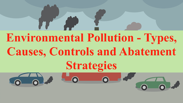
Environmental Pollution – Types, Causes, Controls and Abatement Strategies
Environment Pollution: Types, Causes, Effects:
Environmental Pollution is not a new phenomenon, yet it remains one of the greatest threats to the health and well-being of humanity and one of the major environmental causes of death and morbidity. For example, substances such as plastic materials, heavy metals, etc., once released into the atmosphere. By natural processes, it cannot be degraded and are harmful to living organisms. In environmental pollution, pollutants originate from a source, are transported by air or water, and are dumped into the soil by human beings.
The long-term impacts of pollution are still being felt despite global attention to the issue. Day by day, our atmosphere is becoming more and more polluted due to anthropogenic activities. It is usually due to the pollutants released into the air, water, soil, etc., through many human activities. Let us examine the different types of environmental pollution.

What is Right of Way
What is Right of Way
Energy Performance Evaluation
Energy performance evaluation is a crucial aspect of building design and operation, aimed at assessing and optimizing a building’s energy consumption and efficiency. It involves using various tools, techniques, and simulations to analyze how a building uses energy for heating, cooling, lighting, and other systems. The goal is to identify opportunities for energy savings, make informed design decisions, and improve the overall sustainability of the building.

Here’s an overview of the steps involved in energy performance evaluation:
Data Collection: Gather information about the building’s design, construction, and systems. This includes architectural drawings, specifications of building components, HVAC (heating, ventilation, and air conditioning) system details, lighting specifications, and occupancy patterns.
Energy Modeling: Create a computer-based energy model of the building using specialized software. This model simulates the building’s energy consumption based on factors such as its orientation, location, climate, insulation levels, and the performance characteristics of its systems and components.
Simulation: Run simulations using the energy model to predict how the building will perform under different conditions, such as varying outdoor temperatures, occupancy patterns, and lighting schedules. Simulations can help identify peak energy demand times, potential areas of energy waste, and opportunities for improvement.
Baseline Comparison: Compare the simulation results with a baseline scenario, which typically represents a standard or minimum energy efficiency requirement. This comparison helps gauge the effectiveness of energy-saving measures.
Energy Conservation Measures (ECMs): Identify and evaluate various energy-saving strategies and technologies that can be implemented to improve energy efficiency. These measures could include upgrading insulation, optimizing HVAC systems, using energy-efficient lighting, installing renewable energy sources (such as solar panels), and improving building envelope performance.
Sensitivity Analysis: Conduct sensitivity analyses to understand how changes in different parameters affect energy consumption. This helps prioritize which measures have the most significant impact on energy performance.
Cost-Benefit Analysis: Evaluate the costs associated with implementing energy conservation measures against the expected energy savings over the building’s lifespan. This analysis helps in making informed decisions about which measures are financially viable and provide the best return on investment.
Recommendations: Based on the simulation results, sensitivity analysis, and cost-benefit considerations, generate a set of recommendations for improving the building’s energy performance. These recommendations may vary depending on the project’s goals, budget, and timeline.
Monitoring and Verification: After implementing energy-saving measures, continue to monitor the building’s energy consumption to verify the actual performance and compare it to the predicted results. This step helps ensure that the building is achieving the intended energy savings.
Iterative Process: Energy performance evaluation is often an iterative process, with designers and engineers refining their strategies and simulations as the design progresses or as new data becomes available.
By conducting thorough energy performance evaluations, architects, engineers, and building owners can make informed decisions that result in more energy-efficient buildings, reduced operational costs, and a lower environmental impact.

You must be logged in to post a comment.