What is Cyclone

Cyclones are caused by atmospheric disturbances around a low-pressure area distinguished by swift and often destructive air circulation. Cyclones are usually accompanied by violent storms and bad weather. The air circulates inward in an anticlockwise direction in the Northern hemisphere and clockwise in the Southern hemisphere. Cyclones are classified as: (i) extra tropical cyclones (also called temperate cyclones); and (ii) tropical cyclones. The word Cyclone is derived from the Greek word Cyclos meaning the coils of a snake. It was coined by Henry Peddington because the tropical storms in the Bay of Bengal and the Arabian Sea appear like coiled serpents of the sea.

Classifications

Cyclones are classified as extra tropical cyclones (also called temperate cyclones); and tropical cyclones.

The World Meteorological Organisation (WMO, 1976) uses the term ‘Tropical Cyclone’ to cover weather systems in which winds exceed ‘Gale Force’ (minimum of 34 knots or 63 kph). Tropical cyclones are the progeny of ocean and atmosphere, powered by the heat from the sea; and driven by easterly trades and temperate westerlies, high planetary winds and their own fierce energy.

In India, cyclones are classified by:

  • Strength of associated winds,
  • Storm surges
  • Exceptional rainfall occurrences.

Extra tropical cyclones occur in temperate zones and high latitude regions, though they are known to originate in the Polar Regions.

Cyclones that developin the regions between the Tropics of Capricorn and Cancer are called tropical cyclones. Tropical cyclones are large-scale weather systems developing over tropical or subtropical waters, where they get organized into surface wind circulation.

Worldwide terminology

Cyclones are given many names in different regions of the world – They are known as typhoons in the China Sea and Pacific Ocean; hurricanes in the West Indian islands in the Caribbean Sea and Atlantic Ocean; tornados in the Guinea lands of West Africa and southern USA.; willy-willies in north-western Australia and tropical cyclones in the Indian Ocean. 

Indian Meteorological Department

The criteria below has been formulated by the Indian Meteorological Department (IMD), which classifies the low pressure systems in the Bay of Bengal and the Arabian Sea on the basis of capacity to damage, which is adopted by the WMO.

Type of Disturbances Wind Speed in Km/h Wind Speed in Knots
Low Pressure Less than 31 Less than 17
Depression 31-49 17-27
Deep Depression 49-61 27-33
Cyclonic Storm 61-88 33-47
Severe Cyclonic Storm 88-117 47-63
Super Cyclone More than 221 More than 120

1 knot – 1.85 km per hour
Cyclones are classified into five different levels on the basis of wind speed. They are further divided into the following categories according to their capacity to cause damage:-

Cyclone Category Wind Speed in Km/h Damage Capacity
01 120-150 Minimal
02 150-180 Moderate
03 180-210 Extensive
04 210-250 Extreme
05 250 and above Catastrophic

Storm surges (tidal waves) are defined as the rise in sea level above the normally predicted astronomical tide. Major factors include:

  • A fall in the atmospheric pressure over the sea surface
  • Effect of the wind
  • Influence of the sea bed
  • A funnelling effect
  • The angle and speed at which the storm approaches the coast
  • The tides

The very high specific humidity condenses into exceptionally large raindrops and giant cumulus clouds, resulting in high precipitation rates. When a cyclone makes landfall, rain rapidly saturates the catchment areas and the rapid runoff may extensively flood the usual water sources or create new ones.


How Cyclones are formed

The development cycle of tropical cyclones may be divided into three stages:

Formation and Initial Development Stage
The formation and initial development of a cyclonic storm depends upon various conditions. These are:

  • A warm sea (a temperature in excess of 26 degrees Celsius to a depth of 60 m) with abundant and turbulent transfer of water vapour to the overlying atmosphere by evaporation.
  • Atmospheric instability encouraging formation of massive vertical cumulus clouds due to convection with condensation of rising air above ocean surface.

Mature Tropical Cyclones
When a tropical storm intensifies, the air rises in vigorous thunderstorms and tends to spread out horizontally at the tropopause level. Once air spreads out, a positive perturbation pressure at high levels is produced, which accelerates the downward motion of air due to convection. With the inducement of subsidence, air warms up by compression and a warm ‘Eye’ is generated. Generally, the ‘Eye’ of the storms has three basic shapes: (i) circular; (ii) concentric; and (iii) elliptical. The main physical feature of a mature tropical cyclone in the Indian Ocean is a concentric pattern of highly turbulent giant cumulus thundercloud bands.

Modification and Decay
A tropical cyclone begins to weaken in terms of its central low pressure, internal warmth and extremely high speeds, as soon as its source of warm moist air begins to ebb, or is abruptly cut off. This happens after its landfall or when it passes over cold waters. The weakening of a cyclone does not mean that the danger to life and property is over.

Indian Context

The Indian subcontinent is one of the worst affected regions in the world. The subcontinent with a long coastline of 8041 kilometres is exposed to nearly 10 per cent of the world’s tropical cyclones. Of these, the majority of them have their initial genesis over the Bay of Bengal and strike the East coast of India. On an average, five to six tropical cyclones form every year, of which two or three could be severe. More cyclones occur in the Bay of Bengal than the Arabian Sea and the ratio is approximately 4:1. Cyclones occur frequently on both the coasts (the West coast – Arabian Sea; and the East coast – Bay of Bengal). An analysis of the frequency of cyclones on the East and West coasts of India between 1891 and 1990 shows that nearly 262 cyclones occurred (92 of these severe) in a 50 km wide strip above the East coast. Less severe cyclonic activity has been noticed on the West coast, where 33 cyclones occurred the same period, out of which 19 of were severe.

Tropical cyclones occur in the months of May-June and October-November. Cyclones of severe intensity and frequency in the North Indian Ocean are bi-modal in character, with their primary peak in November and secondary peak in May. The disaster potential is particularly high during landfall in the North Indian Ocean (Bay of Bengal and the Arabian Sea) due to the accompanying destructive wind, storm surges and torrential rainfall. Of these, storm surges cause the most damage as sea water inundates low lying areas of coastal regions and causes heavy floods, erodes beaches and embankments, destroys vegetation and reduces soil fertility.

Cyclones vary in diameter from 50 to 320 km but their effects dominate thousands of square kilometers of ocean surface and the lower atmosphere. The perimeter may measure 1,000 km but the powerhouse is located within the 100-km radius. Nearer the Eye, winds may hit at a speed of 320 km. Thus, tropical cyclones, characterized by destructive winds, torrential rainfall and storm surges disrupt normal life with the  accompanying phenomena of floods due to the exceptional level of rainfall and storm surge inundation into inland areas. Cyclones are characterized by their devastating potential to damage structures, viz. houses; lifeline infrastructure-power and communication towers; hospitals; food storage facilities; roads, bridges and culverts; cropss etc. The most fatalities come from storm surges and the torrential rain flooding the lowland areas of coastal territories.

zone


Recover and build

After ‘All Clear’ is issued for back movement by ‘State’ give attention to the following:

  • Whether ‘roads’ for reaching home is recommended by authorities
  • Whether power lines are safe
  • Whether transport arrangement is approved by authorities
  • Pure drinking water is available
  • Sewage lines are working
  • Any epidemic spread in the area
  • Safety of neighbor(s) assured

Emergency Kit

  • Battery operated torch
  • Extra batteries
  • Battery operated radio
  • First aid kit and essential medicines
  • Important papers (Ration card, Voter ID card, Aadhar card etc)
  • Emergency food (dry items) and water (packed and sealed)
  • Candles and matches in a waterproof container
  • Knife
  • Chlorine tablets or powdered water purifiers
  • Cash, Aadhar Card and Ration Card
  • Thick ropes and cords
  • Shoes

Cyclones – Why and How are they named?

Have you ever wondered how do scientists decides the name for cyclones? Read the whole article to learn it.

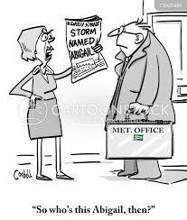
Weather forecasters give each tropical cyclone a name to avoid confusion. Each year, tropical cyclones receive names in alphabetical order. Women and men’s names are alternated. The name list is proposed by the National Meteorological and Hydrological Services (NMHSs) of WMO Members of a specific region, and approved by the respective tropical cyclone regional bodies at their annual/bi-annual sessions.

HISTORICAL BACKGROUND

The practice of naming storms (tropical cyclones) began years ago in order to help in the quick identification of storms in warning messages because names are presumed to be far easier to remember than numbers and technical terms. In the beginning, storms were named arbitrarily. An Atlantic storm that ripped off the mast of a boat named Antje became known as Antje’s hurricane. Then the mid-1900’s saw the start of the practice of using feminine names for storms.

In the pursuit of a more organized and efficient naming system, meteorologists later decided to identify storms using names from a list arranged alphabetically. Thus, a storm with a name which begins with A, like Anne, would be the first storm to occur in the year. By the end of the 1900’s, forecasters started using male names for those forming in the Southern Hemisphere.

Since 1953, Atlantic tropical storms have been named from lists originated by the National Hurricane Centre. The original name lists featured only women’s names. In 1979, men’s names were introduced and they alternate with the women’s names.

Six lists are used in rotation. Thus, the 2019 list will be used again in 2025. The names of tropical cyclones over the north Indian Ocean is however not repeated. Once used, it will cease to be used again.

Why are cyclones given a name ?

Naming of Tropical Cyclones (TCs) helps the scientific community, disaster managers, media and general masses to

  • identify each individual cyclone.
  • use of short, distinctive given names in written as well as spoken communications is quicker and less subject to error than the older more cumbersome latitude-longitude identification methods.
  • create awareness of its development.
  • remove confusion in case of simultaneous occurrence of TCs over a region
  • rapidly and effectively disseminate warnings to much wider audience

These advantages are especially important in exchanging detailed storm information between hundreds of widely scattered stations, coastal bases, and ships at sea.

Criteria for name selection

  • The proposed name should be neutral to (a) politics and political figures (b) religious believes, (c) cultures and (d) gender
  • Name should be chosen in such a way that it does not hurt the sentiments of any group of population over the globe
  • It should not be very rude and cruel in nature
  • It should be short, easy to pronounce and should not be offensive to any member
  • The maximum length of the name will be eight letters
  • The proposed name should be provided along with its pronunciation and voice over

Protocol to Select a name for a cyclone

For north Indian Ocean including Bay of Bengal and Arabian Sea, the RSMC, New Delhi assigns the name to tropical cyclones following a standard procedure.

The naming of the tropical cyclones over the north Indian Ocean commenced from September 2004. This list contained names proposed by then eight member countries of WMO/ESCAP PTC, viz., Bangladesh, India, Maldives, Myanmar, Oman, Pakistan, Sri Lanka and Thailand. A new list containing 169 names has been made available in 2020.

Source : Regional Specialised Meteorological Centre, New Delhi and World Meteorological Organisation

Cyclone Risk Assessment – cas eof Andhra Pradesh

A disaster is a sudden, calamitous event that seriously disrupts the functioning of a community or society and causes human, material, and economic or environmental losses that exceed the community’s or society’s ability to cope using its own resources. Though often caused by nature, disasters can have human origins. The combination of hazards, vulnerability and inability to reduce the potential negative consequences of risk results in disaster.

The Disaster Management Act of India defines disaster as: “A catastrophe, mishap, calamity or grave occurrence in any area arising from natural or man-made causes or by accident or negligence, which results in substantial loss of life or human suffering or damage to and destruction of property or damage to, or degradation of environment and is of such a nature or magnitude as to be beyond the coping capacity of the community of the affected area.

Andhra Pradesh is the second most vulnerable state to cyclone after Odisha. The state risks being battered by cyclones of moderate to severe intensity every two to three years. In the past 40 years, there may not be a single year in which the state did not experience either a storm, a cyclone or heavy rains and floods. The deadliest cyclone in the past 40 years was the one that struck Andhra’s coast in November 1977, killing about 10,000 people. About 250,000 cattle heads perished, one million houses were damaged and crops on 1.35 million hectares (ha) were destroyed that year. According to the State Disaster Management Department, about 44 per cent of the state is vulnerable to tropical storms and related disasters. Vulnerability to storm surges is not uniform along the coast of Andhra. The stretch between Nizampatnam in Guntur district and Machilipatnam in Krishna district is the most prone to storm surges. East and West Godavari districts, with vast stretches of paddy fields and irrigation, drainage canals always bear the brunt of cyclones accompanied by strong winds and pounding rains. In the aftermath of cyclones, these areas get flooded, leading to huge crop losses besides other damage. More than one cyclone in the same season is not unusual for Andhra Pradesh. The vulnerability also increases manifold given its location and the demographic structure of the state. The decrease of alertness in disaster management that often occurs after a few years’ lull in occurrence of cyclones, known as the “fading memory syndrome,” also contributes to increases in loss of lives and property damage.

Proneness or to be prone means ‘likely to do’ or in this case, the districts most likely to be affected by cyclone. Out of 9 districts prone to cyclones, 4 districts i.e., Nellore, Guntur, East Godavari and Srikakulam fall in the category of very highly prone to cyclones. The remaining 5 districts i.e., Prakasam, Krishna, West Godavari, Vishakhapatnam and Vizianagaram fall in the category of highly prone to cyclones. It can be noticed that the coastal districts range from very highly to highly prone to cyclone without any in-between.  Apart from these, the non-coastal districts such as Chittoor and Cuddapah also at times experience the wrath of cyclones in the form of heavy and torrential rainfall or the landfall of cyclones.

All the coastal districts of Andhra Pradesh except one fall in the very highly vulnerable category, which is not a surprise given the density of population in the districts. The density map of Andhra Pradesh shows that out of 9 coastal districts, 4 districts i.e., Srikakulam, East Godavari, West Godavari and Krishna fall in the category of high density of population; 3 coastal districts i.e., Vizianagaram, Vishakhapatnam and Guntur fall in the category of moderate density of population. The reasons for low density districts such as Nellore and Prakasam still being highly vulnerable can be due to high rate of poverty, transport and infrastructure vulnerability.

The density map of Andhra Pradesh shows that out of 9 coastal districts, 4 districts i.e., Srikakulam, East Godavari, West Godavari and Krishna fall in the category of high density of population; 3 coastal districts i.e., Vizianagaram, Vishakhapatnam and Guntur fall in the category of moderate density of population. The reasons for low density districts such as Nellore and Prakasam still being highly vulnerable can be due to high rate of poverty, transport and infrastructure vulnerability.

Over last few decades, NGOs have become important players in the development process across the globe, engaged in wide ranging activities starting with community development to training, policy research, and advocacy. Their organisational flexibility, informal work style, and close engagement with grassroots communities enable them to deliver services to people at lower costs.  Their ability to mobilise people and understand people’s concerns enables them to better articulate problems encountered by people. Thus, they play a very important role in preparedness and mitigation process. For instance, Indian Red Cross Society – New Delhi and other charitable organisations were involved in helping people in Titli cyclone-affected areas. As per the article in The Hindu, IRCS has distributed relief materials, including 1594 kitchen sets, 800 saris, 700 dhotis, 440 buckets, 400 towels, 700 mosquito nets and 405 tarpaulins in selected villages, according to IRCS Srikakulam wing chairperson P. Jaganmohana Rao, Further, after studying the severe damage in 1,145 villages, IRCS-New Delhi, IRCS-A.P. and Telangana units sent relief material worth more than Rs. 62 lakhs. Given such an important role played by voluntary organisations, APSDMA is developing a database of interested volunteers from various governmental and non-governmental agencies and offer them training programs on interesting aspects under Disaster management, preparedness, mitigation and awareness building. This will provide the volunteers with an on-ground experience of the situation and also provide them with an opportunity to learn and teach others what they have observed.

It is equally important for risk assessment to take from time to time so that it comes to light where the improvement is needed the most, where are the loopholes as regular risk assessment will enable to support the development of effective cyclone mitigation policies and implementation of specific measures. Studies have suggested that new developments in the terms of embankments, cyclone shelters, and roadways should be in the places with high and very-high-risk zone. Though successful early warning system reduced the loss of life, false information and lack of awareness claimed many human lives. It has been recommended that Incorporating the spatial distribution of vulnerable people in warning messages may increase trust of people to the warning signals. One of the studies brought in the “fading memory syndrome” in which not being the target of cyclone and cyclonic storms for more than a couple of years makes people forget about the disastrous affect and a reduction has been observed. Thus, the government needs to focus on this aspect too and conduct mock drills among the coastal population at regular intervals, keep them aware about the impact and train the evacuation process. It is equally important to impart education to the population regarding the same. With the proper involvement of the civil bodies and local people, a vastly informed citizens can be placed.

References:

Ahameed, B. K. (2019). Coastal Social Vulnerability and Risk Analysis for Cyclone Hazard Along the Andhra Pradesh, East Coast of India. KN-Journal of Cartography and Geographic Information. doi:DOI: 10.1007/s42489-019-00029-9

GOI-UNDP. (n.d.). Severe Cyclone Storm Titli’s Impact on State of Andhra Pradesh .

Government of Andhra Pradesh. (Accessed 2021). Andhra Pradesh State Disaster Management Authority. Retrieved from Google: https://apsdma.ap.gov.in/

Raghavan, S. &. (2003). Trends in Tropical Cyclone Impact: A Study in Andhra Pradeh, India. American Meterological Society, 635-644. doi:10.1175/BAMS-84-5-635

Rao, A. D. (2005). Vulnerability from Storm Surges and Cyclone Wind Fields on the Coast of Andhra Pradesh, India. Nat Hazards, 515-529. doi:10.1007/s11069-006-9047-4

Image Credit: Google

Cyclone Nisarga : Another fear factor

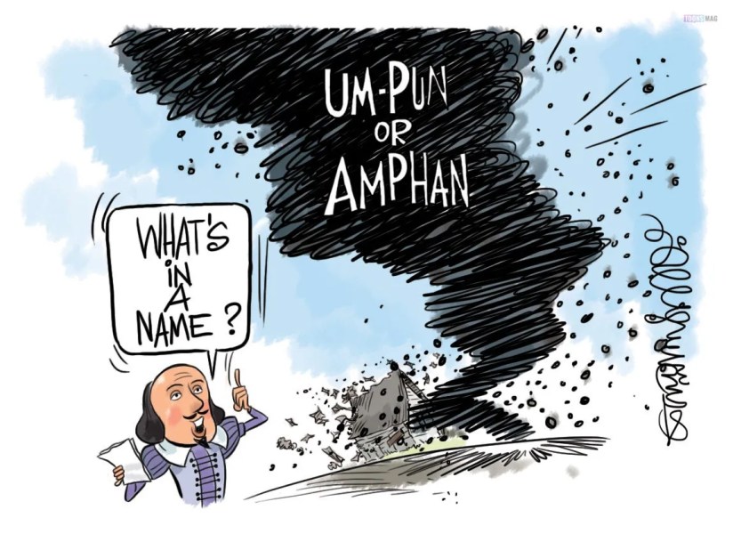
It’s not been even two weeks since the coasts of West Bengal and Orissa are hit by the Amphan cyclone. We are moving ahead towards facing another deadly cyclone but on the western coast. Nisarga cyclone is going to hit the Maharashtra coast on Wednesday which is moving in its full swift northwards, in the Arabian Sea. If we compare Amphan with Nisarga, Amphan was more powerful and intense than this coming cyclone. Moreover, studies have shown that it is not even a full-fledged cylone. Infact it is more similar to a ‘depression’ which has converted itself into ‘deep depression’ lately. The depression is likely to make a landfall between the coastline of Maharashtra and Gujarat. To be precise, Daman and Rigarh are the places where the cyclone is about to make a landfall. IMD(India Meteorological Department) has issued red alert, and instructed the evacuation of the low-lying areas of the western coast.As of 1 June, it has speed of 11 kmph which is laid centered over East-Central Arabian Sea which is 280 kms west-southwest of Panjim, 490 kms south-southwest of Bombay and 710 kms south-southwest of Surat.

Intensity

By the time, it will be evolved into a Severe Cyclonic Storm, it will be of strength 2 on the scale of 1-5 used to measure the strength of cyclones. Their strengths are measured by the magnitude of the wind speeds generated by them. Nisarga’s wind speed would be in the range 95-105 kmph, at its strongest. Cyclones originated in the Arabian Sea side are found less stronger and less intense than those formed in the Bay of Bengal side of the north Indian Ocean. Amphan was called as ‘Super cyclone’ when it was of magnitude 5 but later on it weakened to 4, as ‘Extremely Severe Cyclonic Storm’. Usually the cold water of the Arabian Sea prevents the formation of such strong cyclones which is faced by the eastern coast every year.

What kind of destruction can be caused?

The IMD has said that Nisarga could flood the low-lying areas causing huge structural damage in big cities like Bombay such as falling of trees and power polls. This has lead to the concern that how would the people cope up with such a loss who are already struggling with Covid-19. Some coastal districts of Maharashtra are likely to come directly under the threat of Nisarga. The IMD has already warned the fishermen to not to go towards the Arabian Sea coastline. Cities like Rigad, Thane, Sindhudurg and Ratnagiri are also ought to be affected. Alert has been issued to them. Basically, a red-alert signifying about the possibility of heavy rainfall of more than 204.5 mm. A depression has already marked its presence parallelly to the western coast which keeps on intensifying and is gradually moving along the coast. Both Maharashtra and Gujarat government has ordered the people living in the low-lying areas to move towards the safer places. Due to such circumstances, the southeast and the east-central regions of Arabian Sea are experiencing rough weather, which is about to get intensified by this coming cyclone.

What leads to the formation of cyclones?

Cyclones are formed when due to heat, the water converts into warm and moist air which rises upwards. Thus, a low pressure area is created. Near the equator, tropical cyclones are formed from the warm ocean water. After that, the cool air from the surroundings gradually descends down to fill the low pressure area. Then the process continues and in this way Cyclonic Storms are caused. The warm air which rose up containing the water vapour forms the clouds due to condensation. This cycle is maintained and this system keeps itself feeding from the ocean’s water.

When the system of the storm starts rotating and increases its speed, then an eye is formed at the centre. The surrounding is very clear and calm around the eye. The storm is termed as ‘tropical cyclone’ when its speed crosses 120 kmph. These tropical cyclones are usually weakened when they are not fed by the water vapours of the ocean. Before dying out, they cause rainfall and heavy wind damage. The windy storms bring ocean water to the shore causing flood. This phenomenon is termed as storm surge and it is dangerous for the coastal areas. Cyclones can be of many types depending on the destruction they cause as well as the kinds of winds they produce.