
By Eduindex News Desk
September 10, 2024
Kashi has taken a major leap toward next-generation urban planning with the launch of its 3D Urban Spatial Digital Twin, an advanced digital replica of the entire city being developed under the Varanasi Smart City Mission. The project began with a full-scale aerial survey covering 160 sq. km, marking one of the most comprehensive spatial mapping initiatives undertaken in the region.
Digital twins—virtual 3D models of physical environments—are increasingly recognised as transformative tools in urban planning, landscape architecture, and real-time city governance. Their adoption is reshaping how cities monitor, plan, and manage services.
A Modern Upgrade from 2D to 3D
Divisional Commissioner and Varanasi Smart City Chairman Kaushal Raj Sharma explained that until recently, civic bodies only had access to 2D maps covering 84 sq. km—the earlier municipal boundary. Newly added areas lacked detailed mapping, creating challenges in administration and planning.
The new 3D digital twin will bridge this gap by providing high-precision spatial data for the entire expanded city area, enabling smoother operations across departments.
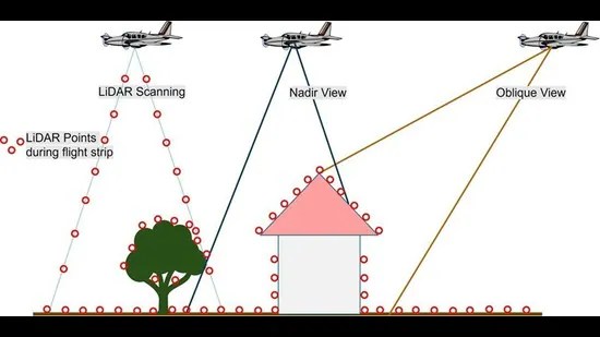
Advanced Aerial Mapping Technology
Chief General Manager Dr. D. Vasudevan revealed that the aerial survey is being conducted using a dual-engine aircraft flying at 3,800 feet, equipped with state-of-the-art LiDAR sensors and high-resolution cameras.
The technology ensures accurate mapping of Varanasi’s complex urban terrain—including ghats, heritage zones, narrow lanes, and dense neighbourhoods—through photogrammetry and laser scanning.
Integrated Smart Governance
Once completed, the digital twin will be integrated with the Kashi Integrated Command and Control Centre (ICCC) to enhance coordinated decision-making. The platform will support agencies such as:
- Jal Kal
- Varanasi Municipal Corporation
- Varanasi Development Authority
- Jal Nigam
Through real-time data, the system will streamline operations related to traffic flow, fire safety, waste management, water supply, sewerage networks, and more. Heat maps and thermographic analytics will also improve crowd management, crucial for a city that attracts millions of pilgrims and tourists.
Project Timeline and Execution
According to Smart City PRO S. Nandan Sonthalia, the project is expected to be completed within nine months. Mumbai-based Genesis International Corporation is executing the initiative.
With this development, Kashi is poised to become a model for data-driven urban governance in India, demonstrating how advanced geospatial technologies can revolutionise heritage cities transitioning into smart, resilient urban systems.

You must be logged in to post a comment.