

Horticulture
The science and art of growing, producing, marketing, and utilizing high-value, intensively grown food, and ornamental plants in a sustainable manner is known as Horticulture.Annual and perennial plants, fruits and vegetables, decorative indoor plants, and landscape plants are all examples of horticulture crops.
Horticulture farming also aims to enhance the quality of life, as well as the beauty, sustainability, and recovery of our ecosystem and the human condition.
Horticulture is divided into the cultivation of plants for food (pomology and olericulture) and plants for ornament (floriculture and landscape horticulture). Pomology deals with fruit and nut crops. Olericulture deals with herbaceous plants for the kitchen, including, for example, carrots (edible root), asparagus (edible stem), lettuce (edible leaf), cauliflower (edible flower buds), tomatoes (edible fruit), and peas (edible seed). Floriculture deals with the production of flowers and ornamental plants; generally, cut flowers, pot plants, and greenery. Landscape horticulture is a broad category that includes plants for the landscape, including lawn turf but particularly nursery crops such as shrubs, trees, and vines.

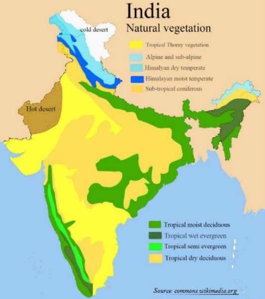
Temperate zones for horticulture cannot be defined exactly by lines of latitude or longitude but are usually regarded as including those areas where frost in winter occurs, even though rarely. Thus, most parts of Europe, North America, and northern Asia are included, though some parts of the United States, such as southern Florida, are considered subtropical. A few parts of the north coast of the Mediterranean and the Mediterranean islands are also subtropical. In the Southern Hemisphere, practically all of New Zealand, a few parts of Australia, and the southern part of South America have temperate climates. For horticultural purposes altitude is also a factor; the lower slopes of great mountain ranges, such as the Himalayas and the Andes, are included. Thus, the temperate zones are very wide and the range of plants that can be grown in them is enormous, probably greater than in either the subtropical or tropical zones. In the temperate zones are the great coniferous and deciduous forests: pine, spruce, fir, most of the cypresses, the deciduous oaks (but excluding many of the evergreen ones), ash, birch, and linden.
There is no sharp line of demarcation between the tropics and the subtropics. Just as many tropical plants can be cultivated in the subtropics, so also many subtropical and even temperate plants can be grown satisfactorily in the tropics. Elevation is a determining factor. For example, the scarlet runner bean, a common plant in temperate regions, grows, flowers, and develops pods normally on the high slopes of Mount Meru in Africa near the Equator, but it will not set pods in Hong Kong, a subtropical situation a little south of the Tropic of Cancer but at a low elevation.In addition to elevation, another determinant is the annual distribution of rainfall. Plants that grow and flower in the monsoon areas, as in India, will not succeed where the climate is uniformly wet, as in Bougainville in the Solomon Islands. Another factor is the length of day, the number of hours the Sun is above the horizon; some plants flower only if the day is long, but others make their growth during the long days and flower when the day is short. Certain strains of the cosmos plant are so sensitive to light that where the day is always about 12 hours, as near the Equator, they flower when only a few inches high; if grown near the Tropic of Cancer or the Tropic of Capricorn, they attain a height of several feet, if the seeds are sown in the spring, before flowering in the short days of autumn and winter. Poinsettia is a short-day plant that may be seen in flower in Singapore on any day of the year, while in Trinidad it is a blaze of glory only in late December.

The glory of gardening: hands in the dirt, head in the sun, heart with nature.
To nurture a garden is to feed not just on the body, but the soul.
Psychology

Psychology has become a very important and popular subject today. It deals with many problems of everyday life. Psychology helps us to understand the behaviour of people around us, to find out why they behave differently and what forces are responsible to make them so different from others.It tries to explain wide array of factors involved in what we human beings do. The principles explained by psychology give us a rational basis of understanding of what we and others do. Psychology has been defined in many ways. In ancient days people were analysing the behavioural aspects on the basis of philosophy. They believed that there is a soul in every individual and this is responsible for all our activities.
This view led to the opinion that the subject matter of psychology must be the study of soul. But this definition could not answer the questions regarding the existence of soul and its accessibility for study. This condition led to a new definition by Greek philosophers who defined psychology as a ‘science of mind’. But this definition was also rejected on the same grounds as soul was rejected.
Gradually, as a result of the development of scientific outlook people started thinking on scientific basis and began to define psychology as a science of behaviour. Finally, it is JB Watson (1913) defined psychology as a science of behaviour of human as well as animal beings.Today this is the most accepted definition. In this definition the term behaviour includes the cognitive activities like thinking, reasoning, intelligence, imagining, memory, etc., co-native activities like walking, dancing, fighting, attacking and other action tendencies and also the affective activities like feeling, joy, happiness, sympathy, anger, jealousy, etc. in a person. This definition also includes the behaviour not only of human beings and animals, but also all living organisms and their mental processes.

Psychologists do experiments and make observations which others can repeat; they obtain data often in the form of quantitative measurements which others can verify. Like any other positive science psychology is also systematic in its approach. Measurement in psychology is often more difficult of course, than it is in other sciences.However, psychologists have devised many ingenious tests to assign numbers to data. Psychology is following all the principles of science like principles of behaviour,objective experimentation, analysis of data and behaviour, formulation of hypothesis, verification and generalization, etc.As a result of such a scientific approach many theories have been developed to explain the behaviour. Psychology believes in cause and effect relationship in behaviour. It is considered as a behavioural science as it deals with behaviour of the organism.
However, because of its objectivity in analysis of behaviour through experiments, it may be considered as a developing positive science of behaviour.
Psychology has a long past, but only a short history
Horticulture
The science and art of growing, producing, marketing, and utilizing high-value, intensively grown food, and ornamental plants in a sustainable manner is known as Horticulture.Annual and perennial plants, fruits and vegetables, decorative indoor plants, and landscape plants are all examples of horticulture crops.
Horticulture farming also aims to enhance the quality of life, as well as the beauty, sustainability, and recovery of our ecosystem and the human condition.
Horticulture is divided into the cultivation of plants for food (pomology and olericulture) and plants for ornament (floriculture and landscape horticulture). Pomology deals with fruit and nut crops. Olericulture deals with herbaceous plants for the kitchen, including, for example, carrots (edible root), asparagus (edible stem), lettuce (edible leaf), cauliflower (edible flower buds), tomatoes (edible fruit), and peas (edible seed). Floriculture deals with the production of flowers and ornamental plants; generally, cut flowers, pot plants, and greenery. Landscape horticulture is a broad category that includes plants for the landscape, including lawn turf but particularly nursery crops such as shrubs, trees, and vines.

Temperate zones for horticulture cannot be defined exactly by lines of latitude or longitude but are usually regarded as including those areas where frost in winter occurs, even though rarely. Thus, most parts of Europe, North America, and northern Asia are included, though some parts of the United States, such as southern Florida, are considered subtropical. A few parts of the north coast of the Mediterranean and the Mediterranean islands are also subtropical. In the Southern Hemisphere, practically all of New Zealand, a few parts of Australia, and the southern part of South America have temperate climates. For horticultural purposes altitude is also a factor; the lower slopes of great mountain ranges, such as the Himalayas and the Andes, are included. Thus, the temperate zones are very wide and the range of plants that can be grown in them is enormous, probably greater than in either the subtropical or tropical zones. In the temperate zones are the great coniferous and deciduous forests: pine, spruce, fir, most of the cypresses, the deciduous oaks (but excluding many of the evergreen ones), ash, birch, and linden.
There is no sharp line of demarcation between the tropics and the subtropics. Just as many tropical plants can be cultivated in the subtropics, so also many subtropical and even temperate plants can be grown satisfactorily in the tropics. Elevation is a determining factor. For example, the scarlet runner bean, a common plant in temperate regions, grows, flowers, and develops pods normally on the high slopes of Mount Meru in Africa near the Equator, but it will not set pods in Hong Kong, a subtropical situation a little south of the Tropic of Cancer but at a low elevation.In addition to elevation, another determinant is the annual distribution of rainfall. Plants that grow and flower in the monsoon areas, as in India, will not succeed where the climate is uniformly wet, as in Bougainville in the Solomon Islands. Another factor is the length of day, the number of hours the Sun is above the horizon; some plants flower only if the day is long, but others make their growth during the long days and flower when the day is short. Certain strains of the cosmos plant are so sensitive to light that where the day is always about 12 hours, as near the Equator, they flower when only a few inches high; if grown near the Tropic of Cancer or the Tropic of Capricorn, they attain a height of several feet, if the seeds are sown in the spring, before flowering in the short days of autumn and winter. Poinsettia is a short-day plant that may be seen in flower in Singapore on any day of the year, while in Trinidad it is a blaze of glory only in late December.

The glory of gardening: hands in the dirt, head in the sun, heart with nature.
To nurture a garden is to feed not just on the body, but the soul.
Ramsar Site
Recently, there has been addition of 5 more Indian sites in Ramsar list i.e. three from Tamil Nadu, one from Mizoram and one from Madhya Pradesh. Including these 5 recently added now makes the total of 54 such sites from the country.
Three wetlands in Tamil Nadu — Karikili Bird Sanctuary, Pallikaranai Marsh Reserve Forest and Pichavaram Mangrove ,Pala wetland in Mizoram and Sakhya Sagar in Madhya Pradesh are newly added to Ramsar list.
So, let’s know what is Ramsar site and it’s importance
Ramsar site is the wetland of international importance designated under the Ramsar Convention on Wetlands. These are unique rare wetlands and are rich in biolgical heritage and diversity.
The Ramsar Convention is an international treaty for the conservation and wise use of wetlands. It is named after the Iranian city of Ramsar, on the Caspian Sea, where the treaty was signed on February 2, 1971.
The aim is to develop and maintain an international network of wetlands which are important for the conservation of global biological diversity and for sustaining human life through the maintenance of their ecosystem components.
Wetlands play a crucial role in maintaining many natural cycles and supporting a wide range of biodiversity. They also purify and replenish the water. They serve as a natural sponge against flooding and drought, protect our coastlines and fight climate change.
Through Ramsar Convention we aim to save our wetlands and to conserve them and bring it to wise use efficiently.
Communalism
For centuries people belonging to different religious communities have been living together in India without any friction or ill will. Major communities in India being the Hindus, the Muslims, the Sikhs, the Christians, the Parsees, the Jains, the Buddhists, etc.All these communities lived with each other in perfect toleration. It was only at the turn of the century that the British rulers in India followed policy of divide and rule and with that the gulf between various religious communities very considerably increased.The device of giving separate representation to each major community in elected bodies and civil services widened the gap, particularly among two major Indian communities, namely, the Hindus and the Muslims. When late Muhammed Ali Jinnah expounded his two nation theory, gap between these communities still more widened.The result of all this was that there was communal hatred. Before the partition of the country, there were communal riots in some parts of the country resulting in the killing of several hundred people and looting and burning property worth crores of rupees. Everything inhuman and unhuman was done in the name of religion.The country had to be partitioned because the Muslim League, under the leadership of M.A. Jinnah made it clear that the Muslims and the Hindus were two separate nations, which could not live together and partition of India was the only solution of communal and political problems of the country.

Communalism as a political philosophy has its roots in the religious and cultural diversity of India.It has been used as a political propaganda tool to create divide, differences and tensions between the communities on the basis of religious and ethnic identity leading to communal hatred and violence.In ancient Indian society, people of different faith coexisted peacefully.Buddha was perhaps the first Indian prophet who gave the concept of secularism.Meanwhile, Kings like Ashoka followed a policy of peace and religious tolerance.Medieval India witnessed the arrival of Islam in India marked by occasional occurrences of violence such as Mahmud Ghazni’s destruction of Hindu temples and Mahmud of Ghor’s attack on Hindus, Jains and Buddhists.While, religion was an important part of people’s lives but there was no communal ideology or communal politics.Rulers like Akbar and Sher Shah Suri followed the religious policy of toleration towards different cultures and tradition practiced across country.However, some sectarian rulers like Aurangzeb were among the least tolerant towards other religious practises.
As a modern phenomenon it has arose as a result of British colonial impact and the response of Indian social strata.

There is need to reform in present criminal justice system, speedy trials and adequate compensation to the victims, may act as deterrent.Increase in representation of minority community and weaker sections in all wings of law-enforcement, training of forces in human rights, especially in the use of firearms in accordance with UN code of conduct.Codified guidelines for the administration, specialised training for the police force to handle communal riots and setting up special investigating and prosecuting agencies can help in damping major communal disgruntlement.
Emphasis on value-oriented education with focus on the values of peace, non-violence, compassion, secularism and humanism as well as developing scientific temper (enshrined as a fundamental duty) and rationalism as core values in children both in schools and colleges/universities, can prove vital in preventing communal feelings.Government can adopt models followed by countries like Malaysia that has developed early-warning indicators to prevent racial clashes.The Malaysian Ethnic Relations Monitoring System (known by its acronym Mesra) that makes use of a quality of life index (included criteria such as housing, health, income and education) and a perception index to gauge people’s needs and feelings about race relations in their area.Also the Hong Kong model of combating communalism by setting up a “Race Relation Unit” to promote racial harmony and facilitate integration of ethnic minorities, can be emulated by India.RRU has established a hotline for complaints and inquiries on racial discrimination. Meanwhile, to create awareness about communal harmony, RRU talks to schools on culture of ethnic minorities and concept of racial discrimination.Government can encourage and support civil society and NGOs to run projects that help create communal awareness, build stronger community relation and cultivating values of communal harmony in next generation.
There is a need for minority welfare schemes to be launched and implemented efficiently by administration to address the challenges and various forms of discrimination faced by them in jobs, housing and daily life.A pro-active approach by National Foundation for Communal Harmony (NFCH), the body responsible for promoting communal harmony is needed.NFCH provides assistance for the physical and psychological rehabilitation of the child victims of communal, caste, ethnic or terrorist violence, besides promoting communal harmony, fraternity and national integration.A legislation is required to curb the communal violence. Communal Violence (Prevention, Control and Rehabilitation of Victims) Bill, 2005 must be enacted soon.
When people unfortunately use religion to facilitate their envy, arrogance and hate, communalism surfaces.
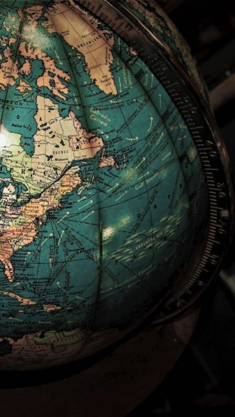
Salient features of world’s physical geography.

Earth is splendid terrestrial haven. It is imperative to know physical geography through its display of environmental diversity. In scientific studies, it is established that Geography is a word that originated from two Greek roots. Geo-denotes to “Earth,” and graphy stands for “picture or writing.” Geography is the study of earth as the home of present day human being (Sagmit, 1998).The main objective of geography is the assessment, and explanation of Earth, its variability from place to place, the way places and features transform over time, and the processes responsible for these variations and changes. Geography is termed as the spatial science because it incorporates recognizing, analysing, and explaining the variations, similarities, or differences in phenomena situated on the surface of Earth. Geography is unique among the sciences by virtue of its characterization and central purpose. It describes the values and attitudes towards environment and sharpen intellectual and practice skill.
Earth’s structure is divided into three zones that include crust, Mantle and core. Crust is the solid outer layer of the Earth, and its depth is usually never more than 1 per cent of the Earth’s radius, or averaging 40–50 km, but this varies significantly around the sphere. These are two different types: oceanic and continental. Mantle is the region within the Earth’s interior that range from 25 to 70 km below the surface, to a depth of ~2,900 km. It is composed mainly of silicate rocks, rich in iron and magnesium. At the base of the mantle, temperatures may reach up to 5,000°C. These high temperatures may help to generate convection currents which drive plate tectonics. Core is the very centre of the Earth and is composed of iron and nickel. It consists of an outer core (semi-molten) and inner core (solid). The temperature at the very centre of the Earth (~6,300 km below surface) may reach 5,500°C.
Geography is inherently encompassing discipline. It brings together facts from other sciences such as physical biological and social. Physical geography is related to the physical science. Physical geography includes the processes and attributes that constitute Earth which incorporate human activities where they interface with the atmosphere. Different branches of Physical geography are climatology, Meteorology, Geomorphology and pedageography (Sagmit, 1998).Scientific studies have revealed that physical geographers are more interested in comprehending all aspects of Earth and can be considered generalists because they are qualified to scrutinize a natural environment in its entirety, and how it functions as a unit. In physical geography, researchers study about lithosphere, atmosphere, hydrosphere, and biosphere. Due to interaction of these elements, numerous changes occur on earth surface. Most physical geographers concentrate on advanced study in one or two specialties. For instance, meteorologists and climatologists believe how the interaction of atmospheric components influences weather and climate. Meteorologists focus their studies learning the atmospheric processes that affect daily weather, and they use current data to predict weather conditions. Climatologists are interested in the averages and extremes of long-term weather data, regional classification of climates, monitoring and understanding climatic change and climatic hazard, and the long term impact of atmospheric conditions on human actions and the surroundings.

The factors involved in landform development are as varied as the environments on Earth, and include gravity, running water, stresses in the Earth’s crust, flowing ice in glaciers, volcanic activity, and the erosion or deposition of Earth’s surface materials. Biogeographers scrutinize natural and human-modified environments and the ecological processes that influence their characteristics and distributions, including vegetation change over time. They also research and explain the ranges and patterns of vegetation and animal species, seeking to find out the environmental factors that limit or facilitate their distributions. Several soil scientists are geographers, who are concerned in mapping and analysing soil types, determining the aptness of soils for certain uses, such as agriculture, and working to conserve soil as a natural resource. Geographers are broadly concerned to study water bodies and their processes, movements, impact, quality, and other features. They may serve as hydrologists, oceanographers, or glaciologists. Many geographers involved with water studies also function as water resource managers, who work to ensure that lakes, watersheds, springs, and groundwater sources are suitable to meet human or environmental needs, provide an adequate water supply, and are as free of pollution as possible. Hydrology is merging science. It helps to understand the processes in which water plays an important role in nature through oceans, rivers and glaciers in sustaining life forms of earth surface.
IN OUR CHANGING WORLD NOTHING CHANGES MORE THAN GEOGRAPHY
Salient features of world’s physical geography
Earth is splendid terrestrial haven. It is imperative to know physical geography through its display of environmental diversity. In scientific studies, it is established that Geography is a word that originated from two Greek roots. Geo-denotes to “Earth,” and graphy stands for “picture or writing.” Geography is the study of earth as the home of present day human being (Sagmit, 1998).The main objective of geography is the assessment, and explanation of Earth, its variability from place to place, the way places and features transform over time, and the processes responsible for these variations and changes. Geography is termed as the spatial science because it incorporates recognizing, analysing, and explaining the variations, similarities, or differences in phenomena situated on the surface of Earth. Geography is unique among the sciences by virtue of its characterization and central purpose. It describes the values and attitudes towards environment and sharpen intellectual and practice skill.
Earth’s structure is divided into three zones that include crust, Mantle and core. Crust is the solid outer layer of the Earth, and its depth is usually never more than 1 per cent of the Earth’s radius, or averaging 40–50 km, but this varies significantly around the sphere. These are two different types: oceanic and continental. Mantle is the region within the Earth’s interior that range from 25 to 70 km below the surface, to a depth of ~2,900 km. It is composed mainly of silicate rocks, rich in iron and magnesium. At the base of the mantle, temperatures may reach up to 5,000°C. These high temperatures may help to generate convection currents which drive plate tectonics. Core is the very centre of the Earth and is composed of iron and nickel. It consists of an outer core (semi-molten) and inner core (solid). The temperature at the very centre of the Earth (~6,300 km below surface) may reach 5,500°C.
Geography is inherently encompassing discipline. It brings together facts from other sciences such as physical biological and social. Physical geography is related to the physical science. Physical geography includes the processes and attributes that constitute Earth which incorporate human activities where they interface with the atmosphere. Different branches of Physical geography are climatology, Meteorology, Geomorphology and pedageography (Sagmit, 1998).Scientific studies have revealed that physical geographers are more interested in comprehending all aspects of Earth and can be considered generalists because they are qualified to scrutinize a natural environment in its entirety, and how it functions as a unit. In physical geography, researchers study about lithosphere, atmosphere, hydrosphere, and biosphere. Due to interaction of these elements, numerous changes occur on earth surface. Most physical geographers concentrate on advanced study in one or two specialties. For instance, meteorologists and climatologists believe how the interaction of atmospheric components influences weather and climate. Meteorologists focus their studies learning the atmospheric processes that affect daily weather, and they use current data to predict weather conditions. Climatologists are interested in the averages and extremes of long-term weather data, regional classification of climates, monitoring and understanding climatic change and climatic hazard, and the long term impact of atmospheric conditions on human actions and the surroundings.
The factors involved in landform development are as varied as the environments on Earth, and include gravity, running water, stresses in the Earth’s crust, flowing ice in glaciers, volcanic activity, and the erosion or deposition of Earth’s surface materials. Biogeographers scrutinize natural and human-modified environments and the ecological processes that influence their characteristics and distributions, including vegetation change over time. They also research and explain the ranges and patterns of vegetation and animal species, seeking to find out the environmental factors that limit or facilitate their distributions. Several soil scientists are geographers, who are concerned in mapping and analysing soil types, determining the aptness of soils for certain uses, such as agriculture, and working to conserve soil as a natural resource. Geographers are broadly concerned to study water bodies and their processes, movements, impact, quality, and other features. They may serve as hydrologists, oceanographers, or glaciologists. Many geographers involved with water studies also function as water resource managers, who work to ensure that lakes, watersheds, springs, and groundwater sources are suitable to meet human or environmental needs, provide an adequate water supply, and are as free of pollution as possible. Hydrology is merging science. It helps to understand the processes in which water plays an important role in nature through oceans, rivers and glaciers in sustaining life forms of earth surface.
IN OUR CHANGING WORLD NOTHING CHANGES MORE THAN GEOGRAPHY
Genral issues on Environmental ecology

The environment plays a significant role to support life on earth. But there are some issues that are causing damages to life and the ecosystem of the earth. It is related to the not only environment but with everyone that lives on the planet. Besides, its main source is pollution, global warming, greenhouse gas, and many others. The everyday activities of human are constantly degrading the quality of the environment which ultimately results in the loss of survival condition from the earth.There are hundreds of issue that causing damage to the environment. But in this, we are going to discuss the main causes of environmental issues because they are very dangerous to life and the ecosystem.
Pollution – It is one of the main causes of an environmental issue because it poisons the air, water, soil, and noise. As we know that in the past few decades the numbers of industries have rapidly increased. Moreover, these industries discharge their untreated waste into the water bodies, on soil, and in air. Most of these wastes contain harmful and poisonous materials that spread very easily because of the movement of water bodies and wind. Greenhouse Gases – These are the gases which are responsible for the increase in the temperature of the earth surface. This gases directly relates to air pollution because of the pollution produced by the vehicle and factories which contains a toxic chemical that harms the life and environment of earth. Climate Changes – Due to environmental issue the climate is changing rapidly and things like smog, acid rains are getting common. Also, the number of natural calamities is also increasing and almost every year there is flood, famine, drought, landslides, earthquakes, and many more calamities are increasing.

Development recognises that social, economic and environmental issues are interconnected, and that decisions must incorporate each of these aspects if there are to be good decisions in the longer term.For sustainable development, accurate environment forecasts and warnings with effective information on pollution which are essential for planning and for ensuring safe and environmentally sound socio-economic activities should be made known.
THE EARTH IS WHAT WE
ALL HAVE IN COMMAN
General issues on Environmental ecology

The environment plays a significant role to support life on earth. But there are some issues that are causing damages to life and the ecosystem of the earth. It is related to the not only environment but with everyone that lives on the planet. Besides, its main source is pollution, global warming, greenhouse gas, and many others. The everyday activities of human are constantly degrading the quality of the environment which ultimately results in the loss of survival condition from the earth.There are hundreds of issue that causing damage to the environment. But in this, we are going to discuss the main causes of environmental issues because they are very dangerous to life and the ecosystem.
Pollution – It is one of the main causes of an environmental issue because it poisons the air, water, soil, and noise. As we know that in the past few decades the numbers of industries have rapidly increased. Moreover, these industries discharge their untreated waste into the water bodies, on soil, and in air. Most of these wastes contain harmful and poisonous materials that spread very easily because of the movement of water bodies and wind. Greenhouse Gases – These are the gases which are responsible for the increase in the temperature of the earth surface. This gases directly relates to air pollution because of the pollution produced by the vehicle and factories which contains a toxic chemical that harms the life and environment of earth. Climate Changes – Due to environmental issue the climate is changing rapidly and things like smog, acid rains are getting common. Also, the number of natural calamities is also increasing and almost every year there is flood, famine, drought, landslides, earthquakes, and many more calamities are increasing.

Development recognises that social, economic and environmental issues are interconnected, and that decisions must incorporate each of these aspects if there are to be good decisions in the longer term.For sustainable development, accurate environment forecasts and warnings with effective information on pollution which are essential for planning and for ensuring safe and environmentally sound socio-economic activities should be made known.
THE EARTH IS WHAT WE
ALL HAVE IN COMMAN
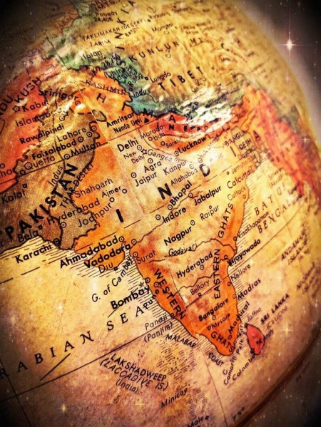
History of India & Indian National Movement.
Early times the Indian subcontinent appears to have provided an attractive habitat for human occupation. Toward the south it is effectively sheltered by wide expanses of ocean, which tended to isolate it culturally in ancient times, while to the north it is protected by the massive ranges of the Himalayas, which also sheltered it from the Arctic winds and the air currents of Central Asia. Only in the northwest and northeast is there easier access by land, and it was through those two sectors that most of the early contacts with the outside world took place.
Within the framework of hills and mountains represented by the Indo-Iranian borderlands on the west, the Indo-Myanmar borderlands in the east, and the Himalayas to the north, the subcontinent may in broadest terms be divided into two major divisions: in the north, the basins of the Indus and Ganges (Ganga) rivers (the Indo-Gangetic Plain) and, to the south, the block of Archean rocks that forms the Deccan plateau region. The expansive alluvial plain of the river basins provided the environment and focus for the rise of two great phases of city life: the civilization of the Indus valley, known as the Indus civilization, during the 3rd millennium BCE; and, during the 1st millennium BCE, that of the Ganges. To the south of this zone, and separating it from the peninsula proper, is a belt of hills and forests, running generally from west to east and to this day largely inhabited by tribal people. This belt has played mainly a negative role throughout Indian history in that it remained relatively thinly populated and did not form the focal point of any of the principal regional cultural developments of South Asia. However, it is traversed by various routes linking the more-attractive areas north and south of it. The Narmada (Narbada) River flows through this belt toward the west, mostly along the Vindhya Range, which has long been regarded as the symbolic boundary between northern and southern India.
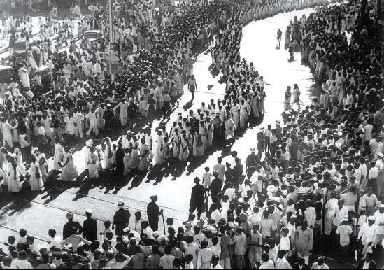
India’s movement for Independence occurred in stages elicit by the inflexibility of the Britishers and in various instances, their violent responses to non-violent protests. It was understood that the British were controlling the resources of India and the lives of its people, and as far as this control was ended India could not be for Indians.
On 28 December 1885 Indian National Congress (INC) was founded on the premises of Gokuldas Tejpal Sanskrit School at Bombay. It was presided over by W.C Banerjee and attended by 72 delegates. A.O Hume played an instrumental role in the foundation of INC with an aim to provide Safety Valve to the British Government.
A.O Hume served as the first General Secretary of INC.
The real Aim of Congress is to train the Indian youth in political agitation and to organise or to create public opinion in the country. For this, they use the method of an annual session where they discuss the problem and passed the resolution.
The first or early phase of Indian Nationalism is also termed as Moderate Phase (1885-1905). Moderate leaders were W.C Banerjee, Gopal Krishna Gokhale, R.C Dutt, Ferozeshah Mehta, George Yule, etc.
Moderates have full faith in British Government and adopted the PPP path i.e. Protest, Prayer, and Petition.
Due to disillusionment from Moderates’ methods of work, extremism began to develop within the congress after 1892. The Extremist leaders were Lala Lajpat Rai, Bal Gangadhar Tilak, Bipin Chandra Pal, and Aurobindo Ghosh. Instead of the PPP path, they emphasise on self-reliance, constructive work, and swadeshi.
With the announcement of the Partition of Bengal (1905) by Lord Curzon for administrative convenience, Swadeshi and Boycott resolution was passed in 1905.
ONE INDIVIDUAL MAY DIE; BUT THAT IDEA WILL, AFTER HIS DEATH, INCARNATE ITSELF IN A THOUSAND LIVES.
-Netaji Subhash Chandra Bose
History of India & Indian National Movement.

Early times the Indian subcontinent appears to have provided an attractive habitat for human occupation. Toward the south it is effectively sheltered by wide expanses of ocean, which tended to isolate it culturally in ancient times, while to the north it is protected by the massive ranges of the Himalayas, which also sheltered it from the Arctic winds and the air currents of Central Asia. Only in the northwest and northeast is there easier access by land, and it was through those two sectors that most of the early contacts with the outside world took place.
Within the framework of hills and mountains represented by the Indo-Iranian borderlands on the west, the Indo-Myanmar borderlands in the east, and the Himalayas to the north, the subcontinent may in broadest terms be divided into two major divisions: in the north, the basins of the Indus and Ganges (Ganga) rivers (the Indo-Gangetic Plain) and, to the south, the block of Archean rocks that forms the Deccan plateau region. The expansive alluvial plain of the river basins provided the environment and focus for the rise of two great phases of city life: the civilization of the Indus valley, known as the Indus civilization, during the 3rd millennium BCE; and, during the 1st millennium BCE, that of the Ganges. To the south of this zone, and separating it from the peninsula proper, is a belt of hills and forests, running generally from west to east and to this day largely inhabited by tribal people. This belt has played mainly a negative role throughout Indian history in that it remained relatively thinly populated and did not form the focal point of any of the principal regional cultural developments of South Asia. However, it is traversed by various routes linking the more-attractive areas north and south of it. The Narmada (Narbada) River flows through this belt toward the west, mostly along the Vindhya Range, which has long been regarded as the symbolic boundary between northern and southern India.

India’s movement for Independence occurred in stages elicit by the inflexibility of the Britishers and in various instances, their violent responses to non-violent protests. It was understood that the British were controlling the resources of India and the lives of its people, and as far as this control was ended India could not be for Indians.
On 28 December 1885 Indian National Congress (INC) was founded on the premises of Gokuldas Tejpal Sanskrit School at Bombay. It was presided over by W.C Banerjee and attended by 72 delegates. A.O Hume played an instrumental role in the foundation of INC with an aim to provide Safety Valve to the British Government.
A.O Hume served as the first General Secretary of INC.
The real Aim of Congress is to train the Indian youth in political agitation and to organise or to create public opinion in the country. For this, they use the method of an annual session where they discuss the problem and passed the resolution.
The first or early phase of Indian Nationalism is also termed as Moderate Phase (1885-1905). Moderate leaders were W.C Banerjee, Gopal Krishna Gokhale, R.C Dutt, Ferozeshah Mehta, George Yule, etc.
Moderates have full faith in British Government and adopted the PPP path i.e. Protest, Prayer, and Petition.
Due to disillusionment from Moderates’ methods of work, extremism began to develop within the congress after 1892. The Extremist leaders were Lala Lajpat Rai, Bal Gangadhar Tilak, Bipin Chandra Pal, and Aurobindo Ghosh. Instead of the PPP path, they emphasise on self-reliance, constructive work, and swadeshi.
With the announcement of the Partition of Bengal (1905) by Lord Curzon for administrative convenience, Swadeshi and Boycott resolution was passed in 1905.

ONE INDIVIDUAL MAY DIE; BUT THAT IDEA WILL, AFTER HIS DEATH, INCARNATE ITSELF IN A THOUSAND LIVES.
-Netaji Subhash Chandra Bose
National Disaster Management Authority (NDMA)
The National Disaster Management Authority (NDMA), headed by the Prime Minister of India, is the apex body for Disaster Management in India. Setting up of NDMA and the creation of an enabling environment for institutional mechanisms at the State and District levels is mandated by the Disaster Management Act, 2005. NDMA is mandated to lay down the policies, plans and guidelines for Disaster Management. India envisions the development of an ethos of Prevention, Mitigation, Preparedness and Response.
The Indian government strives to promote a national resolve to mitigate the damage and destruction caused by natural and man-made disasters, through sustained and collective efforts of all Government agencies, Non-Governmental Organizations and People’s participation. This is planned to be accomplished by adopting a Technology-Driven, Pro-Active, Multi-Hazard and Multi-Sectoral strategy for building a Safer, Disaster Resilient and Dynamic India.
The NDMA Logo reflects the aspirations of this National Vision, of empowering all stakeholders to improve the effectiveness of Disaster Management in India. NDMA has 5 major divisions viz. Policy & Plans, Mitigation , Operations & Communications & Information & Technology , Administration and Finance.
Evolution of NDMA
Emergence of an organization is always through an evolutionary process. NDMA has also gone through the same stages. The Government of India (GOI), in recognition of the importance of Disaster Management as a national priority, set up a High-Powered Committee (HPC) in August 1999 and a National Committee after the Gujarat earthquake, for making recommendations on the preparation of Disaster Management plans and suggesting effective mitigation mechanisms. The Tenth Five-Year Plan document also had, for the first time, a detailed chapter on Disaster Management. The Twelfth Finance Commission was also mandated to review the financial arrangements for Disaster Management.
On 23 December 2005, the Government of India enacted the Disaster Management Act, which envisaged the creation of National Disaster Management Authority (NDMA), headed by the Prime Minister, and State Disaster Management Authorities (SDMAs) headed by respective Chief Ministers, to spearhead and implement a holistic and integrated approach to Disaster Management in India.
The National Disaster Management Authority (NDMA), headed by the Prime Minister of India, is the apex body for Disaster Management in India. Setting up of NDMA and the creation of an enabling environment for institutional mechanisms at the State and District levels is mandated by the Disaster Management Act, 2005.
India envisions the development of an ethos of Prevention, Mitigation and Preparedness. The Indian government strives to promote a national resolve to mitigate the damage and destruction caused by natural and man-made disasters, through sustained and collective efforts of all Government agencies, Non-Governmental Organizations and People’s participation. This is planned to be accomplished by adopting a Technology-Driven, Pro-Active, Multi-Hazard and Multi-Sectoral strategy for building a Safer, Disaster Resilient and Dynamic India.
NDMA Vision
“To build a safer and disaster resilient India by a holistic, pro-active, technology driven and sustainable development strategy that involves all stakeholders and fosters a culture of prevention, preparedness and mitigation.”
Functions and Responsibilities
NDMA, as the apex body, is mandated to lay down the policies, plans and guidelines for Disaster Management to ensure timely and effective response to disasters. Towards this, it has the following responsibilities:-
- Lay down policies on disaster management.
- Approve the National Plan.
- Approve plans prepared by the Ministries or Departments of the Government of India in accordance with the National Plan.
- Lay down guidelines to be followed by the State Authorities in drawing up the State Plan.
- Lay down guidelines to be followed by the different Ministries or Departments of the Government of India for the Purpose of integrating the measures for prevention of disaster or the mitigation of its effects in their development plans and projects.
- Coordinate the enforcement and implementation of the policy and plans for disaster management.
- Recommend provision of funds for the purpose of mitigation.
- Provide such support to other countries affected by major disasters as may be determined by the Central Government.
- Take such other measures for the prevention of disaster, or the mitigation, or preparedness and capacity building for dealing with threatening disaster situations or disasters as it may consider necessary.
- Lay down broad policies and guidelines for the functioning of the National Institute of Disaster Management.
Policy
The National Policy framework has been prepared after due deliberation and keeping in view the National Vision to build a safe and disaster-resilient India by developing a holistic, proactive, multi-disaster and technology-driven strategy for DM. This will be achieved through a culture of prevention, mitigation and preparedness to generate a prompt and efficient response during disasters. The entire process will centre-stage the community and will be provided momentum and sustenance through the collective efforts of all government agencies and Non-Governmental Organizations.
In order to translate this vision into policy and plans, the NDMA has adopted a mission-mode approach involving a number of initiatives with the help of various institutions operating at the national, state and local levels. Central ministries, States and other stakeholders have been involved in the participatory and consultative process of evolving policies and guidelines.
This Policy framework is also in conformity with the International Strategy for Disaster Reduction, the Rio Declaration, the Millennium Development Goals and the Hyogo Framework 2005-2015. The themes that underpin this policy are:-
- Community-based disaster management, including last mile integration of the policy, plans and execution.
- Capacity development in all related areas.
- Consolidation of past initiatives and best practices.
- Cooperation with agencies at the national, regional and international levels.
- Compliance and coordination to generate a multi-sectoral synergy.
NDMA Logo
 The NDMA Logo reflects the aspirations of this National Vision, of empowering all stakeholders to improve the effectiveness of Disaster Management in India. The Map of India, embossed in gold, in the middle of the logo, circumscribed by the National Tricolor of Saffron, White and Green represents the aspiration to contain the potential threat of natural and man-made disasters through Capacity Development of all stakeholders. The outer circle is a Golden Ring of Partnership of all Stakeholders, whose hand holding is an expression of their solidarity to supplement the efforts of the Government. NDMA in the inner circle in tranquil Blue integrates the entire process by empowering all stakeholders at the local, district, state and national levels. NDMA will catalyze this Community Empowerment through institutional capacity development, strengthened public awareness and community resilience by mainstreaming disaster management in India.
Presidential Election
Recently, President election has been the talk of the town with Droupadi Murmu being elected as the India’s 15th President. Ms. Murmu becomes the second woman president and the first member of tribal community to do so as well as youngest president. She was the former Governor of Jharkhand and hails from the Santhal tribe and was born in Mayurbhanj in Odisha.
Coming to it lets know about how the election is conducted and it’s procedures:
The executive power of the Indian Union is vested with the President. The President is the head of the State and the supreme commander of the Defence Forces of India. The President exercises his powers on the advice of the Prime Minister and the Council of Ministers. According to the 42nd Amendment it is necessary for the President to exercise his/her functions with the advice of Council of Ministers.
Qualifications for Election:
A person shall be eligible for election as president if he/she :
- is a citizen of India;
- has completed the age of 35 years;
- is qualified for election as a member of the Lok Sabha.
- should not hold office of profit.
Whenever the office becomes vacant, the new president is chosen by an electoral college consisting of:
the elected members of both houses of Parliament , the elected members of the State Legislative Assemblies of all States and the elected members of the legislative assemblies of union territories with legislatures, i.e. National Capital Territory of Delhi, Jammu and Kashmir and the Union Territory of Puducherry.
The nomination of a candidate for election to the office of the president must be subscribed by at least 50 electors as proposers and 50 electors as seconders. Each candidate has to make a security deposit of ₹15,000 (US$190) in the Reserve bank of India. The security deposit is liable to be forfeited in case the candidate fails to secure one-sixth of the votes polled.
The election is held in accordance with the system of proportional representation (PR) by means of the instant runoff vote (IRV) method .The voting is done by secret ballot system. The manner of election of President is provided by Article 55 of the Constitution.
The actual calculation for votes cast by a particular state is calculated by dividing the state’s population by 1000, which is divided again by the number of legislators from the State voting in the electoral college. This number is the number of votes per legislator in a given state.
A Systematic Literature Review on the Social, Economic, and Environmental Impact of Covid-19 Pandemic on Shopping Malls in India
Citation Dutta, S., & Roy, M. (2026). A Systematic Literature Review on the Social, Economic, and Environmental Impact of Covid-19 Pandemic on Shopping Malls in India. Journal for Studies in Management and Planning, 12(2), 28–45. https://doi.org/10.26643/jsmap/8 Soumyadeep Dutta Doctoral ScholarDepartment of Architecture, Jadavpur UniversityAssistant ProfessorDepartment of Architecture and Planning,Sister Nivedita University Email: soumyadeep.d@snuniv.ac.in Prof. (Dr). Madhumita…
Artificial Intelligence Skills Possessed by Office Technology and Management Professionals for Effective Records Management in Kano State Public Offices
Citation Garba, A. G. (2026). Artificial Intelligence Skills Possessed by Office Technology and Management Professionals for Effective Records Management in Kano State Public Offices. International Journal of Research, 13(2), 254–266. https://doi.org/10.26643/edupub/1 Garba, Ado Gude Ph.D Department of Office Technology and Management Federal Polytechnic Kabo, Kano State. adogarba20@gmail.com https://orcid.org/0000-0002-6540-0887 Abstract The main focus of this study is…
Assessing the Modern Employee Management Strategies for Optimum Organizational Productivity in Nigeria
Citation Chukwuka, E. J., & Amahi, F. U. (2026). Assessing the Modern Employee Management Strategies for Optimum Organizational Productivity in Nigeria. Journal for Studies in Management and Planning, 12(2), 1–27. https://doi.org/10.26643/jsmap/7 Ernest Jebolise Chukwuka (PhD) Department of Entrepreneurship and Business Innovation Faculty of Management Sciences University of Delta, Agbor ernest.chukwuka@unidel.edu.ng ORCID: 0000-0002-7876-9974 Fidelis U.…
Home Cleaning 101: The Ultimate Beginner’s Guide to a Spotless and Stress-Free Home
Learn Home Cleaning 101 with beginner-friendly tips on daily resets, room-by-room routines, decluttering, and simple habits for a spotless, stress-free home.Keywords CleaNESTOR Text unique 99.9% Text of post Keeping your home clean doesn’t have to feel overwhelming, time-consuming, or complicated. For beginners, the biggest challenge is often knowing where to start, what to clean first, and…
Twin-Arch Crown High-Rise Towers: Geometry-Driven Structural Stability and Passive Environmental Performance in Coastal Urban Contexts
Citation Mashrafi, M. (2026). Twin-Arch Crown High-Rise Towers: Geometry-Driven Structural Stability and Passive Environmental Performance in Coastal Urban Contexts. Journal for Studies in Management and Planning, 11(12), 58–78. https://doi.org/10.26643/jsmap/6 :Mokhdum Mashrafi (Mehadi Laja) Email: mehadilaja311@gmail.com Research Associate, Track2Training, India Researcher from Bangladesh Abstract High-rise development in coastal urban environments is governed by the combined challenges of…
A Bulb-Crowned Exoskeletal High-Rise Integrating Compression-Dominant Structural Flow and Passive Coastal Environmental Control
Citation Mashrafi, M. (2026). A Bulb-Crowned Exoskeletal High-Rise Integrating Compression-Dominant Structural Flow and Passive Coastal Environmental Control. Journal for Studies in Management and Planning, 11(12), 35–57. https://doi.org/10.26643/jsmap/5 Prepared, verified, and formatted by:Mokhdum Mashrafi (Mehadi Laja) Email: mehadilaja311@gmail.com Research Associate, Track2Training, India Researcher from Bangladesh Abstract Coastal high-rise development requires the simultaneous resolution of structural efficiency,…
Every elected member of the parliament enjoys the same number of votes, which may be obtained by dividing the total number of votes assigned to the members of legislative assemblies by the total number of elected representatives of the parliament.
- #festivals
- Admission
- Art and Culture
- Authors
- Awards
- Book Publication
- Book Review
- book reviews
- Book-Chapters
- Books
- Business
- Call for Book Chapters
- Call for Papers
- Commerce
- communication
- Conferences
- Convocation
- Courses
- Cryptocurrency
- Culture and History
- days
- Design
- eCommerce
- Economy
- Editing Service
- Editorial
- Education
- Educational News Channel
- Entertainment
- Entrepreneurship
- Environment
- Examinations
- Fellowship
- finance
- Forum
- Grants
- Guest-Posts
- Health
- Health and Fitness
- Human Resources
- India
- ISBN
- Jobs
- journalism
- Journals
- law and order
- Learning
- Literature
- management
- marketing
- Nations
- News
- News Analysis
- News Update
- personality
- Personality and Self Help
- PhD
- Politics
- Postdoc
- Proceedings
- Proofreading Service
- Publication
- Publication Services
- Real Estate
- research
- reviews
- schemes
- Scholarship
- schools
- Science
- security
- Services
- Skill Development
- social issues
- Sports
- Surveys
- Symposium
- Tech
- Tech Updates
- Technology
- Tourist Destinations
- Training
- travel
- travel and tourism
- universities
- Western
- Workshop
- World
- writing

You must be logged in to post a comment.