

Transit-Oriented Development and Inclusive Urban Mobility: Integrating Accessibility, Land Use, Green Infrastructure and Intelligent Transportation Systems

By SN Sharma

Photo by Dextar Studio u2122 on Pexels.com

Introduction

Transportation is one of the most influential forces shaping the contemporary city. It determines how people access employment, education, healthcare, public spaces, markets, and social opportunities, while also influencing land values, urban expansion, energy consumption, air quality, and the spatial distribution of development. As cities continue to grow, transportation planning can no longer be treated as a technical exercise concerned only with moving vehicles. It must increasingly be understood as a central component of sustainable urban development.

Transit-Oriented Development (TOD) has emerged as an important planning approach for connecting land use and transportation. At its core, TOD seeks to organise urban development around public transportation and create environments in which walking, cycling, and transit become convenient components of everyday mobility. However, successful TOD involves considerably more than constructing high-density buildings near a transit station. It requires an integrated relationship between land use, accessibility, pedestrian networks, public spaces, housing, economic activity, environmental quality, and transportation services.

The increasing importance of this integrated approach is reflected in contemporary research. Sharma et al. (2024) discuss the precursors of transit-oriented development, while Sharma and Dehalwar (2025a) examine the role of TOD in economic development through a systematic literature review. Yadav et al. (2025a) examine the factors affecting first- and last-mile accessibility in TOD, while Yadav et al. (2025b) investigate user satisfaction with last-mile connectivity in Tier-2 Indian cities. Yadav et al. (2025c) extend this field through a user-centric machine-learning framework for predicting multimodal accessibility. Sharma and Dehalwar (2025b) examine the inclusivity of India’s National Urban Transport Policy for senior citizens, while Lodhi et al. (2024) investigate bus-user satisfaction using discrete-choice models in Bhopal.

These studies can be connected with research on public-space accessibility, urban growth, green buildings, recycled construction materials, artificial intelligence, and digital twins. Lalramsangi et al. (2025), for example, demonstrate the importance of route choices for accessing public open spaces in hill cities. Kumar et al. (2025) show how CA–ANN modelling can contribute to understanding urban growth. Sharma et al. (2025) connect green buildings with sustainable neighbourhoods, while Sharma (2026) explores generative AI and digital twins for sustainable last-mile logistics. Dehalwar and Sharma (2024) provide a methodological foundation for combining quantitative and qualitative approaches in complex urban research.

This article examines TOD from a broader perspective: as an integrated framework for creating accessible, inclusive, environmentally responsible and economically connected urban environments. Particular attention is given to the relationship between transit stations, first- and last-mile connectivity, public spaces, land-use development, senior citizens, Tier-2 cities, green infrastructure, artificial intelligence, and sustainable logistics.


1. From Transportation Planning to Accessibility Planning

Traditional transportation planning has frequently concentrated on movement. Roads are evaluated according to capacity, traffic speeds, congestion, and vehicle volumes. Public transportation is often evaluated through ridership, fleet size, frequency, and operating performance.

These indicators remain important, but they do not fully explain whether a transportation system enables people to participate in urban life.

A more comprehensive approach focuses on accessibility.

Accessibility asks not simply:

How fast can vehicles move?

but:

How easily can people reach the destinations and opportunities they need?

This distinction is fundamental.

A fast transportation system may provide limited accessibility if stations are difficult to reach. Similarly, a high-capacity bus system may be less useful to people if buses are infrequent, unreliable, overcrowded, or disconnected from pedestrian routes.

Research on TOD increasingly recognises this distinction. Yadav et al. (2025a) identify first- and last-mile accessibility as an important dimension of TOD. The transit journey does not begin when a passenger enters a bus or train. It begins when the person leaves home and starts moving towards the transit system.

The complete mobility chain can therefore be represented as:

Origin → first-mile connection → transit station → main transit journey → destination station → last-mile connection → final destination

A weakness at any stage can reduce the effectiveness of the entire system.

Therefore, TOD should be evaluated through accessibility rather than station proximity alone.


2. Understanding the Principles of Transit-Oriented Development

TOD generally combines several planning principles.

These include:

  • compact development;
  • mixed land use;
  • pedestrian accessibility;
  • public transportation;
  • cycling;
  • reduced dependence on private vehicles;
  • high-quality public spaces;
  • appropriate development intensity;
  • integrated land-use and transportation planning; and
  • accessible services.

The exact configuration can differ according to city size, transport technology, land-market conditions, topography, and institutional capacity.

Sharma et al. (2024), in discussing the precursors of TOD, highlight the importance of the relationship between transportation and urban development. The basic idea is that transportation infrastructure can influence urban form, while urban form influences travel behaviour.

This creates a feedback relationship:

Transportation investment → land-use change → travel behaviour → transportation demand → further transportation investment

If this relationship is not managed carefully, new transportation infrastructure can stimulate development patterns that eventually increase travel demand.

Conversely, if land-use and transportation planning are coordinated, transit investment can support more compact and accessible urban development.


3. TOD as a Land-Use Strategy

TOD is sometimes interpreted simply as high-density development around transit stations. Density, however, is only one component.

A successful TOD area should also provide:

  • diverse land uses;
  • pedestrian connectivity;
  • local employment;
  • public services;
  • accessible housing;
  • public spaces;
  • safe streets;
  • convenient transit;
  • cycling facilities; and
  • appropriate infrastructure.

A high-rise residential development next to a metro station may technically satisfy a narrow definition of transit proximity while still functioning poorly as a TOD environment if pedestrians must cross wide roads, public spaces are inaccessible, and local services are absent.

Therefore, TOD should be understood as a place-making strategy rather than simply a density strategy.

Sharma and Dehalwar (2025a) discuss the relationship between TOD and economic development, reinforcing the idea that transit-oriented development can have implications beyond transportation.

Transit stations can influence:

  • commercial activity;
  • employment;
  • property development;
  • local business;
  • public investment;
  • urban regeneration; and
  • land values.

However, these effects are context-dependent and require appropriate planning and governance.


4. First- and Last-Mile Connectivity

The first and last mile represents one of the most important challenges in TOD.

A person may live only one or two kilometres from a transit station, but this distance can become a significant barrier if:

  • sidewalks are discontinuous;
  • crossings are unsafe;
  • streets are poorly lit;
  • routes are indirect;
  • footpaths are obstructed;
  • gradients are steep;
  • public transport feeder services are unavailable; or
  • cycling infrastructure is inadequate.

Yadav et al. (2025a) specifically examine factors affecting first- and last-mile accessibility in TOD, highlighting the importance of this often-neglected component.

The station should therefore be viewed as the centre of a mobility catchment, rather than an isolated transportation facility.

The catchment should be evaluated through multiple modes:

Walking

Pedestrian routes should be direct, safe, shaded where appropriate, and accessible to diverse users.

Cycling

Cycling networks should connect residential and employment areas with transit stations.

Feeder buses

Feeder services can extend the effective catchment of stations.

Shared mobility

Auto-rickshaws, shared mobility, and other services may provide flexible connections, particularly in Indian cities.

Universal accessibility

Routes should consider the needs of older adults and people with disabilities.


5. User Satisfaction and Public Transportation

The technical performance of public transportation does not always correspond directly to user satisfaction.

Lodhi et al. (2024) examine bus-user satisfaction using discrete-choice models in Bhopal. Their research demonstrates the value of understanding transportation from the user’s perspective.

Passenger experience may depend on:

  • waiting time;
  • travel time;
  • reliability;
  • comfort;
  • cleanliness;
  • safety;
  • crowding;
  • fare;
  • information;
  • vehicle condition; and
  • station or stop accessibility.

This has an important implication for TOD.

A transit-oriented neighbourhood cannot be created simply through land-use regulations. If public transportation is inconvenient or unreliable, residents may continue to rely heavily on private vehicles.

TOD therefore requires coordination between:

land-use intensity + transit quality + pedestrian accessibility + user experience.

The user’s journey should be treated as the central unit of analysis.


6. Senior Citizens and Inclusive TOD

Inclusive transportation requires attention to users who may experience greater mobility barriers.

Older adults can face challenges related to:

  • walking distance;
  • crossing times;
  • stairs;
  • uneven surfaces;
  • crowding;
  • inadequate seating;
  • lack of information;
  • poor lighting;
  • difficult boarding conditions; and
  • inaccessible stations.

Sharma and Dehalwar (2025b) examine the inclusivity of India’s National Urban Transport Policy for senior citizens. Their work is important because it highlights the need to consider age-sensitive mobility within transportation planning.

An inclusive TOD environment can incorporate:

  • step-free routes;
  • ramps and lifts;
  • seating at appropriate intervals;
  • safe crossings;
  • adequate lighting;
  • clear signage;
  • accessible toilets;
  • priority seating;
  • appropriate pedestrian crossing times; and
  • easy-to-understand travel information.

Such measures should not be considered specialised facilities benefiting only a small group. Many improve urban mobility for everyone.

A step-free station, for example, can assist older adults, wheelchair users, people carrying luggage, parents with children, and passengers with temporary injuries.

Universal design can therefore improve the general usability of TOD.


7. TOD in Tier-2 Indian Cities

Much of the global discussion on TOD has focused on major metropolitan areas with extensive rail networks. However, Tier-2 Indian cities represent an important context.

These cities often have:

  • rapidly increasing populations;
  • emerging public-transport systems;
  • expanding peripheral development;
  • mixed formal and informal land uses;
  • comparatively lower densities than major metropolitan regions;
  • significant two-wheeler dependence; and
  • limited transportation resources.

Yadav et al. (2025b) investigate user satisfaction in last-mile connectivity under TOD in Tier-2 Indian cities from a climate-sensitive perspective. This research highlights that transportation solutions developed for large metropolitan areas cannot simply be transferred without adaptation.

In many Tier-2 cities, buses may play a more important role than metro systems. Intermediate public transport, walking, cycling, shared mobility, and auto-rickshaws may also form significant parts of the mobility system.

Consequently, TOD in Tier-2 cities may need to be multimodal rather than rail-centric.

The station or transit hub can become an interchange point between:

  • city buses;
  • walking;
  • cycling;
  • intermediate public transport;
  • shared mobility;
  • private vehicles; and
  • emerging electric mobility.

8. Climate-Sensitive TOD

Climate is increasingly relevant to urban mobility.

In hot climates, walking may become uncomfortable during the middle of the day. During monsoon periods, poorly drained pedestrian routes may become inaccessible. In areas with steep terrain, rainfall can create additional challenges.

Yadav et al. (2025b) incorporate a climate-sensitive perspective into their examination of last-mile connectivity in Tier-2 Indian cities.

Climate-sensitive TOD can include:

  • shaded pedestrian routes;
  • street trees;
  • covered walkways;
  • permeable surfaces;
  • effective drainage;
  • rain shelters;
  • water-sensitive landscapes;
  • cool public spaces;
  • appropriate pavement materials; and
  • climate-responsive station design.

This demonstrates that TOD is not simply a transportation concept. It intersects with landscape architecture, environmental planning, public-space design, and building performance.


9. Public Open Spaces and Transit Accessibility

Transit stations and public spaces can reinforce one another.

A station surrounded by parks, plazas, markets, civic facilities, and active streets can become a node of urban life. Conversely, a station isolated within a large parking area may have weak pedestrian integration.

Lalramsangi et al. (2025) examine route choices for accessing public open spaces in hill cities. Their findings underline the importance of spatial configuration and pedestrian movement.

This insight can be applied to TOD station areas.

A public-space network around a transit station should provide:

  • direct routes;
  • visual connections;
  • comfortable walking conditions;
  • safe crossings;
  • resting spaces;
  • shade;
  • universal accessibility; and
  • connections to surrounding neighbourhoods.

Public spaces can also act as transition areas between transportation infrastructure and surrounding land uses.

For example:

Transit station → public plaza → commercial street → neighbourhood

can provide a more integrated urban experience than:

Transit station → parking area → road barrier → neighbourhood.


10. The Role of Street Connectivity

Street connectivity is one of the most important characteristics of walkable TOD.

A highly connected street network offers multiple route choices. A disconnected network can force pedestrians to take indirect routes.

This issue becomes particularly important when evaluating first- and last-mile accessibility.

Yadav et al. (2025a) identify accessibility factors affecting first- and last-mile connectivity, while Lalramsangi et al. (2025) demonstrate how route choice can be influenced by spatial configuration.

Together, these perspectives suggest that TOD planning should consider:

  • intersection density;
  • block size;
  • route directness;
  • pedestrian crossings;
  • network continuity;
  • permeability;
  • topography; and
  • perceived safety.

A dense road network does not automatically mean a good pedestrian environment. Street design must also consider vehicle speeds, footpath quality, crossing conditions, and shade.


11. Machine Learning for Multimodal Accessibility

As urban mobility systems become more complex, conventional accessibility calculations may not capture all relevant relationships.

Yadav et al. (2025c) propose a user-centric machine-learning framework for predicting multimodal accessibility in TOD zones for sustainable urban construction in Tier-2 Indian cities.

This represents an important transition from descriptive accessibility analysis towards predictive accessibility modelling.

Machine learning can potentially integrate multiple variables, including:

  • population;
  • land use;
  • transit frequency;
  • road connectivity;
  • walking distance;
  • cycling infrastructure;
  • travel time;
  • socioeconomic characteristics;
  • station characteristics; and
  • environmental conditions.

The advantage of such approaches is that they can potentially identify nonlinear relationships that conventional models may not capture easily.

However, machine-learning systems require careful validation.

A model that predicts accessibility accurately in one city may not perform equally well in another because urban form, transportation behaviour, climate, and institutional conditions differ.

Therefore, machine learning should be applied in a context-sensitive manner.


12. CA–ANN and the Future Spatial Structure of TOD

Kumar et al. (2025) demonstrate how CA–ANN can be used to predict urban growth in Indore.

This type of spatial modelling can complement TOD planning.

One challenge in transportation planning is that transit infrastructure is often designed according to current development patterns, while urbanisation continues to expand.

If planners can anticipate where development is likely to occur, they can potentially coordinate:

  • transit routes;
  • stations;
  • roads;
  • pedestrian infrastructure;
  • public facilities;
  • housing; and
  • employment areas.

This creates the possibility of anticipatory TOD.

Instead of waiting for urban development to occur and then attempting to provide transit, planners can coordinate development and transportation in advance.

The challenge is ensuring that predicted growth patterns are used carefully. Models represent scenarios based on assumptions and available data. They should therefore be combined with planning policy, market information, environmental assessment, and stakeholder consultation.


13. TOD and Economic Development

Transportation infrastructure can influence economic activity by reducing travel barriers and increasing access to markets and employment.

Sharma and Dehalwar (2025a) review the role of TOD in economic development. The relationship between transportation and economic activity can operate through several mechanisms.

Improved transit accessibility can potentially:

  • connect workers with employment;
  • expand customer catchment areas;
  • support commercial development;
  • increase access to educational institutions;
  • improve the attractiveness of development areas; and
  • stimulate investment around transit corridors.

However, the economic impacts of TOD depend on context.

A station alone does not automatically produce economic development. Supporting factors may include land availability, infrastructure, local economic activity, planning regulations, market conditions, and public investment.

The economic dimension of TOD should therefore be considered alongside environmental and social outcomes.


14. Land Values and the Risk of Unequal Development

Transportation improvements can influence land values and development pressures.

While increased accessibility can create economic opportunities, rising land values may also create challenges for households and small businesses if development is not accompanied by appropriate housing and inclusion policies.

This makes affordability an important component of TOD.

A genuinely inclusive transit-oriented neighbourhood should consider:

  • affordable housing;
  • rental housing;
  • access to employment;
  • public services;
  • local businesses;
  • displacement risks;
  • accessibility for low-income households; and
  • equitable distribution of infrastructure investment.

The purpose is not simply to maximise development around transit stations but to ensure that improved accessibility benefits diverse populations.

This is particularly relevant to rapidly transforming Indian cities, where land markets and informal development interact in complex ways.


15. Green Buildings Around Transit Stations

TOD and green-building strategies can reinforce each other.

Sharma et al. (2025) discuss the role of green buildings in creating sustainable neighbourhoods. In a TOD environment, green buildings can be integrated with:

  • transit accessibility;
  • passive design;
  • renewable energy;
  • water conservation;
  • green roofs;
  • shaded streets;
  • public spaces; and
  • mixed-use development.

This creates a relationship between building-level and neighbourhood-level sustainability.

For example, a mixed-use building located next to a transit station can reduce travel distances for some activities. If it also incorporates passive design, energy efficiency, water conservation, and green infrastructure, its environmental performance can be strengthened.

However, TOD should not be reduced to high-density construction.

Density should be accompanied by:

  • environmental quality;
  • public-space provision;
  • infrastructure capacity;
  • pedestrian accessibility;
  • social services; and
  • appropriate building design.

16. Circular Construction in TOD Areas

Large-scale TOD projects often involve substantial construction.

Stations, roads, pedestrian areas, buildings, parking structures, utility systems, and public spaces consume significant quantities of materials.

Sharma et al. (2024) demonstrate the relevance of Life Cycle Assessment to recycled and secondary materials in road construction.

This approach can be extended to TOD projects.

Project authorities can evaluate:

  • recycled aggregates;
  • reclaimed asphalt;
  • reused construction materials;
  • low-impact paving;
  • modular components;
  • material durability;
  • maintenance requirements; and
  • end-of-life recovery.

Life-cycle thinking is particularly important because TOD projects are often large and long-lived.

A project that reduces operational emissions but requires high environmental impacts during construction should be assessed across its entire life cycle.

Thus, sustainable TOD should consider both:

operational sustainability and construction sustainability.


17. Last-Mile Logistics and Transit-Oriented Areas

Urban logistics is increasingly intertwined with transit-oriented development.

Commercial areas around transit stations generate deliveries. Residential TOD areas receive parcels and online orders. Retail and office buildings require regular logistics activity.

Sharma (2026) examines generative AI and digital twins for sustainable last-mile logistics, including electric vehicles and alternative delivery systems.

TOD areas can potentially support more sustainable logistics through:

  • urban consolidation centres;
  • parcel lockers;
  • cargo-bike delivery;
  • electric delivery vehicles;
  • shared loading facilities;
  • designated delivery windows;
  • digital route optimisation; and
  • integrated logistics planning.

Digital twins could potentially model interactions between passenger movement and freight movement.

For example, a pedestrian-intensive station plaza may require delivery restrictions during peak periods. A digital model could help planners explore alternative delivery schedules.

This demonstrates how passenger transportation, public space, and freight management need to be coordinated.


18. Digital Twins for TOD Management

A digital twin of a TOD district could integrate:

  • land-use information;
  • building data;
  • transit schedules;
  • pedestrian networks;
  • cycling infrastructure;
  • traffic conditions;
  • parking;
  • public-space use;
  • logistics activity;
  • environmental conditions; and
  • energy consumption.

Such a system could support scenario testing.

For example:

What happens if transit frequency increases?

What happens if parking supply is reduced?

What happens if a pedestrian route is closed?

What happens if a new housing development is constructed?

What happens if electric buses replace conventional buses?

How does extreme rainfall affect station access?

The value of a digital twin lies in its ability to connect these variables.

However, Sharma (2026) also highlights challenges such as cost, data privacy, and equity in digital logistics. These considerations are relevant to TOD digital twins as well.


19. Quantitative and Qualitative Approaches in TOD Research

TOD is a complex phenomenon that cannot be adequately studied through one research method.

Dehalwar and Sharma (2024) discuss the distinctions between quantitative and qualitative research approaches. Their methodological perspective is particularly relevant to TOD because accessibility and mobility involve both measurable and experiential dimensions.

Quantitative methods can examine:

  • travel time;
  • transit frequency;
  • accessibility;
  • population density;
  • land-use mix;
  • route connectivity;
  • ridership;
  • pedestrian counts;
  • emissions;
  • land-use change.

Qualitative methods can investigate:

  • user perceptions;
  • safety;
  • comfort;
  • barriers to walking;
  • reasons for mode choice;
  • satisfaction;
  • social experiences;
  • institutional challenges.

Lodhi et al. (2024), for example, use discrete-choice models to examine bus-user satisfaction, demonstrating how user preferences can be incorporated quantitatively.

Combining these approaches can provide a richer understanding of TOD.


20. Measuring TOD Performance

A major challenge is determining how to evaluate whether a TOD area is functioning effectively.

A comprehensive assessment framework can include several dimensions.

20.1 Accessibility

  • walking time to transit;
  • cycling access;
  • feeder connectivity;
  • public-transport travel time;
  • access to essential services.

20.2 Land use

  • density;
  • land-use diversity;
  • employment opportunities;
  • residential mix;
  • service availability.

20.3 Mobility

  • transit ridership;
  • walking share;
  • cycling share;
  • private-vehicle dependence;
  • transfer efficiency.

20.4 Public space

  • public-space availability;
  • pedestrian connectivity;
  • comfort;
  • accessibility;
  • activity levels.

20.5 Inclusion

  • senior-citizen accessibility;
  • universal design;
  • affordability;
  • accessibility for people with disabilities;
  • distribution of benefits.

20.6 Environment

  • energy use;
  • emissions;
  • green coverage;
  • water efficiency;
  • material impacts.

20.7 Digital performance

  • data availability;
  • real-time information;
  • digital accessibility;
  • system interoperability.

Such a multidimensional framework is preferable to evaluating TOD using a single indicator such as density or transit proximity.


21. TOD and Public Health

Transportation planning also has implications for public health.

Walkable neighbourhoods can create opportunities for physical activity. Reduced dependence on private vehicles can potentially reduce emissions and improve environmental quality. Public spaces can support social interaction.

A TOD environment that encourages walking from home to a transit station can integrate physical activity into daily routines.

However, the health benefits of TOD depend on environmental conditions.

Walking is less attractive when streets are:

  • heavily polluted;
  • excessively hot;
  • unsafe;
  • poorly maintained;
  • noisy; or
  • lacking shade.

Therefore, pedestrian planning should be connected with environmental and landscape planning.

Green buildings and sustainable neighbourhood strategies discussed by Sharma et al. (2025) can contribute to this broader environmental quality.


22. TOD in Hill Cities

Hill cities require special consideration because topography influences both urban development and transportation.

Lalramsangi et al. (2025) demonstrate the importance of route choices and accessibility in hill-city public-space networks.

TOD in such environments cannot simply reproduce flat-city models.

Important considerations include:

  • slope;
  • stairs;
  • pedestrian gradients;
  • landslide risk;
  • drainage;
  • road geometry;
  • transit accessibility;
  • weather;
  • route redundancy.

Transit stations may need to be connected through carefully designed pedestrian systems incorporating stairs, ramps, lifts, and intermediate resting spaces.

Water-sensitive planning is also relevant because rainfall can affect both pedestrian accessibility and slope stability.

This demonstrates why TOD should always be adapted to local physical geography.


23. TOD and Urban Growth Management

TOD can potentially influence the spatial pattern of future urban expansion.

Kumar et al. (2025) demonstrate the application of CA–ANN for urban-growth prediction. Such models can help planners understand where development pressure may emerge.

If future development occurs around public transportation corridors, infrastructure investment can potentially be coordinated more efficiently.

However, TOD-based growth management requires careful attention to:

  • infrastructure capacity;
  • environmental constraints;
  • housing affordability;
  • public-space requirements;
  • employment;
  • schools;
  • healthcare; and
  • water and sanitation.

Transit infrastructure should not be used as the sole justification for increasing development intensity.

Instead, development intensity should be considered in relation to the overall capacity and sustainability of the neighbourhood.


24. Creating TOD Around Existing Cities

New TOD districts can be planned from the beginning, but many Indian cities must retrofit existing urban areas.

Retrofitting can involve:

  • improving sidewalks;
  • creating pedestrian crossings;
  • reorganising parking;
  • introducing feeder services;
  • improving bus stops;
  • creating cycle routes;
  • upgrading public spaces;
  • improving station entrances;
  • integrating street vendors;
  • introducing universal accessibility.

The advantage of incremental improvement is that cities do not need to wait for large redevelopment projects.

Small interventions can gradually improve the station-area environment.

For example, improving a 500-metre walking route between a residential neighbourhood and a transit stop may have immediate benefits even if surrounding land uses remain unchanged.


25. Governance and Institutional Coordination

TOD requires coordination between multiple institutions.

Relevant agencies may include:

  • urban development authorities;
  • municipal corporations;
  • transport authorities;
  • road agencies;
  • housing agencies;
  • environmental departments;
  • utility providers;
  • private developers;
  • community organisations.

Without coordination, transportation investment and land-use planning can move in different directions.

For example, a transit agency may develop a station while the planning authority permits disconnected development around it. Alternatively, a municipality may improve pedestrian infrastructure while parking policy continues to encourage private-vehicle use.

Integrated TOD governance therefore requires common objectives, shared data, coordinated investment, and institutional mechanisms for implementation.


26. The Role of Data in Future TOD

Data will increasingly influence transportation planning.

Potential data sources include:

  • GIS;
  • remote sensing;
  • GPS;
  • mobile-phone data;
  • smart-card transactions;
  • traffic sensors;
  • pedestrian counters;
  • public surveys;
  • social-media information;
  • vehicle tracking;
  • environmental sensors.

However, data should not be collected simply because it is available.

Each dataset should be evaluated according to:

  • relevance;
  • accuracy;
  • spatial coverage;
  • temporal coverage;
  • privacy;
  • representativeness;
  • accessibility; and
  • institutional usefulness.

Dehalwar and Sharma (2024) remind researchers of the importance of methodological appropriateness. The same principle applies to data-driven TOD.


27. A Framework for Integrated TOD Planning

The research discussed above can be combined into a ten-step TOD planning framework.

Step 1: Understand existing urban form

Map land uses, population, employment, public facilities, streets, and development patterns.

Step 2: Assess current mobility

Measure public transport, walking, cycling, private vehicles, and intermediate modes.

Step 3: Analyse first- and last-mile conditions

Identify barriers to station access using network and user-based analysis (Yadav et al., 2025a).

Step 4: Understand user experience

Assess satisfaction, safety, comfort, reliability, and preferences (Lodhi et al., 2024).

Step 5: Evaluate inclusion

Assess accessibility for older adults and other users with mobility constraints (Sharma & Dehalwar, 2025b).

Step 6: Model future growth

Use spatial prediction approaches such as CA–ANN to explore potential development patterns (Kumar et al., 2025).

Step 7: Improve public spaces

Create accessible pedestrian and public-space networks (Lalramsangi et al., 2025).

Step 8: Integrate green and circular infrastructure

Apply green-building principles and life-cycle assessment (Sharma et al., 2024; Sharma et al., 2025).

Step 9: Apply digital technologies

Use machine learning and digital twins for scenario analysis and operational management (Yadav et al., 2025c; Sharma, 2026).

Step 10: Monitor and adapt

Continuously evaluate outcomes and modify interventions according to evidence.


28. Future Research Agenda

The future of TOD research can develop in several directions.

28.1 Multimodal accessibility

Future research should combine walking, cycling, buses, rail, shared mobility, and intermediate public transport rather than evaluating each mode independently.

28.2 Climate-sensitive TOD

Accessibility models should consider heat, rainfall, flooding, air quality, and other environmental conditions.

28.3 AI-enabled planning

Machine learning can potentially improve prediction of multimodal accessibility and urban development patterns, building on the framework of Yadav et al. (2025c).

28.4 Inclusive TOD

Research should examine accessibility for older adults, people with disabilities, children, low-income households, and other groups.

28.5 Green TOD

Future studies should integrate green buildings, public spaces, vegetation, water-sensitive infrastructure, and transportation.

28.6 Circular TOD

Life-cycle assessment should be extended to complete TOD districts rather than individual infrastructure components.

28.7 Digital twins

Digital twins can potentially integrate land use, transportation, logistics, buildings, public spaces, and environmental conditions.

28.8 Tier-2 cities

More research is needed on TOD models appropriate for cities where buses, walking, cycling, intermediate public transport, and two-wheelers coexist with emerging mass transit.


Conclusion

Transit-Oriented Development represents much more than a strategy for placing high-density development near public transportation. Properly understood, it provides a framework for coordinating land use, transportation, public space, economic development, environmental performance, inclusion, and digital technologies.

The research cited in this article demonstrates the breadth of knowledge required for this transformation. Sharma et al. (2024) provide insight into the conceptual foundations of TOD. Sharma and Dehalwar (2025a) connect TOD with economic development, while Yadav et al. (2025a) highlight the importance of first- and last-mile accessibility. Yadav et al. (2025b) bring a climate-sensitive perspective to user satisfaction and last-mile connectivity in Tier-2 Indian cities. Yadav et al. (2025c) demonstrate the potential of machine learning for multimodal accessibility prediction. Sharma and Dehalwar (2025b) highlight the importance of considering senior citizens in urban transportation policy. Lodhi et al. (2024) demonstrate the value of understanding bus-user satisfaction through discrete-choice modelling.

These transportation studies can be strengthened further when connected with research from other urban domains. Lalramsangi et al. (2025) demonstrate the importance of route choice and spatial configuration in accessing public open spaces. Kumar et al. (2025) show how CA–ANN modelling can support understanding of urban growth. Sharma et al. (2025) connect green buildings with sustainable neighbourhoods. Sharma et al. (2024) demonstrate the relevance of life-cycle thinking and recycled materials in road construction. Sharma (2026) explores how generative AI and digital twins can support sustainable last-mile logistics. Dehalwar and Sharma (2024) provide a methodological foundation for combining quantitative and qualitative approaches.

Taken together, these studies suggest that the future of TOD should be multimodal, inclusive, climate-sensitive, spatially integrated, environmentally responsible, and increasingly data-enabled.

A transit station should not be viewed as an isolated piece of transportation infrastructure. It should be understood as an urban node connecting people, places, economic activities, public spaces, buildings, and environmental systems.

The first and last mile should receive as much attention as the main transit journey. A station that cannot be reached comfortably on foot or by other convenient modes cannot fully realise the potential of TOD. Public spaces around stations should be accessible and connected. Buildings should respond to environmental conditions. Infrastructure should incorporate circular material strategies. Development should be coordinated with predicted urban growth. Digital technologies should be used where they can provide meaningful decision support.

Most importantly, TOD should be evaluated from the perspective of people’s ability to access opportunities.

The ultimate objective is not simply to increase density around transit stations or increase transit ridership. The broader objective is to create urban environments in which people can reach employment, education, healthcare, recreation, public services, and social opportunities conveniently and equitably.

For Indian cities, this requires context-sensitive approaches. The TOD model for a major metropolitan rail corridor cannot simply be transferred to a Tier-2 city. A bus-based system, intermediate public transport, walking, cycling, and emerging electric mobility may need to be combined differently according to local conditions. Hill cities require attention to slopes and route configuration, while rapidly expanding cities require stronger integration between urban-growth modelling and transportation planning.

The future TOD district can therefore be conceived as a connected urban ecosystem:

compact land use + accessible transit + walkable streets + public spaces + inclusive design + green buildings + circular infrastructure + intelligent logistics + digital decision support.

Such integration can help shift transportation planning away from a narrow focus on vehicle movement towards a broader focus on accessibility, place-making, environmental quality, and human well-being.

The most significant transformation is consequently not technological but conceptual. TOD should no longer be understood merely as development around transit. It should be understood as a way of organising urban development around accessibility, connectivity, sustainability, and everyday human needs.


References

Dehalwar, K., & Sharma, S. N. (2024). Exploring the distinctions between quantitative and qualitative research methods. Think India Journal, 27(1), 7–15.

Kumar, G., Vyas, S., Sharma, S. N., & Dehalwar, K. (2025). Urban growth prediction using CA-ANN model and spatial analysis for planning policy in Indore city, India. GeoJournal, 90(3), 139.

Lalramsangi, V., Garg, Y. K., & Sharma, S. N. (2025). Route choices to access public open spaces in hill cities. Environment and Urbanization ASIA, 16(2), 283–299. https://doi.org/10.1177/09754253251388721

Lodhi, A. S., Jaiswal, A., & Sharma, S. N. (2024). Assessing bus users’ satisfaction using discrete choice models: A case of Bhopal. Innovative Infrastructure Solutions, 9(11), 437. https://doi.org/10.1007/s41062-024-01652-w

Sharma, S. N., Kumar, A., & Dehalwar, K. (2024). The precursors of transit-oriented development. Economic and Political Weekly, 59(14), 16–20. https://doi.org/10.5281/zenodo.10939448

Sharma, S. N., Dehalwar, K., Lodhi, A. S., & Jaiswal, A. (2024). Life Cycle Assessment (LCA) of recycled & secondary materials in the construction of roads. IOP Conference Series: Earth and Environmental Science, 1326(1), 012102.

Sharma, S. N., Singh, S., Kumar, G., Pandey, A. K., & Dehalwar, K. (2025). Role of green buildings in creating sustainable neighbourhoods. IOP Conference Series: Earth and Environmental Science, 1519(1), 012018.

Sharma, S. N., & Dehalwar, K. (2025a). A systematic literature review of transit-oriented development to assess its role in economic development of city. Transportation in Developing Economies, 11(2), 23. https://doi.org/10.1007/s40890-025-00245-1

Sharma, S. N., & Dehalwar, K. (2025b). Examining the inclusivity of India’s National Urban Transport Policy for senior citizens. In D. S.-K. Ting & J. A. Stagner (Eds.), Transforming healthcare infrastructure (pp. 115–134). CRC Press. https://doi.org/10.1201/9781003513834-5

Sharma, S. N. (2026). Generative AI and digital twins for sustainable last-mile logistics: Enabling green operations and electric vehicle integration. In A. Awad & D. Al Ahmari (Eds.), Accelerating logistics through generative AI, digital twins, and autonomous operations. IGI Global.

Yadav, K., Dehalwar, K., & Sharma, S. N. (2025a). Assessing the factors affecting first and last mile accessibility in transit-oriented development: A literature review. GeoJournal, 90, 298. https://doi.org/10.1007/s10708-025-11546-8

Yadav, K., Dehalwar, K., Sharma, S. N., & Yadav, S. (2025b). Understanding user satisfaction in last-mile connectivity under transit-oriented development in Tier 2 Indian cities: A climate-sensitive perspective. IOP Conference Series: Earth and Environmental Science, 1579, 012006. https://doi.org/10.1088/1755-1315/1579/1/012006

Yadav, K., Dehalwar, K., & Sharma, S. N. (2025c). A user-centric machine learning framework for predicting multi-modal accessibility in transit-oriented development zones for sustainable urban construction in Tier-2 Indian cities. Asian Journal of Civil Engineering. https://doi.org/10.1007/s42107-025-01625-z

What’s a moment in your life that made you feel truly alive?

View all responses
Water-Sensitive Urbanism: Integrating Blue-Green Infrastructure, Spatial Planning, Mobility and Digital Technologies for Sustainable Cities

By Kavita Dehalwar

Photo by Rodolfo Gaion on Pexels.com

Introduction

Water has always been fundamental to the formation and functioning of cities. Settlements emerged around rivers, lakes, wetlands, coastlines, and other water resources because water supported agriculture, transportation, trade, sanitation, and human life. Yet contemporary urbanisation has increasingly separated cities from their natural water systems. Rivers have been channelised, wetlands have been filled, streams have been buried, floodplains have been developed, and stormwater has often been treated primarily as a waste product that must be removed from urban areas as rapidly as possible.

This conventional approach is becoming increasingly difficult to sustain. Climate variability, intense rainfall events, rapid urban expansion, groundwater depletion, increasing impervious surfaces, pollution, and infrastructure limitations are creating complex water-related challenges. At the same time, cities need to accommodate growing populations while providing safe housing, mobility, public spaces, economic opportunities, and environmental quality.

These challenges have encouraged the emergence of water-sensitive urbanism, an approach that considers water as an integral component of urban planning rather than merely a utility or drainage issue. Water-sensitive urbanism seeks to integrate stormwater management, water conservation, ecological restoration, public space, landscape design, buildings, transportation, and land-use planning.

The transition towards water-sensitive cities also requires a transformation in planning methods. Spatial analysis can help identify areas exposed to water-related risks. Predictive models can help anticipate urban growth. Life Cycle Assessment can inform infrastructure and material choices. Green buildings can contribute to water efficiency at the building and neighbourhood scales. Artificial intelligence and digital twins can potentially support real-time water and infrastructure management. At the same time, qualitative research and community participation are essential for understanding how residents perceive and respond to water-related interventions.

The studies by Dehalwar and Sharma (2024), Lalramsangi et al. (2025), Sharma et al. (2024), Kumar et al. (2025), Sharma et al. (2025), and Sharma (2026), although addressing different aspects of urban research, provide useful conceptual and methodological foundations for developing such an integrated perspective.

This article explores how water-sensitive urbanism can become a framework for sustainable, resilient, accessible, and technologically informed urban development.


1. From Drainage-Based Planning to Water-Sensitive Urbanism

Conventional urban drainage systems generally follow a simple principle: collect rainfall runoff and transport it away from developed areas as quickly as possible. This approach has historically been effective for reducing local flooding under certain conditions. However, it can create problems downstream by increasing peak flows, reducing groundwater recharge, carrying pollutants into rivers, and disconnecting urban communities from natural water systems.

Urbanisation changes the hydrological cycle in several ways. Natural vegetation and soil are replaced by roads, roofs, parking areas, pavements, and other impervious surfaces. Rainfall that would previously infiltrate into the ground instead becomes surface runoff. As urban density increases, the volume and speed of runoff can increase.

The result is a paradox: cities may experience flooding during heavy rainfall while simultaneously experiencing water shortages during dry periods.

Water-sensitive urbanism seeks to address this contradiction by treating rainfall as a resource rather than simply a hazard.

Instead of immediately removing water, urban systems can seek to:

  • capture rainfall;
  • infiltrate water into the ground;
  • store excess runoff;
  • reuse water;
  • restore ecological systems;
  • reduce pollution;
  • recharge groundwater;
  • provide urban cooling; and
  • create attractive public spaces.

This requires a fundamental shift in planning philosophy.

The question is no longer simply:

How can stormwater be removed from the city?

It becomes:

How can water be retained, reused, infiltrated, cleaned, and integrated into urban life?


2. Urbanisation and Changing Water Landscapes

The relationship between urban growth and water is strongly influenced by spatial development.

Kumar et al. (2025), through their research on urban-growth prediction using a CA–ANN model and spatial analysis in Indore, demonstrate the value of understanding how urban areas expand spatially. Although their study focuses on urban growth rather than water management specifically, the methodological implications are important for water-sensitive planning.

Urban growth prediction can be connected to hydrological planning by examining whether future development is likely to occur in:

  • flood-prone areas;
  • drainage corridors;
  • wetlands;
  • low-lying land;
  • groundwater-recharge zones;
  • river buffers;
  • agricultural areas; and
  • environmentally sensitive landscapes.

If urban-growth models are used only to predict where buildings will appear, they provide incomplete information for sustainable planning. Future research can incorporate water-related environmental constraints into such models.

For example, a CA–ANN framework could potentially consider variables such as elevation, slope, distance from drainage channels, soil characteristics, land cover, rainfall patterns, existing development, road accessibility, and infrastructure availability.

The purpose would not necessarily be to prohibit all development near water. Instead, spatial modelling could help planners distinguish between areas suitable for development and areas where development should be limited, adapted, or accompanied by specific water-sensitive measures.

This demonstrates how urban-growth modelling can become a component of environmental planning.


3. The Urban Catchment as a Planning Unit

Conventional urban planning often follows administrative boundaries. Hydrological systems do not.

A river basin, watershed, drainage catchment, or groundwater system can cross multiple municipal jurisdictions. Consequently, water-sensitive urbanism requires planners to understand the city as part of a larger hydrological landscape.

A neighbourhood may discharge stormwater into another neighbourhood. A wetland located outside the administrative boundary may reduce downstream flooding. Development upstream may influence water quality downstream.

This means that water governance needs coordination across institutional boundaries.

The urban catchment can therefore complement the conventional planning unit.

At the catchment level, planners can examine:

  1. rainfall patterns;
  2. topography;
  3. drainage networks;
  4. impervious surfaces;
  5. soil characteristics;
  6. vegetation;
  7. groundwater conditions;
  8. development intensity;
  9. flood exposure; and
  10. infrastructure capacity.

Spatial information can then be used to identify locations for retention ponds, wetlands, rain gardens, infiltration areas, green corridors, and other interventions.

Such an approach connects land-use planning with hydrological processes.


4. Blue-Green Infrastructure

One of the central concepts in water-sensitive urbanism is blue-green infrastructure.

“Blue” infrastructure refers broadly to water-related systems such as rivers, streams, lakes, wetlands, ponds, drainage channels, retention areas, and water bodies. “Green” infrastructure includes vegetation, parks, urban forests, green roofs, rain gardens, bioswales, permeable landscapes, and ecological corridors.

Their integration can produce multiple benefits.

A wetland can simultaneously:

  • retain stormwater;
  • improve water quality;
  • support biodiversity;
  • provide recreational opportunities;
  • reduce downstream flood risk; and
  • contribute to landscape identity.

Similarly, a vegetated drainage corridor can provide:

  • stormwater conveyance;
  • groundwater recharge;
  • pedestrian movement;
  • shade;
  • biodiversity;
  • recreation; and
  • visual improvement.

This multifunctionality is particularly valuable in dense cities where land is scarce.

Rather than constructing separate areas for drainage, recreation, mobility, and ecological protection, planners can seek spaces that perform several functions.

The sustainable neighbourhood perspective discussed by Sharma et al. (2025) is relevant here because green-building strategies can be extended to neighbourhood-scale systems. Buildings, landscapes, streets, and water infrastructure can work together rather than being designed as isolated elements.


5. Water-Sensitive Streets

Streets occupy a substantial proportion of urban land and therefore represent an important opportunity for water-sensitive design.

Conventional streets typically direct rainfall into gutters and underground drainage systems. A water-sensitive street can instead incorporate landscape-based stormwater management.

Possible elements include:

  • permeable pavements;
  • tree pits;
  • bioswales;
  • rain gardens;
  • vegetated medians;
  • infiltration trenches;
  • permeable parking areas;
  • rainwater storage;
  • planted drainage channels; and
  • roadside wetlands.

Such infrastructure can reduce runoff while improving the quality of public space.

This is also where mobility and water management intersect.

A street can simultaneously serve as:

a movement corridor + drainage system + ecological corridor + public space.

Lalramsangi et al. (2025) demonstrate the importance of route configuration and accessibility in relation to public open spaces, particularly in hill cities. Their findings can be extended conceptually to water-sensitive streets because pedestrian movement needs to be considered alongside drainage and topography.

In steep areas, for example, stormwater can move rapidly downslope, while pedestrians may also experience difficult gradients. Carefully designed street infrastructure can potentially address both problems.


6. Topography, Mobility and Water

Topography plays a particularly important role in water-sensitive urban planning.

In hill cities, slopes determine how water moves through the urban landscape. The same slopes also influence pedestrian routes and transportation accessibility.

Lalramsangi et al. (2025) investigate route choices for accessing public open spaces in hill cities, showing how spatial configuration and topography influence movement.

This provides an important basis for integrated planning.

A steep corridor may simultaneously be:

  • a pedestrian route;
  • a stormwater flow path;
  • an erosion-prone area;
  • an ecological corridor; and
  • a potential public-space connection.

Consequently, transportation planning, landscape planning, and stormwater planning should not always be undertaken independently.

In hill settlements, water-sensitive design may require:

  • terraced landscapes;
  • check structures;
  • permeable surfaces;
  • planted drainage channels;
  • slope stabilisation;
  • pedestrian stairs;
  • accessible resting points;
  • vegetation-based erosion control; and
  • carefully designed crossings.

Such interventions can improve environmental performance while also supporting human mobility.


7. Public Spaces as Water Infrastructure

The relationship between public space and water infrastructure deserves greater attention.

Traditional engineering approaches may separate parks from drainage systems. Water-sensitive urbanism can combine them.

A public park can incorporate:

  • retention basins;
  • wetlands;
  • rain gardens;
  • permeable surfaces;
  • seasonal water storage;
  • bioswales; and
  • floodable landscapes.

During normal conditions, these areas can function as recreational spaces. During heavy rainfall, they can temporarily store excess water.

This concept of multifunctional public space is particularly useful in dense urban areas.

The research of Lalramsangi et al. (2025) demonstrates the importance of accessibility to public open spaces. A water-sensitive public space must therefore be both hydrologically functional and socially accessible.

A flood-retention park that is disconnected from neighbourhoods may provide environmental benefits but limited social value. Conversely, an accessible park designed to accommodate temporary water storage can provide recreation and environmental services simultaneously.

This approach can transform perceptions of water infrastructure.

Instead of seeing drainage facilities as technical infrastructure hidden from public view, cities can make water systems visible and educational.


8. Green Buildings and Water Efficiency

Buildings are important components of urban water management.

They consume water for drinking, sanitation, cleaning, landscaping, cooling, and other activities. They also generate wastewater and influence stormwater runoff through their roofs and surrounding surfaces.

Sharma et al. (2025) examine green buildings as contributors to sustainable neighbourhoods. This perspective can be extended to water-sensitive building design.

Water-sensitive buildings can incorporate:

  • rainwater harvesting;
  • greywater reuse;
  • water-efficient fixtures;
  • wastewater treatment;
  • green roofs;
  • permeable landscapes;
  • rainwater storage;
  • drought-tolerant landscaping; and
  • smart water monitoring.

Green roofs can reduce and delay stormwater runoff while also contributing to thermal regulation. Rainwater harvesting can reduce demand on municipal supplies. Greywater reuse can reduce freshwater demand for non-potable uses.

At the neighbourhood scale, these individual interventions can collectively reduce pressure on urban water systems.

This reinforces the importance of moving from green buildings to water-sensitive neighbourhoods.


9. Life Cycle Assessment and Water Infrastructure

Water infrastructure is often evaluated according to construction cost and technical performance. However, its environmental impacts can extend throughout its life cycle.

Sharma et al. (2024) examine Life Cycle Assessment of recycled and secondary materials in road construction. Their approach is relevant to water-sensitive infrastructure because roads, drainage channels, pavements, retention structures, and public spaces all require materials whose production and maintenance generate environmental impacts.

Life Cycle Assessment can consider:

  • raw-material extraction;
  • manufacturing;
  • transportation;
  • construction;
  • operation;
  • maintenance;
  • rehabilitation; and
  • end-of-life recovery.

This is important because water-sensitive infrastructure should not create environmental problems elsewhere.

For example, a drainage improvement project may reduce flooding but require large quantities of high-impact construction materials. A nature-based alternative may have different construction and maintenance requirements.

The objective should therefore be to compare alternatives systematically.

Life-cycle thinking can also support circularity. Recycled aggregates and secondary materials may potentially be incorporated into pavements, drainage structures, landscape infrastructure, and other components, subject to technical requirements.

Thus, water-sensitive urbanism should not be separated from circular construction.


10. Water, Circular Economy and Urban Resource Management

Cities can be understood as systems through which materials, water, energy, food, and information flow.

Traditional urban management often treats these flows independently. Circular urbanism attempts to close loops.

For water, this can mean:

capture → treat → reuse → recover → recharge.

For materials:

produce → construct → maintain → recover → reuse.

For organic waste:

collect → process → compost → return to soil.

These cycles can interact.

For example, treated wastewater can potentially be reused for landscape irrigation. Organic waste can support soil restoration. Recovered construction materials can be used in landscape infrastructure. Green spaces can improve stormwater management.

The Life Cycle Assessment perspective of Sharma et al. (2024) supports this broader resource-efficiency approach.

Water-sensitive cities therefore have the potential to become resource-recovery cities rather than simply consumption-based cities.


11. Predictive Planning for Water-Sensitive Urban Expansion

Future urban development must account for hydrological consequences before construction occurs.

The CA–ANN approach discussed by Kumar et al. (2025) demonstrates how predictive modelling can help understand future urban expansion.

This framework can potentially be enhanced by incorporating water-sensitive indicators.

For example, future development suitability could be evaluated according to:

  • elevation;
  • slope;
  • flood susceptibility;
  • proximity to rivers;
  • wetland locations;
  • groundwater recharge potential;
  • drainage capacity;
  • impervious-surface growth;
  • road accessibility; and
  • existing infrastructure.

Such a model could generate alternative growth scenarios.

Scenario A: Uncontrolled expansion

Development follows existing market and accessibility patterns.

Scenario B: Infrastructure-led expansion

Growth is concentrated around areas with existing infrastructure.

Scenario C: Water-sensitive expansion

Development is guided by infrastructure capacity and hydrological constraints while protecting ecological systems.

The purpose of scenario modelling is not to determine a single inevitable future but to help decision-makers understand the consequences of alternative policies.


12. Artificial Intelligence for Urban Water Management

Artificial intelligence can potentially contribute to water-sensitive planning in several ways.

Machine-learning systems can be used to analyse large datasets and identify patterns in:

  • rainfall;
  • water consumption;
  • groundwater levels;
  • drainage performance;
  • flood occurrence;
  • land-use change;
  • infrastructure deterioration; and
  • urban growth.

Predictive models can potentially support early warning systems and infrastructure management.

For example, historical rainfall, terrain, drainage capacity, and land-cover information could be combined to identify areas where flooding is more likely under specific rainfall conditions.

However, AI should not be treated as a replacement for physical understanding.

Urban water systems are complex. Data may be incomplete, sensors may fail, and unusual events may fall outside historical patterns.

Therefore, AI-based systems should be combined with hydrological knowledge, field observation, engineering expertise, and community information.

This is consistent with the broader methodological perspective of Dehalwar and Sharma (2024): the method should be selected according to the research question and the nature of the evidence required.


13. Digital Twins and Real-Time Water Management

Sharma (2026) discusses the role of generative AI and digital twins in sustainable last-mile logistics. The digital-twin concept has wider applications in urban water management.

A water-management digital twin could potentially integrate:

  • rainfall sensors;
  • water-level sensors;
  • drainage networks;
  • reservoirs;
  • pumping systems;
  • land-use information;
  • terrain models;
  • weather forecasts;
  • traffic conditions; and
  • emergency-response information.

Such a system could create a dynamic representation of urban water conditions.

During heavy rainfall, authorities could potentially use the system to identify locations where drainage capacity is being exceeded and determine where interventions may be required.

Digital twins could also support infrastructure maintenance by monitoring performance over time.

The long-term objective would be to move from:

reactive management → predictive management → adaptive management.

However, digital infrastructure introduces challenges concerning cost, data privacy, interoperability, technical capacity, and equity. Sharma (2026) identifies cost and data-related concerns in the context of digital logistics, and similar considerations are relevant to urban water systems.


14. Community Knowledge and Water Management

Water is not only a technical issue. It is also social and cultural.

Residents often possess detailed knowledge of local drainage patterns, flood locations, water shortages, traditional water systems, and environmental changes.

A technical model may identify a flood-prone area, but local residents may already know which streets flood first, how long water remains, which routes become inaccessible, and which buildings serve as informal shelters.

Qualitative research is therefore essential.

Dehalwar and Sharma (2024) emphasise the value of qualitative and quantitative research approaches for different types of research questions. In water-sensitive planning, both are needed.

Quantitative evidence can determine:

  • rainfall intensity;
  • runoff volumes;
  • flood depth;
  • drainage capacity;
  • groundwater levels;
  • water consumption.

Qualitative evidence can reveal:

  • local perceptions;
  • historical flood experience;
  • household adaptation;
  • water-use practices;
  • cultural relationships with water;
  • community priorities.

Combining these sources can produce more comprehensive planning knowledge.


15. Participatory Water-Sensitive Planning

Community participation can improve water-sensitive planning in several ways.

Residents can participate in:

  • mapping flood-prone locations;
  • identifying blocked drains;
  • documenting traditional water bodies;
  • selecting public-space improvements;
  • monitoring water quality;
  • identifying water-use practices; and
  • evaluating proposed interventions.

Participatory mapping can be particularly useful.

Residents can mark locations of:

  • flooding;
  • waterlogging;
  • unsafe pedestrian crossings;
  • damaged drainage infrastructure;
  • water shortages;
  • informal water sources;
  • valuable ecological areas; and
  • important community spaces.

These observations can be combined with GIS and remote sensing.

The result is a form of hybrid knowledge, in which scientific data and local experience inform one another.


16. Water-Sensitive Mobility

Transportation systems interact with water in several ways.

Roads and parking areas contribute to impervious surfaces and runoff. Bridges and culverts interact directly with drainage systems. Public transport infrastructure may be vulnerable to flooding. Pedestrian routes can become inaccessible during rainfall events.

A water-sensitive mobility system should therefore consider:

  • permeable surfaces;
  • drainage;
  • flood-resilient crossings;
  • elevated infrastructure where appropriate;
  • safe pedestrian routes;
  • vegetation;
  • stormwater storage; and
  • alternative routes.

The route-choice research of Lalramsangi et al. (2025) provides a useful conceptual connection. Accessibility is not simply about the existence of roads; it depends on how people can actually move through spatial networks.

In water-sensitive planning, this means ensuring that important pedestrian and transportation routes remain usable under a range of environmental conditions.


17. Urban Logistics and Water Resilience

Last-mile logistics is increasingly important to contemporary cities.

Sharma (2026) examines how generative AI and digital twins can support sustainable last-mile logistics, including electric vehicles and alternative delivery strategies.

Water-sensitive planning can intersect with logistics in several ways.

Delivery vehicles contribute to road use, while warehouses and logistics facilities require substantial land and infrastructure. Poorly located logistics facilities can occupy flood-prone areas or interfere with drainage networks.

Urban logistics planning should therefore consider:

  • flood risk;
  • drainage capacity;
  • road accessibility;
  • emergency access;
  • delivery timing;
  • vehicle type;
  • charging infrastructure; and
  • land-use compatibility.

Digital twins could potentially simulate delivery movements during extreme weather events and identify alternative routes or facilities.

This demonstrates again that urban systems cannot be planned independently.


18. Blue-Green Infrastructure and Climate Adaptation

Climate adaptation is one of the strongest arguments for water-sensitive urbanism.

Increasingly variable rainfall and extreme precipitation can place pressure on conventional drainage systems. Blue-green infrastructure provides opportunities to distribute water-management functions throughout the urban landscape.

Potential interventions include:

Rain gardens

Small landscaped areas that temporarily store and infiltrate stormwater.

Bioswales

Vegetated channels that slow and filter runoff.

Wetlands

Ecological systems that store water and improve water quality.

Green roofs

Vegetated roofs that can retain rainfall and reduce runoff.

Permeable pavements

Surfaces that allow some rainfall to infiltrate.

Urban forests

Vegetation systems that provide shade, improve microclimates, and influence runoff.

Retention landscapes

Spaces designed to temporarily hold excess water.

These interventions should be connected rather than treated as isolated projects.

A network of blue-green infrastructure can form an urban ecological system.


19. The Neighbourhood Water Budget

A useful planning concept is the neighbourhood water budget.

Instead of assessing water only at the building or utility level, planners can estimate how much water enters, moves through, is consumed, stored, reused, and leaves a neighbourhood.

The budget can include:

Water inputs

  • rainfall;
  • municipal supply;
  • groundwater;
  • reclaimed water.

Water uses

  • domestic consumption;
  • commercial use;
  • irrigation;
  • institutional uses;
  • industrial uses.

Water recovery

  • rainwater harvesting;
  • greywater reuse;
  • treated wastewater;
  • groundwater recharge.

Water losses

  • evaporation;
  • runoff;
  • leakage;
  • untreated discharge.

Such a framework can help planners identify opportunities for reducing freshwater demand and increasing local water retention.

Green-building strategies discussed by Sharma et al. (2025) can contribute to this process at the building level, while blue-green infrastructure can address neighbourhood-scale water flows.


20. Water-Sensitive Urban Design in Indian Cities

Indian cities provide a particularly important context for water-sensitive urbanism because they experience a wide range of water challenges.

Different cities may experience:

  • monsoon flooding;
  • groundwater depletion;
  • water scarcity;
  • river pollution;
  • wetland loss;
  • rapid urban expansion;
  • inadequate drainage;
  • informal development;
  • coastal hazards; and
  • increasing impervious surfaces.

The appropriate solution will vary by city.

In a water-scarce city, rainwater harvesting and wastewater reuse may receive greater attention. In a flood-prone city, retention and drainage capacity may be priorities. In a hill city, slope management and erosion control may be particularly important. In a rapidly expanding city such as Indore, predictive growth modelling can help identify future areas where water infrastructure will be required.

The CA–ANN and spatial-analysis approach examined by Kumar et al. (2025) can therefore be connected to water-sensitive development planning.

Similarly, the accessibility research of Lalramsangi et al. (2025) can inform the design of water-sensitive public spaces and mobility networks in topographically complex environments.


21. A Framework for Water-Sensitive Neighbourhood Planning

An integrated planning framework can be organised into eight steps.

Step 1: Map the natural water system

Identify rivers, streams, wetlands, drainage channels, groundwater-recharge zones, floodplains, and natural slopes.

Step 2: Map existing urban systems

Map buildings, roads, public spaces, infrastructure, land uses, and population.

Step 3: Predict future growth

Use spatial models such as CA–ANN to examine likely development patterns (Kumar et al., 2025).

Step 4: Assess accessibility

Examine how people reach public spaces, transportation, schools, healthcare, and other essential destinations (Lalramsangi et al., 2025).

Step 5: Evaluate materials and infrastructure

Apply LCA to compare alternative infrastructure and material strategies (Sharma et al., 2024).

Step 6: Integrate green buildings

Incorporate water-efficient buildings into neighbourhood-scale sustainability strategies (Sharma et al., 2025).

Step 7: Develop digital management systems

Use AI, sensors, and digital twins where appropriate to monitor and manage complex systems (Sharma, 2026).

Step 8: Engage communities

Combine quantitative evidence with qualitative research and local knowledge (Dehalwar & Sharma, 2024).

This framework integrates all six research contributions into a coherent planning approach.


22. From Grey Infrastructure to Hybrid Infrastructure

Water-sensitive urbanism does not imply that conventional infrastructure should be abandoned.

Large drainage systems, reservoirs, pumping stations, treatment facilities, flood-control structures, and engineered channels will remain important in many cities.

The objective is instead to create hybrid infrastructure.

Grey infrastructure can provide capacity and reliability, while blue-green systems can provide ecological and multifunctional benefits.

For example:

Underground drainage + rain gardens + retention parks + permeable streets + wetlands

can potentially provide a more distributed system than underground drainage alone.

Hybrid systems also provide redundancy. If one component performs below capacity during an extreme event, other components may provide partial support.

This principle of redundancy is central to resilient infrastructure.


23. Governance Challenges

Implementing water-sensitive urbanism requires more than technical knowledge.

Several institutional challenges must be addressed.

Fragmented responsibilities

Water supply, drainage, transportation, parks, land use, and environmental management are often handled by different agencies.

Short-term budgeting

Projects may be evaluated according to initial cost rather than long-term benefits.

Maintenance

Blue-green infrastructure requires regular maintenance and monitoring.

Technical capacity

Municipal institutions may lack expertise in advanced modelling, AI, LCA, or digital systems.

Public acceptance

Residents may initially perceive new landscape-based drainage systems as unconventional.

Land availability

Dense areas may have limited space for new water infrastructure.

These challenges demonstrate why water-sensitive urbanism is ultimately a governance issue as much as an engineering issue.


24. Future Research Directions

Several areas offer opportunities for future research.

24.1 AI-enabled flood prediction

Machine-learning models could integrate rainfall, topography, land use, drainage capacity, and historical flooding data.

24.2 Water-sensitive urban-growth modelling

CA–ANN models could incorporate hydrological and ecological constraints into urban-growth prediction.

24.3 Accessibility of blue-green infrastructure

Research could examine whether parks, wetlands, waterfronts, and other blue-green spaces are accessible to different social groups.

24.4 Life-cycle assessment of nature-based infrastructure

LCA could compare the environmental performance of conventional grey infrastructure and hybrid blue-green alternatives.

24.5 Digital twins for integrated water management

Digital twins could connect water, land use, transportation, energy, and public-space information.

24.6 Participatory water governance

Qualitative research could investigate how communities perceive and use water-sensitive infrastructure.

24.7 Neighbourhood water budgets

Research could develop practical indicators for assessing water inflows, consumption, reuse, storage, and discharge at neighbourhood scale.


Conclusion

Water-sensitive urbanism provides an opportunity to rethink the relationship between cities and their water systems. Rather than treating water as a technical service or stormwater as waste, it positions water as an important component of urban structure, ecological health, public space, mobility, building performance, and community life.

The research cited in this article provides complementary methodological and conceptual foundations for this transition. Dehalwar and Sharma (2024) demonstrate why both quantitative and qualitative methods are important when investigating complex problems. Kumar et al. (2025) show how CA–ANN and spatial analysis can support understanding of urban growth. Lalramsangi et al. (2025) demonstrate the importance of spatial configuration and route choice in access to public open spaces, particularly in hill-city contexts. Sharma et al. (2024) highlight the value of Life Cycle Assessment in evaluating recycled and secondary materials for infrastructure. Sharma et al. (2025) connect green buildings with sustainable neighbourhoods, while Sharma (2026) demonstrates the emerging relevance of generative AI and digital twins for sustainable urban logistics.

When these approaches are brought together, a broader planning framework becomes possible.

Urban-growth models can identify where development may occur. Hydrological analysis can determine how water moves through these areas. Accessibility analysis can reveal how residents reach public spaces and services. Green-building strategies can reduce water and resource consumption. Life Cycle Assessment can inform infrastructure-material decisions. AI and digital twins can support monitoring and scenario analysis. Qualitative research and public participation can ensure that technical systems remain connected to local experience.

The resulting city is not simply a “smart city” or a “green city.” It is a water-sensitive, resource-efficient, accessible, and adaptive city.

Such a city recognises that roads are also drainage surfaces, parks can also be water-retention systems, buildings can also be water-management units, streets can also be ecological corridors, and digital platforms can also support environmental governance. The boundaries between infrastructure, landscape, mobility, and water management become less rigid.

The most important transformation is therefore conceptual. Instead of asking how cities can control water, planners should increasingly ask how cities can live with water.

This means restoring natural water systems where possible, retaining rainfall, reusing water, protecting wetlands, integrating blue-green infrastructure, improving public-space accessibility, reducing resource consumption, and using technology responsibly.

The future water-sensitive city will depend not on a single intervention but on the integration of multiple systems. Its success will depend on the ability of planners, engineers, architects, environmental researchers, policymakers, technology specialists, and communities to work across disciplinary and institutional boundaries.

Ultimately, water-sensitive urbanism is not only about flood reduction or water conservation. It is about creating a different relationship between water, land, infrastructure, ecology, and society.

When water becomes an organising principle of urban planning, cities can become more environmentally responsive while also creating healthier public spaces, more resilient infrastructure, more efficient buildings, and more connected communities.


References

Dehalwar, K., & Sharma, S. N. (2024). Exploring the distinctions between quantitative and qualitative research methods. Think India Journal, 27(1), 7–15.

Kumar, G., Vyas, S., Sharma, S. N., & Dehalwar, K. (2025). Urban growth prediction using CA-ANN model and spatial analysis for planning policy in Indore city, India. GeoJournal, 90(3), 139.

Lalramsangi, V., Garg, Y. K., & Sharma, S. N. (2025). Route choices to access public open spaces in hill cities. Environment and Urbanization ASIA, 16(2), 283–299. https://doi.org/10.1177/09754253251388721

Sharma, S. N., Dehalwar, K., Lodhi, A. S., & Jaiswal, A. (2024). Life Cycle Assessment (LCA) of recycled & secondary materials in the construction of roads. IOP Conference Series: Earth and Environmental Science, 1326(1), 012102.

Sharma, S. N., Singh, S., Kumar, G., Pandey, A. K., & Dehalwar, K. (2025). Role of green buildings in creating sustainable neighbourhoods. IOP Conference Series: Earth and Environmental Science, 1519(1), 012018.

Sharma, S. N. (2026). Generative AI and digital twins for sustainable last-mile logistics: Enabling green operations and electric vehicle integration. In A. Awad & D. Al Ahmari (Eds.), Accelerating logistics through generative AI, digital twins, and autonomous operations. IGI Global.

What are your favorite side-hustle ideas?

View all responses

Reclaiming the Human-Centred City: Public Space, Everyday Mobility, Neighbourhoods and Sustainable Urban Life

By Kavita Dehalwar

Photo by Tibor Janas on Pexels.com

Introduction

The contemporary city is experiencing a profound transformation. Urban development is no longer defined only by the construction of buildings, roads, bridges, and infrastructure. Increasingly, attention is being directed towards the quality of everyday urban life: how easily people can reach essential destinations, whether neighbourhoods provide accessible public spaces, how buildings interact with their surroundings, how materials are consumed, and how emerging technologies can support more sustainable urban systems.

For much of the twentieth century, urban development was strongly influenced by functional separation. Housing, employment, commerce, recreation, and transportation were frequently planned as distinct components. The expansion of automobile-oriented development further increased spatial separation between everyday activities. While this model enabled large-scale urban expansion, it also contributed to longer travel distances, dependence on motorised transport, fragmented public spaces, increased infrastructure costs, and unequal access to urban opportunities.

An alternative approach is to reconsider the city from the perspective of everyday life. Instead of beginning with infrastructure, land parcels, or development intensity, planning can begin with people and their daily activities. Where do people live? Where do they work and study? How do they reach parks and public facilities? What makes a route convenient or uncomfortable? How do buildings contribute to neighbourhood quality? How can technology support, rather than replace, human experience?

Recent research provides several useful foundations for this perspective. Dehalwar and Sharma (2024) highlight the complementary nature of quantitative and qualitative research approaches. Lalramsangi et al. (2025) investigate route choices for accessing public open spaces in hill cities. Sharma et al. (2024) examine the life-cycle implications of recycled and secondary materials in road construction. Kumar et al. (2025) demonstrate the use of CA–ANN and spatial analysis to understand urban growth. Sharma et al. (2025) examine green buildings in relation to sustainable neighbourhoods, while Sharma (2026) explores generative AI and digital twins for sustainable last-mile logistics.

Taken together, these studies can inform a broader discussion about the human-centred city—a city in which accessibility, proximity, public space, environmental responsibility, technological innovation, and social experience are considered together.


1. From the City of Infrastructure to the City of Everyday Life

Cities are often represented through infrastructure. Maps show roads, buildings, transit lines, land-use zones, drainage systems, and utility networks. These representations are essential for planning, but they do not fully capture how cities are experienced.

For residents, the city is encountered through everyday activities: walking to a bus stop, taking children to school, visiting a market, meeting friends in a public space, travelling to work, accessing healthcare, buying groceries, or simply sitting outdoors.

This distinction between the physical city and the experienced city is fundamental.

Two neighbourhoods with similar infrastructure may produce very different experiences. One may have shaded streets, active public spaces, short walking routes, accessible services, and good connectivity. Another may have technically adequate infrastructure but long distances, poor pedestrian conditions, disconnected streets, and limited public life.

Consequently, the quality of urban development cannot be measured solely through the amount of infrastructure provided. The more important question is how infrastructure enables people to use and experience the city.

This perspective suggests a shift from infrastructure provision to urban usability.

A road is not simply a transportation facility; it can also be a pedestrian barrier, a public-space edge, a commercial environment, or a source of noise and air pollution. A park is not simply an area of vegetation; it is also a social space whose value depends on accessibility, safety, comfort, and usability.

Similarly, a building should not be considered independently from its street, neighbourhood, transportation system, and environmental context.

The human-centred city therefore requires planners to examine relationships between individual components rather than treating them as isolated objects.


2. Proximity as a Principle of Urban Planning

One of the most important principles of a human-centred city is proximity.

When essential destinations are located close to residential areas, people can make more journeys by walking or cycling. Shorter distances can also reduce dependence on private vehicles, decrease travel costs, and make daily activities more manageable for people who cannot drive.

Proximity is particularly important for children, older adults, people with disabilities, low-income households, and others who may have limited access to private vehicles.

However, proximity should not be understood simply as straight-line distance. Actual accessibility depends on the structure of the street network, topography, crossings, barriers, safety, and the quality of pedestrian routes.

Lalramsangi et al. (2025) demonstrate the importance of this distinction in their research on route choices for accessing public open spaces in hill cities. In environments with significant topographical variation, the physical distance between two locations does not necessarily represent the difficulty of travelling between them.

A public park may appear geographically close to a neighbourhood while requiring a long or difficult walking route because of steep terrain, disconnected streets, stairs, or other barriers.

Therefore, planning for proximity requires an understanding of effective distance rather than simply geographical distance.


3. Public Open Spaces as Everyday Urban Destinations

Public open spaces are among the most important components of a human-centred city.

They provide opportunities for recreation, relaxation, physical activity, social interaction, community events, children’s play, and contact with nature. They can also contribute to environmental functions such as shade, stormwater management, biodiversity, and urban cooling.

However, the existence of public open space does not guarantee its social value.

A park located far from residential areas may have limited everyday use. A centrally located park may still be underused if access is difficult, safety is poor, or the space does not respond to local needs.

The work of Lalramsangi et al. (2025) is relevant because it places attention on route choice and accessibility. Understanding how people reach public spaces provides insight into whether these spaces are genuinely integrated into urban life.

This suggests that public-space planning should consider at least four dimensions:

3.1 Availability

Is there a public open space within a reasonable travel distance?

3.2 Accessibility

Can people reach it through safe and convenient routes?

3.3 Usability

Does the space provide facilities and environmental conditions appropriate for different users?

3.4 Connectivity

Is the space connected to other parks, streets, neighbourhoods, and public facilities?

A city can therefore move from a simple target of providing a certain amount of open space towards a more meaningful objective: creating an accessible network of public spaces.


4. Streets as Public Spaces

The traditional distinction between transportation infrastructure and public space is increasingly being questioned.

Streets occupy a large proportion of urban land and influence the daily experience of residents. They accommodate vehicles, pedestrians, cyclists, vendors, trees, street furniture, drainage, utilities, and social activity.

In many cities, however, street design has prioritised vehicle movement over other functions.

A human-centred approach would reconsider the street as a multifunctional space.

A successful street can:

  • move people efficiently;
  • provide comfortable walking routes;
  • accommodate cycling;
  • support local commerce;
  • provide shade;
  • manage stormwater;
  • create social interaction;
  • improve visual quality; and
  • connect public spaces.

This is especially important in dense neighbourhoods where creating new public land may be difficult.

Instead of viewing streets exclusively as transport corridors, planners can consider them part of the broader public-space network.

This perspective is consistent with the findings of Lalramsangi et al. (2025), because the quality and configuration of movement routes influence access to public destinations.


5. Designing for Different Users

The human-centred city cannot be designed around an abstract “average user.”

People differ in age, physical ability, income, travel behaviour, occupation, gender, family structure, and access to technology. These differences influence how they use urban environments.

For example, a steep pedestrian route may be acceptable to some users but difficult for people with mobility limitations. A long distance may be manageable for a young adult but challenging for an older person. A digitally managed transport system may be convenient for some users but inaccessible to people with limited digital literacy.

Urban design should therefore incorporate principles of universal accessibility.

This involves:

  • step-free routes where feasible;
  • appropriate gradients;
  • tactile surfaces;
  • accessible crossings;
  • adequate seating;
  • shade;
  • lighting;
  • clear signage;
  • accessible public transportation;
  • safe pedestrian intersections; and
  • appropriately designed public toilets and facilities.

The objective is not to design separate cities for different groups. Rather, it is to design common urban environments that can accommodate diverse needs.


6. The Neighbourhood as the Basic Unit of Everyday Urbanism

The neighbourhood is an important scale for human-centred planning.

The metropolitan scale is useful for understanding regional transportation, economic development, and large infrastructure. The building scale is necessary for architectural and environmental performance. However, many everyday activities occur at the neighbourhood level.

People interact with:

  • local streets;
  • schools;
  • parks;
  • shops;
  • clinics;
  • community facilities;
  • transit stops;
  • religious and cultural spaces;
  • workplaces; and
  • neighbours.

Sharma et al. (2025), in examining the role of green buildings in creating sustainable neighbourhoods, provide a useful foundation for considering this intermediate scale.

A neighbourhood should not be viewed merely as a collection of buildings. It is an integrated environmental and social system.

A sustainable neighbourhood can combine:

  1. energy-efficient buildings;
  2. accessible public spaces;
  3. pedestrian-friendly streets;
  4. public transportation;
  5. water-sensitive infrastructure;
  6. green infrastructure;
  7. waste management;
  8. local services; and
  9. community facilities.

This approach creates opportunities for coordinated interventions.

For example, a street improvement programme can simultaneously incorporate pedestrian infrastructure, trees, stormwater management, seating, lighting, and cycle facilities. Such multifunctionality can increase the value generated from limited urban land.


7. Green Buildings and the Neighbourhood Context

Green buildings are frequently evaluated through energy efficiency, water conservation, material selection, indoor environmental quality, and renewable energy.

These characteristics remain important, but their contribution to urban sustainability depends partly on the neighbourhood in which the building is located.

A highly efficient building surrounded by inaccessible roads, limited public transportation, and few services may still generate substantial transportation demand.

Sharma et al. (2025) emphasise the relationship between green buildings and sustainable neighbourhoods. This relationship suggests that building sustainability should be integrated with spatial planning.

For example, building orientation can influence pedestrian comfort and public-space quality. Ground-floor uses can influence street activity. Green roofs can contribute to ecological networks. Water-sensitive building systems can complement neighbourhood drainage. Renewable energy systems can contribute to local energy resilience.

This creates a multi-scalar approach:

Building → Street → Neighbourhood → City

Sustainability interventions should ideally be evaluated across all four levels.


8. Circularity and the Material City

The human-centred city must also consider the materials from which it is constructed.

Urban residents may rarely think about the origin of road aggregates, concrete, asphalt, steel, bricks, or other construction materials. Nevertheless, these materials have environmental and economic consequences.

Sharma et al. (2024) examine recycled and secondary materials for road construction using Life Cycle Assessment. Their work demonstrates why infrastructure should be evaluated across its life cycle rather than solely through initial construction cost.

A circular city attempts to reduce the linear consumption of resources.

Instead of:

extract → manufacture → construct → discard,

the circular model seeks:

extract less → reuse → recycle → maintain → recover → reuse again.

This approach is particularly important for roads and other infrastructure because they contain substantial quantities of materials.

Construction and demolition waste can potentially become a resource for new infrastructure, provided that technical quality and environmental safety are appropriately assessed.

Life-cycle thinking can also influence design. Infrastructure can be designed to facilitate maintenance, repair, replacement, disassembly, and future material recovery.

This represents a fundamental change in the concept of infrastructure.

Infrastructure should not be considered a permanent object. It should be considered part of a long-term material cycle.


9. Urban Growth and the Loss of Proximity

One of the major threats to the human-centred city is uncontrolled spatial expansion.

When cities grow outward without coordinated planning, residential areas may become separated from employment, services, schools, and recreational spaces. This increases travel requirements and makes public transportation more difficult to provide efficiently.

Kumar et al. (2025) demonstrate the usefulness of CA–ANN modelling and spatial analysis for understanding urban growth in Indore. Predictive urban-growth modelling can help planners understand where expansion is likely to occur and examine the implications for infrastructure and land-use planning.

From a human-centred perspective, urban-growth modelling should not only ask:

Where will the city expand?

It should also ask:

What will this expansion mean for everyday accessibility?

A new development area may contain thousands of housing units, but if schools, healthcare, public transportation, workplaces, and public spaces are distant, residents may become highly dependent on motorised transportation.

Therefore, spatial-growth models can be combined with accessibility analysis to assess whether future urban expansion supports or undermines proximity.

This creates an important connection between macro-scale urban modelling and micro-scale everyday life.


10. The Relationship Between Land Use and Mobility

Land use and transportation are deeply interconnected.

When housing, employment, education, shopping, recreation, and services are spatially separated, people travel longer distances. Conversely, mixed-use and well-connected neighbourhoods can reduce the distance between everyday destinations.

However, mixed-use development alone does not guarantee accessibility. Street connectivity, pedestrian infrastructure, public transportation, and the quality of public spaces also matter.

A human-centred planning framework should therefore evaluate land-use patterns according to their mobility implications.

For example, a neighbourhood could be assessed through:

  • average distance to schools;
  • distance to healthcare facilities;
  • access to public transport;
  • access to parks;
  • pedestrian-network connectivity;
  • cycling accessibility;
  • travel-time distribution; and
  • availability of local employment.

Such indicators can transform the idea of “mixed-use development” from a land-use category into an assessment of actual everyday accessibility.


11. Last-Mile Connectivity and Everyday Urban Experience

The last kilometre of a journey often determines whether a transportation system is genuinely usable.

A person may live close to a railway station or bus terminal, but if the final connection requires an uncomfortable or unsafe walk, the theoretical accessibility of the transit system may not translate into actual use.

This is particularly important in dense urban areas and in cities with complex topography.

Lalramsangi et al. (2025) demonstrate the importance of understanding route choices and spatial configuration. Their work can be connected to a broader understanding of last-mile accessibility.

A complete mobility chain can be represented as:

Home → pedestrian route → local transport → main transit system → pedestrian route → destination

Weakness at any stage can reduce the usability of the entire system.

Therefore, transportation planning should not end at the transit station. The surrounding pedestrian environment is equally important.


12. Digital Technologies and the Human Experience

Technology is becoming increasingly important in managing urban systems. However, technology should ultimately serve human needs.

Sharma (2026) examines the potential of generative AI and digital twins for sustainable last-mile logistics. These technologies can support route optimisation, scenario analysis, electric-vehicle integration, and more efficient logistics operations.

The same technologies could potentially contribute to everyday urban management.

For example, digital twins could be used to examine:

  • pedestrian flows;
  • public-space utilisation;
  • transportation demand;
  • delivery movements;
  • building energy use;
  • infrastructure conditions; and
  • environmental conditions.

Generative AI could assist planners in developing and comparing scenarios.

However, the purpose should not be technological complexity for its own sake.

A digital system is valuable when it helps answer a meaningful question or improve a public outcome.

For example:

  • Can residents reach a park more easily?
  • Can deliveries be completed with fewer emissions?
  • Can public transport become more accessible?
  • Can infrastructure materials be reused?
  • Can future development reduce travel distances?

These questions maintain the focus on people.


13. The Risk of a Technology-Centred City

There is a danger that the concept of the smart city can become overly technology-centred.

A city may install sensors, cameras, digital platforms, and artificial-intelligence systems while still having poor sidewalks, inaccessible public spaces, inadequate maintenance, and unequal access to services.

Technology cannot compensate automatically for poor planning.

Sharma (2026) identifies issues such as cost, data privacy, and equity in relation to digital technologies for logistics. These concerns are relevant to broader urban applications as well.

A human-centred digital strategy should therefore satisfy three conditions:

First, technological relevance

The technology should address a clearly defined urban problem.

Second, institutional capacity

Authorities should have the skills and organisational systems necessary to operate and maintain it.

Third, social accessibility

The technology should not create new barriers for people who lack digital access or skills.

Technology should therefore be treated as an enabler of better planning, not as a substitute for planning.


14. The Importance of Research Methods

Human-centred planning requires evidence about both physical conditions and human experience.

Dehalwar and Sharma (2024) provide an important methodological perspective by examining distinctions between quantitative and qualitative research methods.

Quantitative methods can measure:

  • travel time;
  • accessibility;
  • land-use change;
  • building energy use;
  • material impacts;
  • pedestrian flows;
  • urban-growth patterns; and
  • transportation demand.

Qualitative approaches can explore:

  • user perceptions;
  • behavioural motivations;
  • cultural meanings;
  • social barriers;
  • institutional processes;
  • stakeholder expectations; and
  • lived experiences.

A comprehensive neighbourhood study may therefore combine both.

For example, researchers could use GIS to calculate walking accessibility to public spaces and then conduct interviews to understand why some residents do not use those spaces.

The quantitative analysis identifies what is happening, while qualitative research can help explain why it is happening.

This methodological combination is especially important when planning for vulnerable groups whose experiences may not be visible in aggregate datasets.


15. Measuring the Human-Centred City

If cities are to become more human-centred, planning institutions need appropriate indicators.

Traditional urban indicators often focus on:

  • road length;
  • floor-space development;
  • infrastructure expenditure;
  • number of buildings;
  • vehicle capacity; or
  • total developed area.

These remain relevant, but additional indicators can capture everyday urban experience.

Accessibility indicators

  • percentage of residents within walking distance of public transport;
  • percentage within walking distance of public open spaces;
  • average walking time to essential services.

Public-space indicators

  • public-space area per resident;
  • proportion of residents with convenient access;
  • pedestrian connectivity;
  • quality and usability.

Neighbourhood indicators

  • local service accessibility;
  • mixed-use intensity;
  • pedestrian connectivity;
  • green coverage;
  • building environmental performance.

Resource indicators

  • proportion of recycled construction materials;
  • construction waste recovery;
  • life-cycle emissions;
  • material reuse.

Digital indicators

  • availability of urban data;
  • digital-service accessibility;
  • system transparency;
  • data-protection performance.

The purpose of such indicators is not simply to create another ranking system. Their purpose is to help planners understand whether urban interventions are improving everyday conditions.


16. Towards a New Planning Model

The research discussed in this article suggests a new model of planning based on six principles.

16.1 Proximity

Essential destinations should be located within reasonable reach of residents.

16.2 Connectivity

Neighbourhoods should provide connected networks for walking, cycling, public transport, and other forms of mobility.

16.3 Inclusivity

Urban environments should respond to diverse physical, social, economic, and demographic needs.

16.4 Circularity

Buildings and infrastructure should be designed around efficient resource use, maintenance, reuse, and recovery.

16.5 Intelligence

Spatial analysis, AI, digital twins, and other technologies should support evidence-based decisions.

16.6 Participation

Residents and communities should contribute knowledge and perspectives to planning processes.

These principles are mutually reinforcing.

For example, a connected pedestrian network improves accessibility, reduces dependence on motorised travel, strengthens public-space use, and can contribute to neighbourhood vitality. Green buildings reduce resource consumption while contributing to neighbourhood environmental quality. Circular construction reduces material pressure while supporting long-term infrastructure sustainability.


17. A Human-Centred Planning Cycle

A practical planning process can be organised into eight stages.

Stage 1: Understand the neighbourhood

Map land use, infrastructure, population, public spaces, mobility, environmental conditions, and social characteristics.

Stage 2: Measure accessibility

Analyse actual travel routes, not only straight-line distances. The route-choice perspective highlighted by Lalramsangi et al. (2025) is particularly relevant.

Stage 3: Understand growth

Use spatial analysis and predictive approaches such as CA–ANN to understand potential future development (Kumar et al., 2025).

Stage 4: Evaluate environmental performance

Apply LCA and other environmental assessment tools to infrastructure and material choices (Sharma et al., 2024).

Stage 5: Improve buildings and neighbourhoods

Integrate green-building strategies with neighbourhood-scale planning (Sharma et al., 2025).

Stage 6: Explore digital scenarios

Use AI and digital twins to evaluate mobility, logistics, infrastructure, and operational alternatives (Sharma, 2026).

Stage 7: Engage communities

Use interviews, surveys, workshops, and participatory methods alongside quantitative analysis (Dehalwar & Sharma, 2024).

Stage 8: Monitor outcomes

Measure whether interventions actually improve accessibility, environmental quality, resource efficiency, and everyday experience.

This cycle turns planning into a process of continuous learning.


18. Implications for Indian Urban Development

The human-centred approach is especially relevant to Indian cities because of their diversity of urban forms.

Indian cities contain historic cores, planned colonies, informal settlements, peri-urban villages, new residential developments, industrial areas, institutional campuses, and rapidly transforming corridors.

A uniform model is therefore unlikely to work everywhere.

In older urban areas, improving pedestrian connectivity and public spaces may be more important than constructing new roads. In rapidly expanding peripheral areas, managing urban growth and ensuring proximity to services may be the priority. In hill cities, topography-sensitive accessibility may require greater attention. In rapidly developing Tier-2 cities, predictive urban-growth modelling may help coordinate infrastructure investment.

The research represented by Kumar et al. (2025), Lalramsangi et al. (2025), Sharma et al. (2024), Sharma et al. (2025), Sharma (2026), and Dehalwar and Sharma (2024) collectively illustrates the importance of context-sensitive approaches.

Indian urban planning can benefit from integrating these methods rather than applying them independently.


19. Future Research Agenda

Future research on human-centred urbanism can expand in several directions.

First, accessibility studies should integrate physical, social, and perceived accessibility. Distance alone cannot capture the full experience of urban movement.

Second, urban-growth models should be connected with accessibility indicators. Predicting where development will occur is useful, but understanding whether future development will provide adequate access to services is equally important.

Third, LCA can be extended beyond roads to neighbourhood infrastructure, buildings, pavements, public spaces, and urban utilities.

Fourth, green-building research should increasingly examine relationships between building performance and public-space quality.

Fifth, digital twins can be explored as platforms for integrating transportation, land use, logistics, energy, and environmental information.

Sixth, AI-based planning systems should be evaluated not only for accuracy but also for transparency, fairness, privacy, and practical usefulness.

Finally, mixed-method research should become more common. Quantitative modelling can provide systematic evidence, while qualitative research can ensure that planning remains connected to people’s lived experiences.


Conclusion

The idea of the human-centred city offers an alternative way of understanding urban development. Instead of treating infrastructure, buildings, mobility, public spaces, materials, and digital technologies as separate sectors, it considers them components of everyday urban life.

The research discussed in this article provides valuable building blocks for this perspective. Dehalwar and Sharma (2024) demonstrate the importance of selecting appropriate quantitative and qualitative research methods. Lalramsangi et al. (2025) show how route choices and spatial configuration influence access to public open spaces. Kumar et al. (2025) demonstrate how CA–ANN and spatial analysis can contribute to understanding urban growth. Sharma et al. (2024) highlight the relevance of life-cycle thinking and recycled materials in road construction. Sharma et al. (2025) connect green buildings with sustainable neighbourhood development. Sharma (2026) demonstrates the emerging potential of generative AI and digital twins for sustainable logistics.

These contributions can be interpreted through a common principle: urban sustainability should ultimately be evaluated through its consequences for people, places, resources, and everyday life.

A human-centred city is not necessarily a city with fewer technologies or less infrastructure. Rather, it is a city where infrastructure and technology are directed towards meaningful human outcomes. It is a city where residents can reach essential services conveniently, access public spaces safely, move through streets comfortably, live in environmentally responsive buildings, and benefit from infrastructure designed with long-term resource efficiency in mind.

The human-centred city is also not a rejection of data-driven planning. On the contrary, it requires better data. But data must be interpreted carefully and combined with local knowledge. A model can identify patterns; communities can explain experiences. A digital twin can simulate scenarios; planners must decide which scenarios are socially and environmentally appropriate. LCA can quantify environmental consequences; policymakers must incorporate these findings into investment decisions.

The future of urban planning therefore lies in integration rather than substitution.

Artificial intelligence should complement professional judgement. Quantitative analysis should complement qualitative understanding. Digital models should complement field observation. Green buildings should complement sustainable neighbourhoods. Public spaces should complement mobility networks. Circular construction should complement long-term infrastructure planning.

Ultimately, the most meaningful measure of an urban system is not how sophisticated its technology appears or how much infrastructure it contains, but whether people can live, move, interact, work, and participate in urban life with reasonable accessibility, safety, comfort, dignity, and environmental quality.

The city of the future should consequently be understood not merely as a smart city, a green city, or a compact city, but as a human-centred and continuously learning city—one that uses spatial knowledge, environmental assessment, emerging technologies, and community experience to improve the everyday conditions of urban life.


References

Dehalwar, K., & Sharma, S. N. (2024). Exploring the distinctions between quantitative and qualitative research methods. Think India Journal, 27(1), 7–15.

Kumar, G., Vyas, S., Sharma, S. N., & Dehalwar, K. (2025). Urban growth prediction using CA-ANN model and spatial analysis for planning policy in Indore city, India. GeoJournal, 90(3), 139.

Lalramsangi, V., Garg, Y. K., & Sharma, S. N. (2025). Route choices to access public open spaces in hill cities. Environment and Urbanization ASIA, 16(2), 283–299. https://doi.org/10.1177/09754253251388721

Sharma, S. N., Dehalwar, K., Lodhi, A. S., & Jaiswal, A. (2024). Life Cycle Assessment (LCA) of recycled & secondary materials in the construction of roads. IOP Conference Series: Earth and Environmental Science, 1326(1), 012102.

Sharma, S. N., Singh, S., Kumar, G., Pandey, A. K., & Dehalwar, K. (2025). Role of green buildings in creating sustainable neighbourhoods. IOP Conference Series: Earth and Environmental Science, 1519(1), 012018.

Sharma, S. N. (2026). Generative AI and digital twins for sustainable last-mile logistics: Enabling green operations and electric vehicle integration. In A. Awad & D. Al Ahmari (Eds.), Accelerating logistics through generative AI, digital twins, and autonomous operations. IGI Global.

Which relationship has taught you the most about yourself?

View all responses

Communication Skills in Social Work: An In-Depth Exploration

Daily writing prompt
Do you spend more time thinking about the future or the past? Why?

by Kavita Dehalwar

Communication skills are pivotal in the field of social work, as they enable practitioners to effectively engage with clients, collaborate with colleagues, and advocate for change. Social workers must navigate complex situations involving diverse individuals and communities, making the mastery of communication a cornerstone of professional competence.


1. Types of Communication Skills in Social Work

A. Verbal Communication

Verbal communication involves spoken words and is essential for interviewing clients, conducting assessments, and sharing information. Key aspects include:

  • Clarity and Simplicity: Using language that clients can easily understand.
  • Empathy: Showing understanding and compassion through tone and word choice.
  • Active Listening: Engaging with clients by giving verbal feedback, such as paraphrasing or summarizing their concerns.

B. Nonverbal Communication

Nonverbal cues, such as body language, facial expressions, and gestures, often convey more than words. Social workers should:

  • Maintain open and approachable body language.
  • Use eye contact appropriately, respecting cultural sensitivities.
  • Be mindful of physical proximity to create a comfortable environment.

C. Written Communication

Writing is critical for case notes, reports, and correspondence with agencies. Effective written communication requires:

  • Precision: Ensuring accuracy in documentation.
  • Professionalism: Adhering to formal standards and avoiding colloquial language.
  • Confidentiality: Protecting client information in all written records.

D. Digital Communication

With the increasing use of technology, social workers must be adept at digital communication. This includes:

  • Email and Messaging: Using professional etiquette in digital correspondence.
  • Virtual Meetings: Employing video conferencing tools effectively.
  • Social Media: Engaging responsibly and ethically online.

2. Key Communication Techniques

A. Active Listening

Active listening involves fully concentrating on the speaker, understanding their message, and responding thoughtfully. Techniques include:

  • Reflecting emotions to show empathy.
  • Avoiding interruptions or premature judgments.
  • Asking open-ended questions to encourage elaboration.

B. Empathy and Validation

Demonstrating empathy helps build trust and rapport. Validation involves acknowledging clients’ feelings and experiences, making them feel heard and understood.

C. Cultural Competence

Social workers often work with diverse populations, necessitating an awareness of cultural differences in communication styles. This includes:

  • Learning about clients’ cultural backgrounds.
  • Avoiding assumptions or stereotypes.
  • Being respectful of linguistic preferences and needs, such as using interpreters when necessary.

D. Conflict Resolution

Social workers frequently mediate disputes. Effective conflict resolution requires:

  • Clear articulation of the issues at hand.
  • Remaining neutral and unbiased.
  • Facilitating dialogue that promotes mutual understanding.

E. Advocacy Communication

Advocating for clients involves persuasive and impactful communication. Social workers must present arguments convincingly to policymakers, organizations, and other stakeholders.


3. Challenges in Communication

Social workers may encounter barriers that hinder effective communication:

  • Language Differences: Overcoming language barriers requires creativity, such as employing interpreters or translation tools.
  • Emotional Distress: Clients in crisis may struggle to articulate their feelings, necessitating a calm and patient approach.
  • Nonverbal Misinterpretation: Cultural variations in nonverbal communication can lead to misunderstandings.
  • Technology Access: Digital communication may be inaccessible to some clients, requiring alternative methods.

4. Improving Communication Skills

A. Training and Education

Regular training on communication techniques can enhance a social worker’s ability to engage with clients effectively.

B. Self-Reflection

Reflecting on personal biases and communication patterns can help identify areas for improvement.

C. Feedback and Supervision

Seeking feedback from supervisors and peers provides valuable insights into one’s communication strengths and weaknesses.

D. Adaptability

Tailoring communication styles to suit individual clients ensures messages are received and understood.


5. Ethical Considerations in Communication

Social workers must adhere to ethical standards in all communication, which include:

  • Confidentiality: Ensuring privacy and discretion in all interactions.
  • Informed Consent: Clearly explaining services and obtaining consent.
  • Professional Boundaries: Avoiding inappropriate or overly personal communication.

6. The Role of Communication in Social Work Practice

Effective communication is integral to various aspects of social work:

  • Building Trust: Open communication fosters trust between clients and social workers.
  • Problem-Solving: Clear articulation of problems and solutions helps clients navigate challenges.
  • Advocacy and Awareness: Social workers use communication to advocate for social justice and inform the public about pressing social issues.

Conclusion

Mastering communication skills is essential for social workers to fulfill their roles effectively. From empathetic listening to clear advocacy, the ability to communicate well impacts the outcomes of social work interventions significantly. Ongoing development in this area ensures that social workers can continue to empower individuals and communities in meaningful ways.

References

Dinham, A. (2006). A review of practice of teaching and learning of communication skills in social work education in England. Social work education, 25(8), 838-850.

Forrester, D., Kershaw, S., Moss, H., & Hughes, L. (2008). Communication skills in child protection: How do social workers talk to parents?. Child & Family Social Work, 13(1), 41-51.

Koprowska, J. (2007). Communication skills in social work. In Social work: A companion to learning (pp. 123-133). SAGE Publications Ltd.

Lefevre, M., Tanner, K., & Luckock, B. (2008). Developing social work students’ communication skills with children and young people: A model for the qualifying level curriculum. Child & Family Social Work, 13(2), 166-176.

Ogbanga, M. M. (2024). Communication Skills in Social Work. EduPedia Publications Pvt Ltd.

Ogbanga, M. M., & Bukie, B. F. (2024). Traditional Institutions and Conflict Resolution in Nigeria: A Social Work Analysis.

Ogbanga, M. M. (2024). Oil, Gender and Unemployment: Social Issues in the Niger. Eduindex.

Richards, S., Ruch, G., & Trevithick, P. (2005). Communication skills training for practice: the ethical dilemma for social work education. Social work education, 24(4), 409-422.

Trevithick, P. (2005). Social work skills. Berkshire: Open University Press.

Job Opportunities After CTET Exam

Daily writing prompt
Share what you know about the year you were born.

The Central Teacher Eligibility Test (CTET) is a national-level examination conducted by the Central Board of Secondary Education (CBSE) to assess candidates’ eligibility for teaching positions in schools. Qualifying CTET opens the door to various teaching opportunities in both government and private schools across India. This article provides a comprehensive overview of the career prospects available after clearing the CTET exam.


Why CTET is Important?

  1. Mandatory Qualification: CTET is a prerequisite for applying to teaching positions in central government schools like Kendriya Vidyalayas (KVs) and Navodaya Vidyalayas (NVs).
  2. Enhanced Credibility: CTET certification adds weight to a candidate’s profile, even in private and unaided schools.
  3. Nationwide Acceptance: The CTET score is recognized by schools across India, providing broader career opportunities.

Teaching Opportunities After CTET

1. Central Government Schools

  • Examples: Kendriya Vidyalayas (KVs), Navodaya Vidyalayas (NVs), Tibetan Schools, and other schools under the administrative control of the central government.
  • Roles:
    • Primary Teacher (PRT) for Classes I-V.
    • Trained Graduate Teacher (TGT) for Classes VI-VIII (requires additional qualifications).
  • Benefits:
    • Competitive salary.
    • Job security and pension benefits.
    • Opportunities for professional development.

2. State Government Schools

  • Many state governments consider CTET scores for recruitment in state-run and aided schools.
  • Candidates may need to meet specific state eligibility criteria, such as proficiency in the local language.

3. Private and Unaided Schools

  • Role: Teachers in reputed private schools often prioritize candidates with CTET certification.
  • Advantages:
    • Higher chances of selection due to CTET qualification.
    • Negotiable salary packages in high-ranking schools.

4. Education Departments

  • Role: Educational officers or trainers for teacher training programs.
  • Scope: Opportunities to work in curriculum development, teacher training, and educational policy implementation.

5. Special Category Schools

  • Examples: Schools run by the Ministry of Defence, such as Army Public Schools and Air Force Schools.
  • Role: Primary and secondary teachers for children of defense personnel.

6. E-Learning and EdTech Platforms

  • Role: Content developers, online tutors, or subject matter experts in educational technology companies.
  • Scope: Creating teaching material, video lessons, or conducting live classes.

7. International Schools

  • Some international schools in India and abroad recognize CTET and prioritize candidates with this qualification for teaching positions.

Non-Teaching Opportunities After CTET

  1. Educational Content Development
    • Designing teaching aids, lesson plans, and curriculum resources for publishers and educational organizations.
  2. Teacher Training
    • Assisting in the professional development of teachers by conducting workshops and training sessions.
  3. Education Consultant
    • Advising schools or educational bodies on curriculum design, teaching methodologies, and assessment practices.

Salary Prospects After CTET

  1. Government Schools:
    • Primary Teacher (PRT): ₹35,000 to ₹50,000 per month.
    • Trained Graduate Teacher (TGT): ₹40,000 to ₹60,000 per month.
    • Post Graduate Teacher (PGT): ₹50,000 to ₹70,000 per month.
  2. Private Schools:
    • Salaries vary based on the school’s reputation and location, ranging from ₹20,000 to ₹60,000 per month.
  3. EdTech Platforms:
    • Online tutors or content developers may earn ₹25,000 to ₹75,000 per month, depending on experience.

Career Advancement Opportunities

  1. Promotions:
    • With experience, teachers can advance to positions like Head of Department (HOD), Vice Principal, or Principal.
  2. Further Qualifications:
    • Pursue courses like Bachelor of Education (B.Ed.), Master of Education (M.Ed.), or specialized certifications to enhance career prospects.
  3. Research and Higher Studies:
    • Opportunities to work in educational research or pursue higher studies in pedagogy and child development.

Preparation for Further Exams

CTET qualification also makes candidates eligible to apply for other competitive exams, such as:

  1. State TET Exams: To qualify for state-level teaching positions.
  2. KVS/NVS Recruitment Exams: For higher-level positions in central government schools.
  3. NET (National Eligibility Test): For college and university-level teaching positions.

Conclusion

Qualifying CTET is a significant milestone for aspiring teachers. It not only opens the doors to rewarding teaching positions in government and private schools but also provides opportunities in diverse educational roles. With the growing emphasis on quality education, the demand for CTET-qualified teachers is set to rise. Those passionate about teaching can look forward to a fulfilling and impactful career.

Job Opportunities after Qualifying in SSC Exams

Daily writing prompt
Are you a good judge of character?

The Staff Selection Commission (SSC) is one of the most prestigious organizations in India, conducting various competitive exams for recruitment into government departments and organizations. Clearing SSC exams opens the door to secure, respectable, and well-paying jobs in the public sector. This article provides a detailed overview of the job opportunities available after qualifying in SSC exams.


Major SSC Exams and Their Scope

1. SSC Combined Graduate Level (CGL) Exam

The SSC CGL exam is conducted for graduate-level candidates and offers positions in Group B and Group C posts in various government departments.

Job Roles After SSC CGL:

  • Assistant Section Officer (ASO): In ministries, departments, and organizations.
  • Inspector (Income Tax, Customs, GST): Enforcement and compliance roles in financial departments.
  • Sub-Inspector (CBI, NIA): Investigative positions in security and intelligence agencies.
  • Auditor/Accountant: Roles in offices under the Comptroller and Auditor General (CAG) or other departments.
  • Statistical Investigator: For candidates with expertise in statistics and analysis.

Key Benefits:

  • Growth opportunities through departmental exams.
  • High prestige and societal respect.
  • Job stability and security.

2. SSC CHSL (Combined Higher Secondary Level) Exam

The SSC CHSL exam is conducted for candidates who have completed their higher secondary education (10+2).

Job Roles After SSC CHSL:

  • Lower Division Clerk (LDC): Administrative support roles in various departments.
  • Data Entry Operator (DEO): Handling data and maintaining records.
  • Postal Assistant/Sorting Assistant: Managing postal services and sorting operations.
  • Court Clerk: Assisting judicial officers in courts.

Key Benefits:

  • Entry into government service at an early age.
  • Opportunities for further education and promotions.

3. SSC JE (Junior Engineer) Exam

This exam is conducted for candidates with a background in engineering disciplines.

Job Roles After SSC JE:

  • Junior Engineer (Civil, Electrical, Mechanical): Technical roles in government construction and maintenance projects.
  • Engineering Assistant: Support in implementing technical solutions in departments like CPWD, MES, and BRO.

Key Benefits:

  • Lucrative salary and perks.
  • Involvement in national infrastructure projects.

4. SSC MTS (Multi-Tasking Staff) Exam

The SSC MTS exam recruits for Group C posts suitable for candidates who have passed the 10th standard.

Job Roles After SSC MTS:

  • Peon, Daftary, Chowkidar: Supporting administrative and operational functions.
  • Junior Gestetner Operator: Handling duplicating and copying equipment.
  • Gardener, Gatekeeper: Maintenance and security roles.

Key Benefits:

  • Easy entry-level jobs in government sectors.
  • Scope for career progression through departmental promotions.

5. SSC Stenographer Exam

This exam is for candidates proficient in stenography, providing opportunities in Group C and D posts.

Job Roles After SSC Stenographer Exam:

  • Stenographer in Ministries and Departments: Assisting in documentation and correspondence.
  • Personal Assistant: High-profile roles assisting senior officers.

Key Benefits:

  • Direct interaction with senior government officials.
  • Opportunities to work in prestigious government offices.

6. SSC GD Constable Exam

This exam is for recruitment into paramilitary forces and CAPFs.

Job Roles After SSC GD Constable Exam:

  • Constable in BSF, CRPF, ITBP, CISF, and SSB: Security and law enforcement roles.
  • Rifleman in Assam Rifles: Regional security roles.

Key Benefits:

  • Respectable job in national defense and security.
  • Adventure and opportunities to serve the nation.

7. SSC CPO (Central Police Organization) Exam

This exam recruits candidates for sub-inspector and assistant sub-inspector roles in police forces and paramilitary organizations.

Job Roles After SSC CPO Exam:

  • Sub-Inspector in Delhi Police, CAPFs: Crime investigation and law enforcement.
  • Assistant Sub-Inspector in CISF: Administrative support in industrial security.

Key Benefits:

  • Hands-on involvement in maintaining law and order.
  • Prospects for promotions to higher ranks like Inspector or Assistant Commissioner of Police (ACP).

Advantages of Jobs Through SSC Exams

  1. Job Security: Permanent roles in government sectors with stability.
  2. Attractive Salary: Competitive pay scales, allowances, and pension benefits.
  3. Work-Life Balance: Fixed working hours with ample leave provisions.
  4. Social Prestige: High regard for government employees in society.
  5. Career Growth: Opportunities for promotion through departmental exams and seniority.

Preparation Tips for SSC Exams

  1. Understand the Syllabus: Analyze the exam pattern and topics thoroughly.
  2. Practice Mock Tests: Regular practice improves speed and accuracy.
  3. Stay Updated: General awareness and current affairs are crucial for success.
  4. Time Management: Allocate time wisely during preparation and in exams.

Conclusion

Qualifying SSC exams opens doors to diverse career opportunities in the government sector, offering job security, financial stability, and societal respect. Whether you are a graduate, a 10+2 candidate, or have a technical background, there’s an SSC exam tailored for you. With diligent preparation and dedication, a rewarding career in the public sector awaits.

Street Space Index (SSI)

Daily writing prompt
Describe a man who has positively impacted your life.

The Street Space Index (SSI) is a concept used primarily in urban planning and transportation studies. It is a measure that assesses the efficiency, accessibility, and utilization of street spaces in cities. The index evaluates how well the street environment accommodates different functions like walking, cycling, driving, and public transport. The goal is to help cities improve the design and use of their streets for more sustainable and livable urban spaces.

Photo by Chris Larson on Pexels.com

Key Aspects of Street Space Index:

  1. Multimodal Transport Integration: The SSI often takes into account various transportation modes—cars, buses, bicycles, pedestrians, etc.—and measures how well these modes coexist and are prioritized in the street design.
  2. Space Allocation: It looks at how much space is dedicated to each mode of transportation and public space (e.g., sidewalks, bike lanes, lanes for cars, parking spots). A high-quality street space prioritizes pedestrians and cyclists over cars, enhancing safety and reducing congestion.
  3. Accessibility and Connectivity: It considers how easily people can access public transport, walkways, or bike paths, and how well-connected the street is to other key areas of the city.
  4. Public Space and Amenities: The SSI may also evaluate the presence of public amenities such as benches, trees, lighting, and street furniture that contribute to the street’s overall livability.
  5. Environmental Impact: The environmental sustainability of street space is also a consideration. This includes assessing factors like green spaces, water drainage, and the presence of nature, as well as the promotion of low-carbon transport options.

Purpose of the Street Space Index:

  • Urban Planning: The SSI helps city planners identify areas where streets are underutilized or poorly designed. This information can guide interventions to make streets more efficient and inclusive for all users.
  • Sustainability: It aids in designing streets that promote sustainable transport modes like cycling or public transport and reduce dependency on private cars.
  • Quality of Life: By improving the design and functionality of street spaces, cities can enhance residents’ overall quality of life, making neighborhoods more pedestrian-friendly and less car-dominated.

In essence, the Street Space Index provides a quantitative and qualitative evaluation of how streets function and how they could be improved to meet the needs of urban communities.

What is Street Index

Daily writing prompt
Is your life today what you pictured a year ago?

The term “street index” can refer to different concepts depending on the context in which it’s used. Below are some of the most common meanings:

Photo by Josh Sorenson on Pexels.com
  1. In Urban Planning or Mapping: A street index is a reference list or map that organizes the streets within a particular area. This index allows people to easily locate streets based on their names, numbers, or grid system. It might be included in city maps, directories, or GPS applications, providing a comprehensive list of streets and their locations.
  2. In Finance or Economics: A street index can sometimes refer to a benchmark or index that tracks the performance of a specific set of stocks or financial instruments, similar to the way the Dow Jones Industrial Average or S&P 500 tracks stock market performance. In this sense, “street” could be a shorthand reference to Wall Street or financial markets in general.
  3. In Real Estate: A street index might be used to track property values, trends, or transactions specific to various streets within a city or region. This could be used by real estate professionals or analysts to measure the relative value of properties in certain areas.
  4. In Postal Systems or Directories: A street index might be used in postal codes or address directories, helping individuals or delivery services quickly find specific streets based on postal codes or other identifiers.

If you meant a different concept by “street index,” please clarify, and I’d be happy to provide more specific information.

Gukesh Dommaraju – Youngest Chess Champion of the World

Daily writing prompt
Tell us about your first day at something — school, work, as a parent, etc.

Gukesh Dommaraju ; commonly known as Gukesh D, is an Indian chess grandmaster and the 18th World Chess Champion. He is the youngest world chess champion in history, third-youngest grandmaster in history, the third-youngest to reach a chess rating of 2700, the youngest to reach a rating of 2750, and is the eighteenth-highest rated player in history with a peak rating of 2794. He is also the youngest Candidates Tournament winner and the youngest World Chess Championship winner beating Ding Liren of China. He has won one team and two individual gold medals at the Olympiad as well as one bronze team medal. He is a silver medalist at the Asian Games.

Gukesh Dommaraju, an 18-year-old Indian chess prodigy, made history on December 12, 2024, by becoming the youngest-ever undisputed World Chess Champion. He achieved this remarkable feat by defeating reigning champion Ding Liren in a tense and closely fought match that ended with a score of 7.5–6.5 in Gukesh’s favor​

Hailing from Chennai, India, Gukesh began playing chess at the age of seven. Over the years, he trained under the mentorship of Indian chess legend Viswanathan Anand, who played a crucial role in nurturing his talent. Gukesh’s rise to prominence included several milestones, such as surpassing Anand in 2022 to become India’s top-ranked player—a position Anand had held for 36 years​

In 2024, Gukesh won the prestigious Candidates Tournament, becoming the youngest winner in its history. He carried this momentum into the World Chess Championship, where his skill, preparation, and psychological resilience were on full display. His journey to the title also saw him shine in the 2024 Chess Olympiad, where he led India to its first-ever team gold medal​

Gukesh’s victory marks a new era for chess, as he not only broke records set by legends like Garry Kasparov but also demonstrated the growing dominance of young talent on the global stage​

Vernacular Architecture: A Comprehensive Guide

Daily writing prompt
What are your favorite physical activities or exercises?

Vernacular architecture refers to a style of building that is rooted in local traditions, materials, and construction techniques. It evolves organically over time, reflecting the culture, climate, and lifestyle of the people in a specific region. Unlike modern or formal architecture, which often follows standardized designs, vernacular architecture is deeply connected to its surroundings, embodying sustainable and community-driven practices.

Photo by Rachel Claire on Pexels.com

Key Characteristics of Vernacular Architecture

  1. Use of Local Materials:
    • Builders use materials readily available in the environment, such as mud, timber, stone, bamboo, or thatch.
    • This not only reduces costs but also minimizes the environmental impact.
  2. Climatic Responsiveness:
    • Structures are designed to adapt to local weather conditions. For instance, thick mud walls provide insulation in hot climates, while sloped roofs are common in regions with heavy rainfall.
  3. Cultural Expression:
    • Reflects the customs, beliefs, and social practices of the local community.
    • Ornamentation and layout often have symbolic or ritualistic significance.
  4. Sustainability:
    • Low environmental footprint due to the use of natural and renewable materials.
    • Passive cooling and heating techniques reduce reliance on energy-intensive systems.
  5. Adaptability:
    • Structures are often modified over generations to suit changing needs and lifestyles.

Historical Context of Vernacular Architecture

Vernacular architecture has been practiced since ancient times and varies significantly across the globe. Each region developed its unique style based on:

  • Geography and Resources: Coastal areas often use shells or coral stones, while mountainous regions rely on stone and wood.
  • Climate: Hot arid zones feature courtyards and thick walls, while cold regions emphasize insulation and compact layouts.
  • Cultural Practices: Religious beliefs, rituals, and social structures shape the design and use of spaces.

Examples of Vernacular Architecture Around the World

  1. India:
    • Havelis of Rajasthan: Intricately carved mansions with courtyards to combat extreme heat.
    • Kerala Houses: Sloped roofs and verandas suited for heavy monsoons.
    • Bhunga Houses of Kutch: Circular structures with mud walls, resistant to earthquakes.
  2. Japan:
    • Minka Houses: Wooden structures with sliding panels and thatched roofs, designed for flexibility and climatic adaptation.
  3. Africa:
    • Zulu Huts: Beehive-shaped structures made of grass and wood, ideal for the subtropical climate.
    • Adobe Houses: Mud-brick constructions seen in North African deserts, offering excellent insulation.
  4. Europe:
    • English Cottages: Stone and thatch houses designed for cold weather.
    • Alpine Chalets: Wooden houses with steep roofs to shed snow.
  5. South America:
    • Chilean Rucas: Cone-shaped huts made from natural fibers, used by the indigenous Mapuche people.
    • Amazonian Malocas: Communal structures using palm leaves and bamboo.

Climatic Adaptations in Vernacular Architecture

Hot and Arid Climates:

  • Thick walls and small windows reduce heat gain.
  • Courtyards enhance air circulation and cooling.
  • Whitewashed exteriors reflect sunlight.

Tropical Climates:

  • Large overhangs and verandas provide shade.
  • Elevated structures prevent flooding and improve ventilation.

Cold Climates:

  • Compact layouts retain heat.
  • Use of insulating materials like wood or thick stone.
  • Fireplaces and central hearths provide warmth.

Rainy Climates:

  • Sloped roofs to drain rainwater quickly.
  • Raised plinths to protect from flooding.

Modern Relevance of Vernacular Architecture

  1. Sustainability:
    • With growing concerns over environmental degradation, vernacular practices offer insights into eco-friendly construction.
    • The use of local materials reduces transportation emissions and costs.
  2. Resilience:
    • Many vernacular techniques are inherently disaster-resistant, such as earthquake-proof Bhunga houses or flood-adaptive stilted homes.
  3. Cultural Preservation:
    • Reviving vernacular architecture helps preserve intangible heritage and traditional craftsmanship.
  4. Affordable Housing:
    • Cost-effective construction methods make it suitable for low-income housing projects.

Challenges in Practicing Vernacular Architecture Today

  1. Urbanization:
    • Rapid urban growth often sidelines traditional practices in favor of modern construction methods.
  2. Loss of Traditional Knowledge:
    • The decline in skilled artisans and transmission of traditional techniques poses a significant challenge.
  3. Perception Issues:
    • Vernacular architecture is sometimes viewed as outdated or unsuitable for contemporary lifestyles.
  4. Material Scarcity:
    • Depletion of local resources, like timber and clay, affects the viability of traditional practices.

Future of Vernacular Architecture

Vernacular architecture is seeing a resurgence, especially in sustainable design movements. Architects and planners are integrating traditional principles with modern technologies to create hybrid designs that meet contemporary needs while respecting the environment. Some notable examples include:

  • Earthship Biotecture: Combines vernacular earth-building techniques with renewable energy systems.
  • Green Roofs and Walls: Inspired by traditional vegetative insulation techniques.

Conclusion

Vernacular architecture is more than just a building style—it is a testament to humanity’s ability to harmonize with nature while meeting functional and cultural needs. As the world grapples with climate change and resource scarcity, revisiting these age-old practices can guide us toward sustainable and resilient built environments. Integrating vernacular principles with modern design approaches will not only preserve this invaluable heritage but also provide innovative solutions for a sustainable future.

Scope for Bachelor of Architecture (B.Arch) Course

Daily writing prompt
What is something others do that sparks your admiration?

The Bachelor of Architecture (B.Arch) is a professional undergraduate degree designed for individuals passionate about planning, designing, and constructing buildings and other physical structures. With the rapid pace of urbanization, technological advancements, and a growing focus on sustainable development, the demand for skilled architects has grown exponentially. This article explores the scope, opportunities, and career prospects for students pursuing a B.Arch course.


1. Overview of the B.Arch Course

The B.Arch program is a five-year degree course blending theoretical knowledge with practical skills in architecture. It covers diverse topics, including:

  • Architectural Design and Principles
  • Building Materials and Construction Techniques
  • Urban Planning and Landscape Architecture
  • Sustainable and Green Architecture
  • Computer-Aided Design (CAD) and Building Information Modeling (BIM)

This holistic approach equips students with the skills to design aesthetically pleasing, functional, and sustainable structures.


2. Career Opportunities After B.Arch

A degree in architecture opens up diverse career opportunities in various domains. Here are some of the prominent career paths:

a. Professional Practice

Graduates can become licensed architects by registering with professional bodies like the Council of Architecture (COA) in India. This allows them to design residential, commercial, or public buildings and work as independent consultants or join architectural firms.

b. Urban Planner

Urban planning involves designing and developing efficient, sustainable cities. Architects with a focus on urban design can work with government bodies, private organizations, or international agencies to address challenges in urbanization and infrastructure.

c. Landscape Architect

Specializing in landscape architecture enables graduates to design outdoor spaces such as parks, gardens, and recreational areas that harmonize with the natural environment.

d. Sustainable Design Specialist

With the growing emphasis on green buildings and energy-efficient designs, architects specializing in sustainability are in high demand to create eco-friendly structures.

e. Academics and Research

Those with a passion for teaching can pursue advanced studies (M.Arch or Ph.D.) and contribute to architectural education and research.

f. Interior Designer

Architects with a flair for interiors can transition into designing functional and aesthetic interior spaces for homes, offices, and public spaces.

g. Real Estate Development

Graduates can work as project managers or consultants in real estate firms, overseeing the design and execution of large-scale residential and commercial projects.


3. Emerging Trends in Architecture

a. Smart Cities and Infrastructure Development

The global push towards smart cities has created significant opportunities for architects to design intelligent, technology-driven urban spaces.

b. Sustainable Architecture

The need for energy-efficient and environmentally friendly designs has led to a surge in demand for architects skilled in sustainable practices and materials.

c. Digital Architecture

Architects are leveraging advanced tools like virtual reality (VR), augmented reality (AR), and AI-driven design software to revolutionize how buildings are conceptualized and built.

d. Heritage Conservation

Preserving cultural and historical sites is a growing field that requires architects to balance restoration with modern requirements.


4. Skills Required for Success

To excel in the field of architecture, students should develop the following skills:

  • Creative Thinking: Essential for innovative and aesthetic designs.
  • Technical Proficiency: Knowledge of CAD, BIM, and structural analysis tools.
  • Problem-Solving Abilities: Addressing client needs and environmental challenges.
  • Project Management: Overseeing budgets, timelines, and resources.
  • Communication Skills: Collaborating with clients, engineers, and contractors.

5. Job Market and Salary Prospects

The architecture field offers lucrative salary packages, which vary depending on experience, location, and specialization:

  • Entry-Level: ₹3–6 lakhs per annum in India or $40,000–$60,000 globally.
  • Mid-Level: ₹6–12 lakhs per annum or $60,000–$90,000 globally.
  • Senior-Level: ₹12–25 lakhs per annum or $90,000–$150,000 globally. Experienced architects and those working in niche fields like sustainable design or urban planning often command higher salaries.

6. Future Prospects

The B.Arch course offers a promising future due to:

  • Increasing urbanization and the demand for infrastructure development.
  • Growing awareness of climate change, driving the need for sustainable architecture.
  • Expanding real estate and construction industries worldwide.
  • Government initiatives like the Smart Cities Mission in India and global green building movements.

7. Higher Education and Specialization

After completing a B.Arch degree, graduates can pursue advanced studies to specialize in areas such as:

  • Master of Architecture (M.Arch) in Urban Design, Landscape Architecture, or Interior Design.
  • Certifications in sustainable design or advanced software like BIM.
  • Ph.D. programs for academic and research careers.

8. Challenges in the Field

While the scope of architecture is vast, it comes with challenges:

  • Meeting client expectations while adhering to budget constraints.
  • Keeping up with evolving technologies and building regulations.
  • Balancing aesthetics with functionality and sustainability.
  • Handling competition in a saturated market.

9. Conclusion

The B.Arch course is a gateway to a fulfilling career for those with a passion for creativity, design, and problem-solving. With growing urbanization and the focus on sustainable development, architects are increasingly playing a pivotal role in shaping the future of our built environment. The wide-ranging opportunities in professional practice, research, and academia make B.Arch a highly rewarding career choice.

Photo by Andrea Piacquadio on Pexels.com

Recycled & Secondary Materials in the Construction of Roads

Daily writing prompt
What is one thing you would change about yourself?

By Kavita Dehalwar

The use of recycled and secondary materials in road construction has emerged as an essential practice for achieving sustainability in the infrastructure sector. These materials not only reduce the demand for natural resources but also mitigate environmental impacts by repurposing waste products. Below is a detailed examination of the topic, highlighting types of materials, benefits, challenges, and future directions.


1. Types of Recycled and Secondary Materials

Several recycled and secondary materials can be used in road construction, including:

  • Recycled Asphalt Pavement (RAP): Milled material from existing roads, used as a cost-effective substitute for virgin asphalt.
  • Recycled Concrete Aggregate (RCA): Crushed concrete from demolished structures, utilized in sub-base layers or as aggregate in new concrete.
  • Steel Slag: A byproduct of steel production, known for its strength and skid resistance, suitable for aggregates in base layers.
  • Crushed Glass (Glassphalt): Recycled glass incorporated into asphalt mixtures.
  • Rubberized Asphalt: Ground rubber from waste tires mixed with asphalt binders to enhance durability and flexibility.
  • Fly Ash and Bottom Ash: Byproducts of coal combustion, often used as fillers or stabilizers in subgrade soils.
  • Plastic Waste: Melted or shredded plastics incorporated into asphalt mixes to improve durability and resistance to cracking.

2. Benefits

  • Environmental Sustainability:
    • Reduces the need for virgin materials, conserving natural resources like aggregates and bitumen.
    • Diverts waste from landfills and reduces pollution.
    • Lowers greenhouse gas emissions by minimizing the extraction and transportation of raw materials.
  • Economic Advantages:
    • Cost savings from using readily available waste materials.
    • Extended lifespan of roads due to enhanced properties of recycled materials (e.g., rubberized asphalt reduces cracking and maintenance needs).
  • Performance Improvements:
    • Some materials, such as steel slag and rubberized asphalt, improve road strength, flexibility, and resistance to wear.

3. Challenges

  • Material Quality and Consistency:
    Recycled materials can vary in composition and quality, leading to potential performance issues if not properly processed and tested.
  • Technical Limitations:
    • Compatibility of recycled materials with traditional road construction processes can be challenging.
    • Limited research on long-term durability for some innovative materials (e.g., recycled plastics).
  • Regulatory and Standardization Barriers:
    • Lack of universal standards and guidelines for incorporating recycled materials into road construction.
    • Hesitation among contractors and governments due to the perceived risks associated with new materials.
  • Economic Factors:
    • Initial costs of processing and testing recycled materials can be high.
    • In some regions, the availability of virgin materials at low cost reduces the economic incentive to use alternatives.

4. Case Studies

  • Rubberized Asphalt in the United States: States like California and Arizona have successfully used rubberized asphalt in highway projects, reducing waste tires and improving road durability.
  • Plastic Roads in India: Cities like Chennai have pioneered the use of shredded plastic in road asphalt, offering a sustainable solution to plastic waste while enhancing road performance.
  • Steel Slag Roads in Europe: Countries such as the Netherlands have utilized steel slag aggregates for base layers, demonstrating improved load-bearing capacity and lifespan.

5. Future Directions

  • Innovation in Material Processing:
    Advances in processing technologies can improve the quality and consistency of recycled materials, making them more viable for widespread use.
  • Lifecycle Analysis and Circular Economy:
    Conducting comprehensive lifecycle assessments to quantify the environmental and economic benefits of recycled materials will support their adoption.
  • Policy Support and Incentives:
    Governments can promote the use of recycled materials through subsidies, tax incentives, and mandatory quotas in public infrastructure projects.
  • Research and Development:
    Continued R&D into novel materials, such as bio-based binders and composite materials, can provide sustainable alternatives to traditional road construction inputs.

Conclusion

Incorporating recycled and secondary materials in road construction is a promising pathway to sustainable infrastructure development. While challenges exist, ongoing advancements in technology, coupled with supportive policies, can pave the way for broader adoption. This approach not only addresses environmental concerns but also contributes to economic efficiency and enhanced road performance, making it a win-win solution for modern societies.

References

Kassim, T. A., Simoneit, B. R., & Williamson, K. J. (2005). Recycling solid wastes as road construction materials: An environmentally sustainable approach. Water Pollution: Environmental Impact Assessment of Recycled Wastes on Surface and Ground Waters, 59-181.

Marinković, M., Zavadskas, E. K., Matić, B., Jovanović, S., Das, D. K., & Sremac, S. (2022). Application of wasted and recycled materials for production of stabilized layers of road structures. Buildings, 12(5), 552.

Nunes, M. C. M., Bridges, M. G., & Dawson, A. R. (1996). Assessment of secondary materials for pavement construction: Technical and environmental aspects. Waste Management, 16(1-3), 87-96.

Petkovic, G., Engelsen, C. J., Håøya, A. O., & Breedveld, G. (2004). Environmental impact from the use of recycled materials in road construction: method for decision-making in Norway. Resources, Conservation and Recycling, 42(3), 249-264.

Sharma, S. N., Prajapati, R., Jaiswal, A., & Dehalwar, K. (2024, June). A Comparative Study of the Applications and Prospects of Self-healing Concrete/Biocrete and Self-Sensing Concrete. In IOP Conference Series: Earth and Environmental Science (Vol. 1326, No. 1, p. 012090). IOP Publishing.

Sharma, S. N., Lodhi, A. S., Dehalwar, K., & Jaiswal, A. (2024, June). Life Cycle Assessment (LCA) of Recycled & Secondary Materials in the Construction of Roads. In IOP Conference Series: Earth and Environmental Science (Vol. 1326, No. 1, p. 012102). IOP Publishing.

National Mission for Clean Ganga (NMCG) -An Ambitious Project

Daily writing prompt
Share a lesson you wish you had learned earlier in life.

By Kavita Dehalwar

The National Mission for Clean Ganga (NMCG) is an ambitious project initiated by the Government of India with the objective of rejuvenating the Ganga River, one of India’s most important and revered rivers. Launched in 2014 under the Namami Gange Programme, NMCG serves as the implementation arm responsible for coordinating the multi-stakeholder efforts to clean and conserve the Ganga basin.

Background and Need for NMCG

The Ganga River holds immense cultural, spiritual, and economic significance in India, with millions of people depending on it for water, agriculture, and livelihoods. Despite its importance, the river has suffered from years of pollution due to rapid industrialization, urbanization, and population growth. Untreated sewage, industrial effluents, agricultural runoff, and religious activities have all contributed to the degradation of the Ganga, impacting its ecosystem and water quality.

To address this alarming situation, the Government of India has initiated several programs over the decades. However, these efforts were either fragmented or insufficient. The NMCG was formed as part of the Namami Gange Programme to provide a comprehensive and sustained approach to cleaning the river and ensuring its long-term sustainability.

Objectives of NMCG

The core mission of the NMCG is to restore and conserve the Ganga River by reducing pollution and maintaining ecological flow (Aviral Dhara). Its main objectives include:

  1. Pollution Abatement: Reducing pollution levels in the river by treating sewage, industrial effluents, and other pollutants that enter the Ganga.
  2. Riverfront Development: Developing and beautifying the ghats (riverbanks) to promote tourism, sanitation, and the cleanliness of the riverbanks.
  3. Biodiversity Conservation: Restoring and conserving the river’s biodiversity, which includes aquatic life like the endangered Gangetic dolphin and various fish species.
  4. Sustainable Agriculture: Promoting eco-friendly farming practices in the Ganga basin to reduce chemical runoff into the river.
  5. Public Participation: Encouraging active community involvement in Ganga rejuvenation through public awareness campaigns and local participation in river conservation efforts.
  6. Afforestation: Undertaking plantation and conservation activities along the riverbanks to improve the health of the river ecosystem and prevent soil erosion.
  7. Ecological Flow: Ensuring that a sufficient amount of water remains in the river at all times to support its ecological functions, even as demands for irrigation, drinking water, and industrial use grow.

Key Components of NMCG

The National Mission for Clean Ganga operates under a multi-pronged strategy that encompasses the following key components:

  1. Sewerage Infrastructure Development: One of the major contributors to Ganga pollution is untreated sewage. NMCG has focused on building and upgrading sewage treatment plants (STPs) across cities and towns situated along the river. These plants are designed to treat wastewater before it enters the river, reducing the harmful impact of domestic and industrial waste.
  2. River Surface Cleaning: Cleaning the surface of the river is another priority under NMCG. Special equipment like trash skimmers has been deployed to remove floating debris, garbage, and pollutants from the river’s surface.
  3. Industrial Pollution Control: The NMCG has initiated stringent measures to regulate industrial discharge into the Ganga. Industrial units located along the river are required to install effluent treatment plants (ETPs) and adhere to environmental guidelines to minimize pollution.
  4. Rural Sanitation: The mission aligns with the Swachh Bharat Mission (Clean India Campaign) to improve rural sanitation in villages along the Ganga. By promoting the construction of toilets and waste management systems, NMCG aims to prevent open defecation and other practices that contribute to water pollution.
  5. Riverfront Development: Riverfronts are being developed in several cities along the Ganga to create clean, accessible spaces that can be used by residents and tourists. This includes renovating old ghats, constructing new ghats, and providing better facilities for bathing, religious activities, and public use.
  6. Biodiversity and Wetland Conservation: NMCG has also focused on conserving and restoring wetlands and aquatic ecosystems around the Ganga. This effort includes projects to protect the endangered Gangetic dolphin, restore natural habitats, and conserve fish species. These biodiversity efforts aim to improve the ecological health of the river and its surroundings.
  7. Public Awareness and Participation: NMCG places a strong emphasis on public awareness, education, and community participation. Numerous awareness campaigns have been launched to educate the public about the importance of keeping the Ganga clean. Efforts include outreach programs in schools, universities, and communities, as well as engaging religious leaders to promote responsible practices.
  8. Monitoring and Real-Time Data: The NMCG has set up a real-time water quality monitoring system to assess the pollution levels in the Ganga and its tributaries. This system helps authorities monitor the effectiveness of pollution control measures and make necessary interventions.

Governance and Structure of NMCG

NMCG operates under the Ministry of Jal Shakti and functions as a registered society under the Societies Registration Act, 1860. It is part of the National Ganga Council, which is headed by the Prime Minister of India. The council oversees the planning and execution of Ganga rejuvenation projects and is supported by the State Ganga Committees in the five major states through which the river flows—Uttarakhand, Uttar Pradesh, Bihar, Jharkhand, and West Bengal.

NMCG also coordinates with various central and state government agencies, local bodies, non-governmental organizations (NGOs), and other stakeholders to ensure effective implementation of the mission’s objectives.

Achievements of NMCG

The National Mission for Clean Ganga has made significant progress since its inception. Some of its key achievements include:

  1. Sewage Treatment Capacity: As of recent reports, several sewage treatment plants have been constructed and made operational, significantly improving the capacity for treating wastewater in cities along the Ganga.
  2. Reduction in Pollution Levels: Various reports indicate a reduction in pollution levels in stretches of the Ganga, particularly around cities where new sewage treatment plants and industrial pollution control measures have been implemented.
  3. Public Engagement: Millions of people have been engaged in NMCG’s awareness programs and activities, resulting in a greater sense of ownership and responsibility towards the Ganga’s conservation.
  4. Improved Biodiversity: Efforts to protect the Gangetic dolphin and other species have shown positive results, with sightings of the dolphin increasing in several stretches of the river.
  5. Successful Riverfront Projects: Several riverfront development projects have been completed, providing cleaner, well-maintained public spaces for people to interact with the river while ensuring better waste management along the ghats.

Challenges Faced by NMCG

Despite its achievements, NMCG faces several challenges, including:

  1. Coordination Among Stakeholders: The Ganga runs through multiple states, each with its own governance structures, making coordination between different government agencies and local bodies complex.
  2. Sustaining Public Engagement: Keeping the public engaged in the long-term requires continuous awareness programs and education, as the behavior of communities directly affects the health of the river.
  3. Industrial Compliance: Ensuring consistent compliance with pollution norms by industries is an ongoing challenge, especially in regions where industries are a significant source of employment and revenue.
  4. Urbanization and Population Growth: Rapid urbanization and population growth along the Ganga basin contribute to increased pollution, which requires ongoing efforts to expand sewage treatment and waste management infrastructure.

Conclusion

The National Mission for Clean Ganga (NMCG) is one of the largest and most comprehensive river rejuvenation projects in the world. While it has made significant progress in addressing pollution, restoring ecosystems, and engaging the public, there is still a long way to go to achieve the mission’s goals of a clean, sustainable, and healthy Ganga. With continued political will, public participation, and a focus on holistic development, NMCG has the potential to make the Ganga a symbol of ecological restoration and sustainable development in India.

References

Alley, K. D., Barr, J., & Mehta, T. (2018). Infrastructure disarray in the clean Ganga and clean India campaigns. Wiley Interdisciplinary Reviews: Water, 5(6), e1310.

Chatterjee, T. (2018). Independent environmental regulation in India: Less an authority and more a process from below. Indian Journal of Public Administration, 64(4), 614-626.

Kedzior, S. B. (2024). Clean Water and Universal Sanitation in an Era of Sustainable Development: Understanding the Challenges and Prospects for SDG 6 in the Ganga River Basin. Sustainability: Science, Policy, and Practice in India: Challenges and Opportunities, 85-103.

Nagar, S. (2020). Report–Ganga Aamantran Abhiyan: The National Mission for Clean Ganga.

Vyas, J. N., Nath, S., Deogade, R. B., & Chandra, P. (2023). Rejuvenation of Rivers in India: A Case Study on Efforts for Rejuvenation of River Ganga. In Ecosystem Restoration: Towards Sustainability and Resilient Development (pp. 137-147). Singapore: Springer Nature Singapore.

Bus Rapid Transit System (BRTS): A Comprehensive Overview

By Kavita Dehalwar

The Bus Rapid Transit System (BRTS) is an innovative public transportation solution designed to provide fast, efficient, and cost-effective transit services in urban areas. By integrating features traditionally associated with rail systems, such as dedicated lanes, rapid boarding, and high service frequency, BRTS aims to deliver the benefits of rapid transit systems like metros or trams but at a significantly lower cost.

Photo by Martin Alargent on Pexels.com

This article will explore the concept, design, features, benefits, and challenges of BRTS, alongside examples of successful implementations worldwide.

1. What is BRTS?

Bus Rapid Transit System (BRTS) is a high-quality bus-based transit system that operates on dedicated lanes, known as busways, ensuring faster travel times by avoiding the usual traffic congestion that affects traditional bus services. BRTS combines the flexibility of buses with the speed and capacity of rail systems, thus providing an affordable alternative to more expensive infrastructure-heavy solutions like subways.

Key Elements of BRTS:

  • Dedicated Lanes: The hallmark feature of BRTS is its use of bus-exclusive lanes, allowing buses to avoid general traffic, thus ensuring faster transit times.
  • Priority at Intersections: BRTS often incorporates traffic signal priority, meaning buses receive green signals before other vehicles to further reduce delays.
  • Modern Stations: BRTS stations are well-designed, often resembling metro stations, with features like platform-level boarding, real-time information, and passenger amenities.
  • Articulated or Double-Decker Buses: Buses used in BRT systems are often larger than regular city buses, maximizing passenger capacity.
  • Frequent and Reliable Service: High service frequency reduces waiting times, and reliability is improved with dedicated infrastructure and scheduling.

2. Key Features of BRTS

a) Dedicated Bus Lanes

Dedicated lanes are one of the most important features of any BRTS. By removing buses from mixed traffic, these lanes enable fast and reliable service. These lanes are typically marked with distinct colors or signage and are off-limits to other vehicles.

  • Median Bus Lanes: Positioned in the center of the road, ensuring buses avoid the congestion often found in curbside traffic.
  • Curbside Bus Lanes: Positioned on the outer side of roads, providing an easier integration into the city but often more prone to obstruction from parked or turning vehicles.

b) Platform-Level Boarding

Similar to train or metro systems, BRTS stations are designed with platforms that align with the floor level of buses. This eliminates the need for passengers to climb steps, making boarding quicker and easier, especially for elderly, disabled, or wheelchair-bound passengers. It also reduces bus dwell times at stops, enhancing efficiency.

c) Fare Collection Before Boarding

To save time and minimize delays at stops, many BRT systems adopt an off-board fare collection system, where passengers pay their fare before boarding the bus, often via ticket machines or contactless systems at stations. This system reduces boarding times and eliminates the need for onboard fare transactions.

d) Real-Time Information Systems

Many BRTS networks are equipped with real-time tracking and passenger information systems, which provide updates about bus arrival times and service delays. These systems use GPS to monitor buses and relay accurate data to passengers via digital boards, apps, or announcements at stations.

e) High-Capacity Buses

BRT systems often use buses that are larger than typical urban buses. These may include articulated buses, which are longer and have two sections connected by a pivoting joint, or even double-decker buses. This allows BRT systems to carry more passengers per bus, reducing crowding and improving the overall experience.

f) Transit-Oriented Development (TOD)

BRT systems are often planned in coordination with Transit-Oriented Development (TOD), where residential, commercial, and recreational spaces are developed around BRT corridors. This fosters a higher density of population and activity around transit systems, encouraging the use of public transport.

g) BRT Stations

Unlike traditional bus stops, BRT stations are often enclosed, providing shelter and amenities like seating, real-time information displays, and sometimes even shops or kiosks. Stations are usually placed at major intersections or hubs, making them convenient for a large number of passengers.

3. Benefits of BRTS

a) Cost-Effective

One of the major advantages of BRTS is its cost-effectiveness compared to rail-based systems. Constructing a metro or light rail system involves significant infrastructure investments, whereas BRTS can be implemented using existing roadways with relatively minor modifications.

  • Lower Infrastructure Costs: BRTS avoids the expensive tunneling, tracks, and stations associated with rail systems.
  • Rapid Implementation: BRTS projects can be completed in a fraction of the time needed for rail systems, enabling cities to address transit needs quickly.

b) Flexibility and Scalability

BRTS systems are highly flexible. Buses can easily deviate from dedicated lanes when necessary, serving a broader range of areas. The system is also scalable, allowing for gradual expansion as demand grows or as funding becomes available.

c) Environmentally Friendly

By promoting the use of public transport, BRTS can help reduce the number of private vehicles on the road, leading to lower emissions and reduced traffic congestion. Many modern BRT systems also use eco-friendly buses powered by electricity or low-emission fuels, further enhancing their environmental benefits.

d) Improved Accessibility and Equity

BRTS provides affordable, fast, and reliable transport options to a large portion of the population, including underserved communities. By making transportation more accessible, BRTS promotes equity, especially for individuals who rely on public transit to access jobs, education, and healthcare.

e) Enhanced Urban Mobility

The speed and reliability of BRTS lead to enhanced mobility for urban residents. By reducing travel times and providing frequent service, BRTS helps make cities more accessible and livable.

f) Reducing Traffic Congestion

BRT systems have the potential to significantly reduce road traffic by providing a reliable and attractive alternative to private vehicle use. Dedicated lanes ensure that BRTS is not subject to the delays caused by traffic congestion, making it a more appealing option for daily commuters.

4. Challenges and Limitations of BRTS

a) Space Requirements

Implementing dedicated bus lanes in dense urban environments can be a challenge, as it may require reallocating road space or even acquiring additional land. In some cases, dedicated lanes can lead to resistance from drivers and businesses concerned about reduced car access or parking.

b) Maintenance and Management

Like all transit systems, BRTS requires proper maintenance and management. Poorly maintained infrastructure, including bus lanes and stations, can lead to system inefficiencies, delays, and reduced passenger satisfaction. Regular maintenance and robust operational management are critical for the long-term success of BRTS.

c) Overcrowding and Capacity

In rapidly growing cities, BRTS systems can sometimes become victims of their own success. As ridership increases, buses may become overcrowded, reducing comfort and efficiency. While articulated buses can accommodate more passengers, there is a limit to how much capacity BRTS can offer compared to heavier rail systems.

d) Public and Political Support

Successful implementation of BRTS often requires strong public and political support. In some cases, resistance from local businesses, car users, or residents may slow down or impede BRTS development. Effective communication about the long-term benefits of BRTS is essential to gaining the necessary support.

5. Global Examples of Successful BRTS

a) Curitiba, Brazil

Curitiba is often cited as one of the earliest and most successful examples of BRTS implementation. The system was introduced in the 1970s, featuring dedicated busways, high-capacity articulated buses, and integrated urban planning. Curitiba’s BRTS became a model for other cities around the world.

b) Bogotá, Colombia – TransMilenio

TransMilenio, Bogotá’s BRT system, is one of the largest and most well-known BRT networks globally. Launched in 2000, it features a network of dedicated lanes, modern stations, and large, articulated buses. TransMilenio has played a significant role in improving urban mobility in Bogotá, reducing congestion, and offering a reliable transit option for millions of people.

c) Ahmedabad, India – Janmarg BRTS

Ahmedabad’s Janmarg BRTS, launched in 2009, is considered a success story in India. It features dedicated bus corridors, a focus on high-quality service, and integration with other forms of public transit. Janmarg has improved mobility in Ahmedabad while reducing travel times and pollution.

d) Istanbul, Turkey – Metrobüs

Istanbul’s Metrobüs system is another excellent example of BRTS implementation. The Metrobüs operates in a densely populated and traffic-congested city, providing a vital alternative to private vehicles. With over 50 km of dedicated lanes and buses running frequently, the system serves millions of passengers daily.

e) Mexico City, Mexico – Metrobus

Mexico City launched its Metrobus system in 2005, and it now has over 100 kilometers of dedicated bus lanes. This BRTS has significantly reduced travel times for commuters and contributed to the city’s goal of reducing air pollution and improving urban mobility.

Conclusion

The Bus Rapid Transit System (BRTS) offers a practical, efficient, and cost-effective solution to urban transportation challenges. By combining the speed and reliability of rail systems with the flexibility and affordability of buses, BRTS is transforming public transportation in cities worldwide. Its implementation brings numerous.

References

Basso, L. J., Feres, F., & Silva, H. E. (2019). The efficiency of bus rapid transit (BRT) systems: A dynamic congestion approach. Transportation Research Part B: Methodological, 127, 47-71.

Hidalgo, D., & Muñoz, J. C. (2014). A review of technological improvements in bus rapid transit (BRT) and buses with high level of service (BHLS). Public Transport, 6, 185-213.

Jaiswal, A., Dhote, K., Krishnan, R., & Jain, D. (2012). Bus rapid transit system: a milestone for sustainable transport: a case study of Janmarg BRTs, Ahmedabad, India. OIDA International Journal of Sustainable Development, 4(11), 45-62.

Kathuria, A., Parida, M., Ravi Sekhar, C., & Sharma, A. (2016). A review of bus rapid transit implementation in India. Cogent Engineering, 3(1), 1241168.

Wirasinghe, S. C., Kattan, L., Rahman, M. M., Hubbell, J., Thilakaratne, R., & Anowar, S. (2013). Bus rapid transit–a review. International Journal of Urban Sciences, 17(1), 1-31.

Sharma, S. N. (2005). Evaluation of the JnNURM Programme of Government of India for Urban Renewal. Think India Journal, 8(2), 1-7.

Post Matric Scholarship for Scheduled Castes (SC) and Scheduled Tribes (ST) in Madhya Pradesh

Daily writing prompt
In what ways do you communicate online?

By Kavita Dehalwar

The scheme “Post-Matric Scholarship” started in 1945 by the Tribal Welfare and Scheduled Caste (SC) Department, Madhya Pradesh, provides scholarships to Scheduled Tribe students studying in classes 11th, 12th, Colleges, PhD, and Professional Courses.

The Post Matric Scholarship for Scheduled Castes (SC) and Scheduled Tribes (ST) in Madhya Pradesh is a government initiative aimed at promoting higher education among students belonging to SC and ST communities. The scheme provides financial assistance to help students meet the expenses of their education after matriculation (Class 10). Here’s a detailed overview of the scholarship:
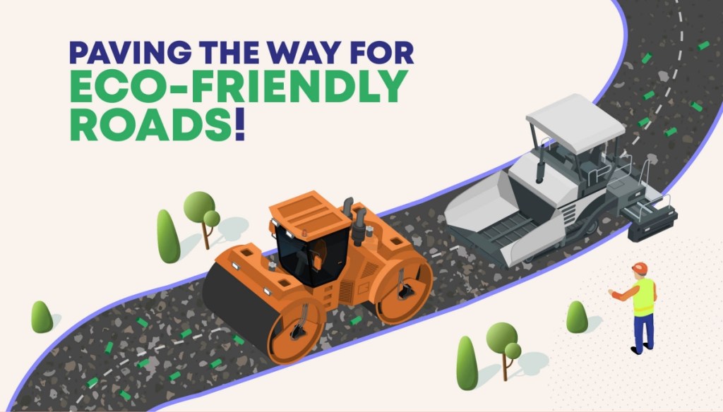

Objective

The primary goal of the Post Matric Scholarship is to reduce the financial burden on students from economically weaker SC and ST communities and to encourage them to pursue education beyond the matriculation level.


Eligibility Criteria

To be eligible for the Post Matric Scholarship, students must meet the following criteria:

  1. Caste Requirements:
    • The applicant must belong to the Scheduled Caste (SC) or Scheduled Tribe (ST) category as recognized by the Government of Madhya Pradesh.
  2. Educational Qualification:
    • Students must have passed Class 10 (matriculation) from a recognized board or institution.
    • The scholarship is applicable for studies at the post-matric level, including higher secondary, undergraduate, postgraduate, diploma, professional, and technical courses.
  3. Income Criteria:
    • For SC students: The family income should not exceed ₹3,00,000 per annum.
    • For ST students: The family income should not exceed ₹6,00,000 per annum.
  4. Domicile:
    • The applicant must be a resident of Madhya Pradesh.
  5. Other Requirements:
    • The student should be enrolled in a government or recognized private educational institution.
    • Students receiving similar scholarships or financial aid from other sources are not eligible.

Benefits of the Scholarship

The benefits of the Post Matric Scholarship include:

  1. Tuition Fee Coverage:
    • The tuition fees for the course are reimbursed directly to the institution.
  2. Maintenance Allowance:
    • A monthly allowance is provided to cover living expenses, books, and other necessities. The amount varies based on the level of study and the type of institution (government or private).
  3. Other Expenses:
    • Examination fees, library fees, and laboratory charges are also covered under the scheme.

Application Process

The application process for the scholarship is entirely online through the Madhya Pradesh Scholarship Portal. Here’s a step-by-step guide:

  1. Registration:
  2. Fill the Application Form:
    • Log in and complete the scholarship application form.
    • Provide details about your academic history, institution, caste certificate, and income certificate.
  3. Upload Documents:
    • Upload scanned copies of the required documents (see the list below).
  4. Verification:
    • Submit the application. The institute will verify the details provided.
  5. Approval:
    • After verification by the institution and authorities, the scholarship amount will be credited to the student’s or institution’s bank account.

Required Documents

Applicants need to upload the following documents during the application process:

  1. Recent passport-sized photograph.
  2. Caste certificate issued by a competent authority.
  3. Income certificate of the family (issued within the past year).
  4. Domicile certificate of Madhya Pradesh.
  5. Previous year’s mark sheet.
  6. Admission proof (fee receipt or admission letter).
  7. Bank account details of the student (linked with Aadhaar).

Important Dates

  • Application Start Date: Generally announced in July or August each year.
  • Application Deadline: Typically by November, with extensions announced as needed.
  • Renewal Applications: Renewal students must reapply before the deadline, providing updated documents.

Key Points to Note

  1. Renewal Process:
    • Students who continue their studies in subsequent years need to apply for scholarship renewal annually.
  2. Monitoring and Transparency:
    • The scheme is monitored through the online portal, ensuring transparency in fund disbursement.
  3. Grievance Redressal:
    • Any issues related to the scholarship can be resolved through the helpline available on the MP Scholarship Portal.

Contact Information

For further assistance, students can contact:

  • Helpline Number: Provided on the official portal.
  • District Education Office: For offline inquiries and document submission.

This scholarship program plays a crucial role in ensuring that financial barriers do not hinder the education of SC and ST students in Madhya Pradesh. By covering tuition fees and providing maintenance support, it encourages higher education and helps bridge the gap in educational opportunities.