

By Devraj Verma
Introduction
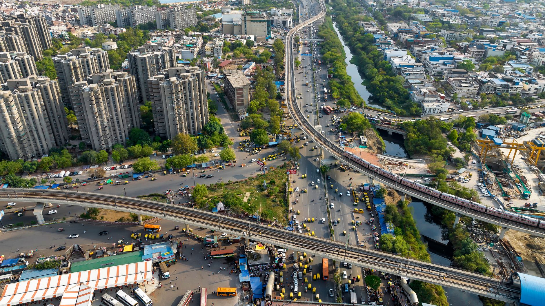
Cities are no longer developing through linear processes in which planners prepare plans, governments implement projects, and communities simply experience the resulting urban environment. Contemporary urbanisation is characterised by continuous change, complex interactions, rapidly evolving technologies, diverse social expectations, and increasingly large volumes of spatial and non-spatial data. Urban governance must therefore evolve from a static, plan-making exercise into a dynamic process of monitoring, interpretation, participation, experimentation, and adaptive decision-making.
The transformation is particularly important in rapidly urbanising countries, where cities are simultaneously dealing with population growth, changing land-use patterns, infrastructure deficits, mobility challenges, environmental pressures, construction activity, and technological disruption. Conventional planning instruments remain necessary, but they are increasingly being complemented by geographic information systems, artificial intelligence, digital twins, machine learning, life-cycle assessment, spatial-network analysis, and other analytical technologies.
Recent research provides a useful basis for examining this transformation. Research on quantitative and qualitative methods demonstrates the importance of selecting appropriate approaches to complex research problems (Dehalwar & Sharma, 2024). Work on route choices to public open spaces illustrates how spatial configuration can influence human movement (Lalramsangi et al., 2025). Life Cycle Assessment of recycled and secondary materials demonstrates the importance of evaluating infrastructure beyond its initial construction stage (Sharma et al., 2024). Research on CA–ANN modelling shows how computational approaches can support urban-growth analysis (Kumar et al., 2025). Green-building research extends sustainability from individual buildings to neighbourhood-scale planning (Sharma et al., 2025). Meanwhile, emerging work on generative AI and digital twins points toward a new generation of digitally enabled urban logistics and management systems (Sharma, 2026).
These studies can be brought together through a different but complementary perspective: the transformation of urban governance from plan-centric governance towards evidence-based, data-enabled and human-centred urban management.
This article explores how such a transformation can occur, focusing on six major themes: data-driven governance, spatial intelligence, accessibility and inclusion, circular resource governance, neighbourhood-scale management, artificial intelligence and digital twins, and the continuing importance of human judgement.
1. From Master Planning to Continuous Urban Governance
The conventional master-planning model is based largely on the preparation of a plan for a defined period. Land uses are identified, development controls are established, infrastructure networks are proposed, and broad spatial strategies are prepared. While this approach remains valuable, urban systems often change faster than statutory plans can be revised.
Population distribution may change within a few years. New employment centres can emerge rapidly. Transportation behaviour can be transformed by ride-hailing, e-commerce, remote work, and new mobility services. Construction technologies change, while environmental conditions and infrastructure demands also evolve.
Consequently, urban governance needs to become more continuous.
Rather than asking only:
What should the city look like in twenty years?
planning institutions increasingly need to ask:
How is the city changing today, why is it changing, and how should planning respond?
This requires continuous monitoring.
Digital maps, satellite imagery, mobile data, traffic information, environmental sensors, building databases, property information, and public feedback can collectively provide a more dynamic picture of urban change. However, collecting data is only the first step. The more important issue is converting information into knowledge and then converting knowledge into appropriate planning decisions.
This is where analytical methodologies become important. Dehalwar and Sharma (2024) emphasise the distinction between quantitative and qualitative approaches, demonstrating that different research questions require different methodological strategies. This principle has direct relevance to urban governance. Numerical data can identify patterns, but qualitative evidence can explain why those patterns occur.
For example, a GIS analysis may identify declining pedestrian movement in a public space. However, only interviews, observation, or participatory research may reveal whether the decline is caused by poor maintenance, safety concerns, lack of shade, changing user preferences, or competing destinations.
The future of urban governance should therefore not be based on data replacing people, but on data and human knowledge working together.
2. Spatial Intelligence as a Foundation of Urban Governance
Urban governance is inherently spatial. Decisions concerning housing, transportation, public facilities, environmental protection, commercial development, and infrastructure all have geographical consequences.
Spatial intelligence refers broadly to the capacity to understand relationships between locations, people, infrastructure, land uses, environmental conditions, and movement patterns.
Geographic Information Systems have already transformed spatial planning by allowing planners to integrate multiple layers of information. However, contemporary spatial intelligence increasingly includes remote sensing, machine learning, network analysis, spatial statistics, and predictive modelling.
Kumar et al. (2025) demonstrate this direction through their work on urban-growth prediction using a CA–ANN model and spatial analysis for planning policy in Indore. The combination of Cellular Automata and Artificial Neural Networks provides a framework for examining how urban development can evolve spatially.
Such models can contribute to governance in several ways.
2.1 Identifying emerging development areas
Instead of waiting until informal or unplanned development has become established, planners can use spatial models to identify areas with a high probability of future urbanisation.
2.2 Anticipating infrastructure requirements
Potential growth areas can be compared with existing transportation, water, sanitation, educational, healthcare, and public-space infrastructure.
2.3 Testing alternative planning strategies
Different land-use or infrastructure scenarios can be evaluated before major investments are made.
2.4 Supporting development control
Predictive spatial information can help planning authorities determine where stronger development controls or infrastructure investments may be required.
However, predictive models should not be interpreted as deterministic forecasts. Urban growth is affected by political decisions, economic changes, infrastructure investment, land markets, migration, social preferences, and unforeseen events. Therefore, computational predictions should be treated as decision-support scenarios rather than inevitable futures.
This distinction is important for responsible urban governance.
3. Accessibility as a Measure of Urban Inclusion
A city may have roads, parks, public buildings, transit stations, and commercial areas, but their existence does not automatically mean that they are accessible to everyone.
Accessibility concerns the ability of people to reach destinations conveniently, safely, affordably, and comfortably. It is therefore more meaningful than simply measuring infrastructure provision.
Lalramsangi et al. (2025) examined route choices for accessing public open spaces in hill cities, highlighting the relationship between spatial configuration and people’s movement. Their research is particularly relevant to cities where topography strongly influences accessibility.
The lesson extends beyond hill cities.
Two neighbourhoods may have the same number of public facilities but substantially different accessibility because of differences in street connectivity, barriers, land-use configuration, pedestrian infrastructure, and terrain.
Accessibility should therefore be incorporated into urban governance through multiple indicators, including:
- walking distance;
- travel time;
- street connectivity;
- route directness;
- public-transport access;
- universal accessibility;
- perceived safety;
- thermal comfort;
- affordability; and
- availability of alternative routes.
The human experience of accessibility is also important. A route may be geographically short but uncomfortable because of steep slopes, inadequate lighting, traffic conflicts, poor pavement conditions, or a lack of shade.
The research of Lalramsangi et al. (2025) reinforces the value of analysing actual route choices rather than assuming that people always follow the mathematically shortest route.
This creates an important governance implication: accessibility should be evaluated from the perspective of users, not only from the perspective of infrastructure providers.
4. Public Spaces as Urban Governance Infrastructure
Public spaces are often treated as aesthetic components of urban development. In reality, they are important social infrastructure.
Parks, plazas, neighbourhood open spaces, streets, waterfronts, playgrounds, and community spaces provide opportunities for recreation, social interaction, informal economic activities, cultural expression, and community life.
Their governance involves more than physical construction. Authorities must also address:
- maintenance;
- safety;
- accessibility;
- programming;
- vegetation management;
- lighting;
- cleanliness;
- universal design;
- community participation; and
- equitable distribution.
The findings of Lalramsangi et al. (2025) concerning access to public open spaces suggest that location and connectivity influence the practical value of these spaces. A large park that is difficult to reach may serve fewer residents than a network of smaller spaces distributed throughout a neighbourhood.
This supports a shift from measuring public-space provision simply in terms of area towards measuring effective accessibility and usability.
Digital technologies can support this process. GIS can identify underserved areas, pedestrian-network analysis can measure accessibility, and community surveys can capture perceptions. Combined, these tools can provide a more comprehensive basis for public-space governance.
5. Circular Governance of Urban Construction
Urban governance also involves managing material flows.
Traditional infrastructure governance often concentrates on procurement and construction. However, cities consume enormous quantities of construction materials, and the resulting waste creates significant environmental challenges.
Sharma et al. (2024) examined the Life Cycle Assessment of recycled and secondary materials in road construction. Their work highlights the importance of evaluating materials through their environmental impacts over the infrastructure life cycle.
This has implications for public procurement and infrastructure policy.
Instead of evaluating infrastructure proposals primarily according to initial cost, public authorities can consider:
- embodied energy;
- carbon emissions;
- raw-material consumption;
- transportation requirements;
- construction waste;
- maintenance requirements;
- durability;
- recyclability; and
- end-of-life recovery.
This approach can transform municipal procurement from a short-term purchasing exercise into a form of circular resource governance.
For example, construction and demolition waste can be viewed not merely as waste requiring disposal but as a potential source of secondary materials. Roads, pavements, buildings, and public spaces can be designed with future recovery and reuse in mind.
Such thinking is especially important for rapidly urbanising cities where infrastructure investment is accelerating.
6. Life-Cycle Thinking in Public Decision-Making
The significance of Life Cycle Assessment extends beyond construction materials.
Governments routinely make decisions involving long-lived assets. A road, public building, drainage system, bridge, or transportation facility may operate for several decades. The initial construction decision therefore creates a long-term pattern of energy use, maintenance, resource consumption, and environmental impact.
Life-cycle thinking requires planners to consider these future implications.
For example, two infrastructure alternatives may have similar construction costs but substantially different maintenance requirements. Another alternative may have a higher initial cost but lower resource consumption over its operational life.
This means that procurement systems need to evolve.
Public authorities can incorporate life-cycle criteria into tendering, infrastructure appraisal, and project evaluation. Environmental performance can become part of decision-making alongside cost and technical feasibility.
Sharma et al. (2024) provide an example of how this approach can be applied to road construction using recycled and secondary materials.
The broader lesson is that sustainability needs to become an institutional criterion rather than an optional project feature.
7. From Green Buildings to Green Neighbourhood Governance
Green-building strategies have traditionally focused on individual buildings. Energy-efficient lighting, renewable energy, water conservation, insulation, efficient mechanical systems, and sustainable materials are common components.
However, Sharma et al. (2025) examine the role of green buildings in creating sustainable neighbourhoods, pointing toward a broader scale of intervention.
The neighbourhood is an important governance scale because it connects buildings with infrastructure and everyday human activity.
A sustainable neighbourhood can integrate:
- energy-efficient buildings;
- public transportation;
- walking and cycling;
- green spaces;
- water-sensitive infrastructure;
- waste management;
- local services;
- community facilities;
- renewable energy; and
- social interaction spaces.
This creates opportunities for coordinated governance.
For example, a municipality could establish neighbourhood sustainability targets rather than focusing only on individual building certification. Indicators might include average walking accessibility, green-space access, energy demand, water efficiency, waste recovery, public-transport accessibility, and environmental quality.
Neighbourhood-scale governance also creates a manageable level for citizen participation. Residents can more easily participate in decisions concerning local parks, streets, public facilities, parking, waste management, and neighbourhood mobility than in metropolitan-scale planning processes.
Thus, the neighbourhood can serve as a bridge between strategic metropolitan planning and individual building management.
8. Artificial Intelligence and the Changing Role of the Planner
Artificial intelligence is increasingly influencing planning practice.
Machine learning can identify patterns in spatial data, predict urban growth, classify land uses, analyse movement patterns, and support infrastructure management. Kumar et al. (2025) demonstrate one application through CA–ANN-based urban-growth prediction.
The emergence of generative AI introduces an additional layer. Unlike conventional analytical models that are designed for particular tasks, generative AI can assist with information synthesis, scenario development, text analysis, communication, and interaction with complex datasets.
This raises an important question:
Will AI replace urban planners?
The more useful question is:
How will AI change what planners do?
Historically, planners have spent considerable time collecting information, preparing maps, analysing documents, preparing reports, and developing scenarios. AI may automate parts of these activities. This could allow planners to devote more attention to interpretation, stakeholder engagement, negotiation, ethics, and strategic decision-making.
However, AI systems can reproduce biases present in their training data. They may also generate plausible but inaccurate information. Therefore, professional verification remains essential.
The planner of the future may increasingly become a curator, interpreter, mediator, and strategic decision-maker, rather than simply a producer of plans and maps.
9. Digital Twins and Urban Governance
Digital twins offer another important development.
Sharma (2026) examines the application of generative AI and digital twins to sustainable last-mile logistics. Digital twins can create virtual representations of physical systems and support scenario testing.
The same principle can be extended to urban governance.
A city digital twin could potentially integrate:
- land-use information;
- building data;
- transportation networks;
- environmental sensors;
- infrastructure conditions;
- energy systems;
- water networks;
- logistics activity; and
- demographic information.
Such a system could help authorities understand how changes in one system influence another.
For instance, a new commercial district may increase traffic, delivery demand, energy consumption, pedestrian activity, and public-space requirements. A digital environment could allow planners to explore these interactions before implementation.
Digital twins can also support infrastructure maintenance. Sensor information could identify deterioration or unusual performance, allowing authorities to move from reactive maintenance towards predictive management.
Nevertheless, digital twins should not become expensive technological platforms without clear governance objectives. Their development should be linked to specific public needs.
Sharma (2026) also highlights issues concerning cost, data privacy, and equity. These considerations are particularly important because digital infrastructure can create new forms of exclusion if smaller businesses, communities, or less technologically capable institutions cannot participate effectively.
10. Data Governance and the Ethics of Smart Cities
The development of data-driven governance creates significant ethical questions.
Who owns urban data?
Who can access it?
How long should it be stored?
Can individual movements be identified?
How should algorithms be audited?
What happens if an AI-based recommendation disadvantages a particular neighbourhood?
These questions demonstrate that smart-city governance cannot be reduced to technology procurement.
Data governance should include principles such as:
- Transparency – people should understand how important data systems are used.
- Privacy protection – personal information should be protected.
- Purpose limitation – data should be collected for legitimate and clearly defined purposes.
- Accountability – institutions should remain responsible for automated decisions.
- Fairness – systems should be assessed for unequal effects.
- Accessibility – public-interest information should be available in usable formats.
- Human oversight – high-impact decisions should not be delegated entirely to algorithms.
These principles are essential if digital transformation is to strengthen public trust.
11. Quantitative Evidence and Community Knowledge
Technology can provide enormous amounts of information, but data alone cannot explain the city.
Dehalwar and Sharma (2024) highlight the distinction between quantitative and qualitative research methods. This distinction becomes especially important in data-driven urban governance.
Consider a neighbourhood where a statistical model indicates low demand for public transportation. The quantitative evidence might suggest that service frequency should be reduced. However, interviews could reveal that elderly residents depend heavily on the service, while limited digital literacy prevents some residents from using alternative mobility platforms.
Similarly, a digital model may identify a particular route as highly accessible, while community members may avoid it because of safety concerns.
These examples demonstrate why urban governance requires methodological pluralism.
Quantitative methods can answer questions such as:
- How many people use a facility?
- How far do they travel?
- How has land use changed?
- What is the predicted growth rate?
- What are the environmental impacts?
Qualitative methods can address:
- Why do people behave in this way?
- How do residents perceive the intervention?
- What barriers are experienced?
- Why do stakeholders disagree?
- How does local knowledge differ from official data?
Combining the two approaches produces richer evidence.
12. Participatory Planning in the Digital Era
The digital transformation of governance should not reduce public participation. Instead, technology can create new forms of participation.
Digital platforms can enable residents to:
- report infrastructure problems;
- identify unsafe locations;
- comment on planning proposals;
- map community assets;
- provide feedback on public spaces;
- participate in surveys; and
- monitor project implementation.
However, digital participation can also exclude people who lack access to technology or digital skills.
Therefore, digital participation should complement rather than replace conventional engagement methods.
Community meetings, interviews, workshops, focus groups, public hearings, and field observations remain important. The methodological perspective discussed by Dehalwar and Sharma (2024) supports this broader understanding of evidence.
The objective should be inclusive participation, not simply digital participation.
13. Integrating Mobility, Land Use and Logistics
Urban governance increasingly needs to address the relationship between passenger mobility and freight movement.
The growth of e-commerce has increased delivery activity in residential and commercial areas. Sharma (2026) discusses how generative AI and digital twins can contribute to more sustainable last-mile logistics, including the integration of electric vehicles and alternative delivery systems.
This issue should also be connected to land-use planning.
Warehouses, distribution centres, commercial streets, residential neighbourhoods, and transport hubs all influence logistics patterns. Poorly located logistics facilities can increase congestion and environmental impacts.
Urban planning can respond through:
- urban consolidation centres;
- designated loading areas;
- low-emission delivery zones;
- electric delivery vehicles;
- cargo-bike infrastructure;
- time-based delivery management;
- logistics-oriented land-use planning; and
- digital route optimisation.
The governance challenge is to coordinate freight requirements with pedestrian activity, public space, residential quality, and environmental objectives.
Digital twins could provide a useful platform for examining these interactions before policies are implemented.
14. Building an Evidence-Based Urban Governance Framework
The research discussed throughout this article can be synthesised into an integrated governance framework.
Step 1: Observe
Use GIS, remote sensing, surveys, sensors, administrative data, and community observations to understand existing conditions.
Step 2: Diagnose
Identify spatial inequalities, infrastructure gaps, accessibility problems, environmental impacts, and emerging development trends.
Step 3: Predict
Apply models such as CA–ANN to investigate potential urban-growth patterns and other computational approaches to explore future scenarios (Kumar et al., 2025).
Step 4: Evaluate
Use accessibility analysis, LCA, building-performance assessment, environmental indicators, and social research to evaluate alternatives (Lalramsangi et al., 2025; Sharma et al., 2024).
Step 5: Engage
Incorporate residents, professionals, institutions, businesses, and other stakeholders through qualitative and participatory approaches (Dehalwar & Sharma, 2024).
Step 6: Simulate
Use AI and digital twins to examine complex scenarios and operational consequences (Sharma, 2026).
Step 7: Implement
Translate evidence into policies, projects, regulations, investments, and programmes.
Step 8: Monitor
Continuously assess outcomes and revise policies as urban conditions change.
This represents a shift from a linear planning cycle towards an adaptive governance cycle.
15. Implications for Indian Cities
The framework has particular relevance to Indian cities, where urbanisation is occurring at different rates and scales.
Metropolitan regions are experiencing rapid peripheral growth, while Tier-2 and Tier-3 cities are expanding and transforming their infrastructure systems. At the same time, many cities contain informal settlements, historic areas, peri-urban landscapes, environmentally sensitive zones, and infrastructure networks developed during different periods.
A single planning model is therefore unlikely to be appropriate for all cities.
Indian urban governance can benefit from:
- locally calibrated spatial-growth models;
- neighbourhood-level accessibility assessment;
- stronger pedestrian networks;
- circular construction practices;
- green-building and neighbourhood strategies;
- integrated land-use and transportation planning;
- AI-supported infrastructure management;
- digital twins for selected urban systems;
- improved public participation; and
- stronger integration of quantitative and qualitative evidence.
The research on Indore by Kumar et al. (2025), the hill-city accessibility work by Lalramsangi et al. (2025), and the material and green-building studies by Sharma and colleagues illustrate how context-specific research can contribute to this broader agenda.
16. Future Research Directions
Several areas deserve further investigation.
16.1 Urban digital twins at neighbourhood scale
Rather than attempting to build complete city-wide digital twins immediately, research could investigate smaller neighbourhood-scale systems that integrate mobility, buildings, public spaces, and infrastructure.
16.2 AI and planning ethics
Future research should investigate algorithmic bias, transparency, explainability, and accountability in planning applications.
16.3 Circular urban metabolism
LCA could be combined with urban material-flow analysis to understand how construction materials enter, circulate through, and leave cities.
16.4 Accessibility for diverse populations
Accessibility studies should incorporate age, disability, gender, income, safety perceptions, and thermal comfort in addition to conventional distance measures.
16.5 Participatory digital governance
Researchers could investigate how digital participation can complement face-to-face engagement without excluding digitally marginalised communities.
16.6 Integration of research methods
Mixed-method approaches could combine spatial modelling, AI, surveys, interviews, observation, and participatory mapping. The methodological distinction discussed by Dehalwar and Sharma (2024) provides a useful foundation for such research.
Conclusion
The transformation of urban governance is not simply a technological transition. It represents a fundamental change in how cities are understood, analysed, managed, and experienced.
Urban governance is moving from static plans towards continuous processes of observation, analysis, participation, implementation, and monitoring. Spatial intelligence can help authorities understand where and how cities are changing. CA–ANN modelling demonstrates the potential for anticipating urban-growth patterns (Kumar et al., 2025). Accessibility research highlights the importance of understanding how people actually navigate urban environments (Lalramsangi et al., 2025). Life Cycle Assessment demonstrates how infrastructure decisions can incorporate long-term environmental considerations (Sharma et al., 2024). Green-building research extends sustainability from individual buildings to neighbourhood-scale systems (Sharma et al., 2025). Generative AI and digital twins create new possibilities for modelling and managing complex urban operations (Sharma, 2026). At the same time, the distinction between quantitative and qualitative approaches reminds researchers and planners that technological data cannot replace human experience and interpretation (Dehalwar & Sharma, 2024).
The emerging model can therefore be described as evidence-based, spatially intelligent, digitally enabled, environmentally conscious, and human-centred urban governance.
The objective should not be to create cities in which algorithms make all decisions. Rather, the objective should be to create planning systems in which better evidence enables better questions, more transparent choices, meaningful participation, and more adaptive policies.
The successful city of the future will not necessarily be the city with the greatest number of sensors or the most sophisticated digital platform. It will be the city capable of combining technology with institutional capacity, scientific evidence with local knowledge, infrastructure investment with environmental responsibility, and computational intelligence with human judgement.
In this context, urban planning remains essential—but its role is changing. The planner increasingly becomes an interpreter of complex evidence, facilitator of multiple interests, evaluator of alternatives, and steward of long-term public value. The integration of spatial analysis, life-cycle thinking, accessibility research, green-building strategies, artificial intelligence, digital twins, and mixed research methodologies can provide the foundations for this transformation.
Ultimately, the digital city should not be understood as a city controlled by technology, but as a city in which technology is responsibly used to understand urban systems, strengthen public institutions, improve accessibility, manage resources, and support better-informed human decisions.
References
Dehalwar, K., & Sharma, S. N. (2024). Exploring the distinctions between quantitative and qualitative research methods. Think India Journal, 27(1), 7–15.
Kumar, G., Vyas, S., Sharma, S. N., & Dehalwar, K. (2025). Urban growth prediction using CA-ANN model and spatial analysis for planning policy in Indore city, India. GeoJournal, 90(3), 139.
Lalramsangi, V., Garg, Y. K., & Sharma, S. N. (2025). Route choices to access public open spaces in hill cities. Environment and Urbanization ASIA, 16(2), 283–299. https://doi.org/10.1177/09754253251388721
Sharma, S. N., Dehalwar, K., Lodhi, A. S., & Jaiswal, A. (2024). Life Cycle Assessment (LCA) of recycled & secondary materials in the construction of roads. IOP Conference Series: Earth and Environmental Science, 1326(1), 012102.
Sharma, S. N., Singh, S., Kumar, G., Pandey, A. K., & Dehalwar, K. (2025). Role of green buildings in creating sustainable neighbourhoods. IOP Conference Series: Earth and Environmental Science, 1519(1), 012018.
Sharma, S. N. (2026). Generative AI and digital twins for sustainable last-mile logistics: Enabling green operations and electric vehicle integration. In A. Awad & D. Al Ahmari (Eds.), Accelerating logistics through generative AI, digital twins, and autonomous operations. IGI Global.
The genie grants you a wish. What is it?
View all responses



You must be logged in to post a comment.