Deserts-‘Something we should know’

Photo by Boris Ulzibat on Pexels.com

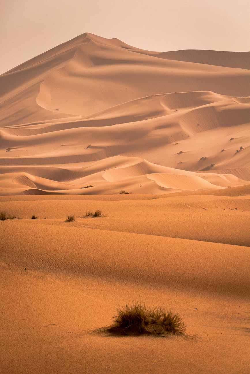
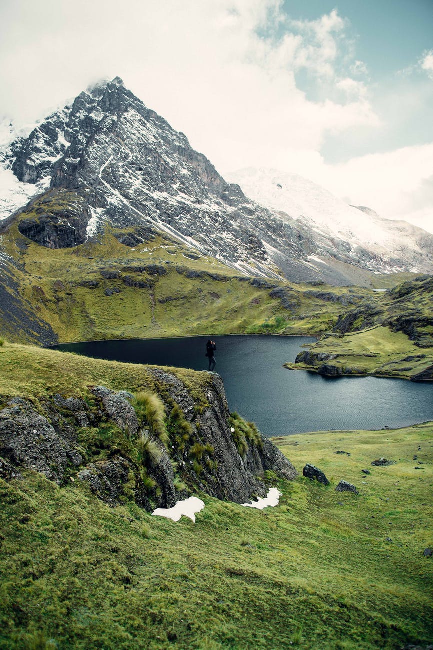
A desert is a stretch of land that can be rocky or sandy, might have zero to some vegetation, might be habitable or might not be live-able but most of all a desert is defined on the basis of amount of precipitation it receives. According to national geographic, a desert receives no more than 25 cm of rainfall per year. Now, let us have a look on the distribution of deserts in the whole world and the possible reasons of their occurrence in those places.

There are 5 types of deserts in the whole world-

  1. Sub tropical deserts- Due to high temperature in the equator, the air gets heated up and absorbs moisture and rise. It reaches high altitudes and the moisture precipitates and comes down as rains. The air cools and the heated air moves away from the equator reaching the tropics. Upon reaching the tropics it cools down and descends where it warms again. Thus it occupies the space meant for moisture laden air and there is no rains in the tropics leading to the formation of deserts in the region. Examples are The Sahara desert in Africa, the Arabian desert, the Syrian desert, the great Victorian desert in Australia, The Thar desert in India. The Sahara desert is the largest sub tropical desert
  2. Coastal deserts- These type of deserts are formed due to the cold oceanic currents that create low pressure in the surrounding regions and the moisture laden winds that should have travelled from the coasts to the continents ends up travelling away instead. Such deserts are formed in the western coasts of continents in lower and middle latitudes and in the eastern side in the upper latitudes (due to the anticlockwise flow of currents in Southern and the clockwise flow of currents in Northern hemisphere). Examples are the Namib deserts in Africa (formed due to Benguela current) and the Atacama desert in Chile (formed due to Peru current). Atacama desert is the driest desert in the world.
  3. Cold deserts and polar deserts- The cold and polar deserts are formed in the Temperate and polar region respectively. These regions are very cold and all the moisture immediately freezes to form ice. The cold deserts exist in regions of high altitude where moisture laden winds cannot reach. Examples are the Antarctic desert(the world largest desert), the Arctic desert, The Ladakh desert, Siberian desert
  4. Interior deserts- Interior deserts are found in the interior of the continents mostly the middle where sufficient moisture laden winds do not reach. Example is the Gobi desert that stretches along both China and Mongolia
  5. Rain shadow deserts-One another subdivision can be of those deserts where the mountains or any other physical feature act as a barrier for the moisture laden clouds. Example is the Death Valley for which four major mountain ranges(including the Sierra Nevada and Panamint Range, according to Wikipedia) act as a barrier and also The Gobi Desert for which the Himalaya act as a barrier(this river is the reason the yellow river appears yellow).

That’s all in deserts. Hit the like if you found it useful and share it among all those who might want to know something about deserts, after all they do form 1/3rd part (and increasing- desertification)of our earth’s continental mass.

The crazy ball and the crazy me

Photo by NEOSiAM 2021 on Pexels.com

The balls above bring back memories. Don’t they? Well, they definitely do for me. When I was a kid, mobiles weren’t very popular and so we had to look for other sources of entertainment that included many board games, those plastic bats, plastic cars and later on those remote controlled ones, a soap bubble maker, stuffed cartoons and bears, cartoon characters in balloons and balls- football, stumper ball, leather balls, table tennis balls, plastic balls, even golf balls, balloon balls and my personal favourite -the crazy balls.

Well, what’s so special about them, you ask. Nothing much, except that once thrown they bounce back soo high and the fact that they come in such attractive colors- neon, green, pink, blue, a mixture of pink and blue, green and yellow and soo many more and the rubber like texture of the balls. You couldn’t help but love it.

And this one fine day, when I was out with my mother and visited a stationery, I saw these crazy balls. Not one or two, but a whole packet. I couldn’t believe they still sell this. Now-a-day, kids have so many sources of entertainment and when they do play outside, it’s usually in those professional stadiums. I thought they had stopped making them. So anyways, when I saw the packet, I couldn’t help but want one. With the best puppy like face I could muster, I looked at my mother and pleaded to have one. My mother looked at me in all her seriousness and she said and I directly quote- “Why do you need one? Are you a kid?”. It was when it stuck me, I wasn’t a kid anymore. I was supposed to be all serious and mature. But then again, feeling that child like excitement once again, after soo long felt strange but it felt soo good. I couldn’t help but want it- both that feeling and the crazy ball. And so I looked at my mother and said, “Yes, I am only a kid “. She smiled. What more could she have said and when I didn’t budge she allowed me to have one. Just like those old days, choosing one was soo difficult. There were soo many colors- neon, green, pink, blue, a mixture of pink and blue, green and yellow, red and green. I took the pink and blue ball and clutched it tightly in my hand all the way back home. The crazy ball sure has me crazy over it. So, gotta go. I still have to play with it. And so, if you ever come across any of those or any of your personal favourites, embrace them. Be a kid. Life is short, the pandemic has taught us this, but our childhood was even shorter. And we all miss it somewhere, sometimes. So when life gives you moments like these, don’t just sit and recollect. Go ahead and relive.

Well, It’s geographically strange…

Photo by Artem Beliaikin on Pexels.com

Hey you all there!!

Here are some facts, I heard or read somewhere and it stuck my mind as strange or unique or interesting and I thought that why not share them with you all. And so here we go-

  1. If most of the sunlight falls on the equator then naturally the oceans in this region should have the highest temperature. But, it turns out that the temperate region’s oceans waters have the highest temperature. And here’s why. The temperature at the equator is high but so is the average yearly rainfall. The higher rainfall sort of counter balances the high temperature. But the rainfall at the temperate regions isn’t that high and so the overall temperature there is higher.
  2. The Norwegian sea lies near the Arctic ocean and its neighbouring countries include Iceland, Greenland and Russia. But, even after being in such a low temperature zone, the water of Norwegian sea doesn’t freeze in winters and the ships are still able to pass while those travelling through Russia aren’t. Well, it is due to a warm oceanic current that goes by the name of Norwegian current that keeps the water way above the freezing point.
  3. The northern part of the Indian ocean experiences both clockwise and anti-clockwise direction of ocean current and it is a feature of the country’s seasons. It was a reason of flourishing trade as well as inter-mixing of the Arabian and the Indian people as the ships travelling had to wait for the seasons to change so that the currents could effectively be used to travel.
  4. Japan has a very high land area as mountainous and a very small area of land. Combine this with the steep continental shelf of the nearby Pacific ocean and the meeting of warm and cold oceanic current, it provides for a very good fishing ground. It is why the Japanese people have a staple diet of fish (in addition to some cultural reasons).
  5. Most of the world’s active volcanoes are concentrated in the Pacific ocean in the ring of fire that is a junction point of several tectonic plates, followed by the Mediterranean sea.
  6. The South pole has a lower temperature as compared to that of the North pole. It is because south pole is a land region surrounded with water and the land region has high altitude mountains that help in lowering the temperature. Most of the ozone holes occur in this region.
  7. The Pacific ocean is sinking and after some million years, it won’t be the largest ocean of the world. Oh! And the Atlantic ocean is expanding, all a result of tectonic plate interaction. This is also why the Himalayas in our country is growing(at the rate of 1 cm/year, though the rate might be soon slowing down as the collision between the Eurasian and Indian plate is slowing down.).
  8. 31 December in Alaska is 1 January in Russia. Now, you know what to do if you happen to stumble upon in Russia during the new year’s eve.

Well, this is all in ‘geographically strange’. If you all like it, I will do a part 2 . Next in this series is ‘biologically strange’. So, stay tuned..

Come, Join me!!

Photo by JAMES WESTMAN on Pexels.com

Come, join me on the path of this river as it begins its journey from the mountain top, travels through the various stages and merges with the sea meeting its end, or is it the beginning of its new life in a new form? Well, it is debatable and a lot about perspective but what stands true is the fact that it goes through various stages, experiences several changes- in itself, in its surroundings and is itself the cause of soo many.

So, come let us join the river in its life course.

The river originates from the mountain top, from the glaciers. This river then travels down the slope, young and full of energy, erosion being its prime activity(vertical corrasion). It, thus, cuts deep through the valley forming gorges and canyons. It is young and naive and arrogant, believes it can do anything. On the way, it meets some hard rocks. They are strong and experienced and do not budge. But the river is adamant and so travels above them, forming rapids and cataracts. It, now, reaches the end of the mountain and has to plunge through a great height. The height could have been the result of the relatives of the above hard rock, who were persistent even when everything else surrounding them was destroyed or it could have been due to the cracks formed between the two plates of the earth, who had seen a lot together but knew it was time to let go or it might have very well been the end of the plateau the river was traversing: maybe, it was time for a new beginning. The river, hence, formed a waterfall, diving towards its new life.

The river has now reached the middle course. It has now lost a lot of its energy, but fairly traded it for wisdom. It again meets the same hard rocks. But now the river knows engaging with them is aa wastage of its energy. And so, it changes its path, curving every time it encounters one. Here, it forms a meander. During the formation of a meander, according to its requirements, it erodes the mud of the outer bank to make space for the water, forming a steep river cliff. It also ends up depositing the mud in its inner bank and mid stream when its needs for space are met. Though, on its path it meets several one of its relatives and some new additions to its family(the tributaries) and has to make space for them(horizontal corrasion). The life here is good. But the river cannot go on this way forever. It has entered the plains and its energy is draining. It has to meet the ocean.

And so , the river now enters its lower course. It, in the beginning, leaves behind the most accommodating waters (forming the ox-bow lake). After all, the world, today, is not a place for the easily bending ones. The river now bears the burden accumulated throughout its life, it sediments. It cannot travel any further carrying the burden. Thus, the river, starts renouncing the burden on its final path. The more silt it deposits, the lighter it feels an the easier it gets to travel. The friends and companions it had accumulated throughout its life, all one-by-one leave it. They will meet again in the sea, but for now each of them has their own journey to make (here, they form a delta).

And this marks the end of life of the river. But, its water is now part of the sea. There, it experiences new challenges in a new place and in a new form.

WBYR- White, Black, Yellow, Red

Photo by Daniel Spase on Pexels.com

The names of the colors seemed strange, didn’t they? And I bet the picture above makes it all a lot more bizarre. But here’s the thing, all those colors above are names of lakes, well seas actually, that are spread all over the world. For those who knew we were gonna talk about seas, I bet you don’t know what gives them this distinctive name. Do you? Well, if you do know where they are located and why they are named so, you can skip the article. Or, you can read it, you know. It can be a wonderful revision and you can let me know if I miss something.

Well let’s start with black lake, shall we? The black lake helps the Urals, the Caspian sea and the Caucasus define the boundary between Europe and Asia. It shares its boundary with Ukraine to the north, Russia and Georgia to the east, Turkey to the south, and Bulgaria and Romania to the west. The black sea is connected to the small sea of Marmara (via the Bosporus strait) which is connected to Aegean sea via the strait of Dardanelles Well, this is something about the geography of the black sea. Now, to why it is known as the black sea. In earlier times, sailors and pirates saw the sea’s blue-green water appear all dark and black, especially during severe storms. Black sea has high concentration of hydrogen sulfide. When metal objects, dead plants and animal matter sunk deeper into the sea, they get covered with black sludge due to the hydrogen sulfide.

The next is Yellow sea. A marginal sea(sea bordering continents, separated from open ocean by island arcs and land ridges) of Pacific ocean, located between mainland China and Korean peninsula, the northwest part of East China sea. The sea becomes golden-yellow due to the yellow colored sand particles that flow in from the Gobi desert (located in Northern China and southern Mongolia).

The third is the red sea. It is located between the Arabian peninsula and the African peninsula. To the south lies the gulf of Aden and to the north lies the Sinai peninsula, the gulf of Suez and the gulf of Aqaba. Its name is a direct translation of its ancient Greek name, Erythra Thalassa, and many people believe that it derives its name because its normally blue-green water occasionally turns reddish-brown in the presence of a cyanobacteria called Trichodesmium erythraeum.

The last is the white sea. It is located in the North-west coast of Russia(in Europe) and is the southern inlet of Barents sea . It is covered with ice for 6-7 months every year. The covering of ice gives it a white color and hence the name.

This is all for the day. See you tomorrow with some more interesting phenomenon happening all around us.

Forget the results(no matter how good or bad)- Class 12

Photo by MART PRODUCTION on Pexels.com

Today, CBSE, The central board of secondary education, has released the class 12th board exam results. According to the statistics available on the internet, we have achieved an overall pass percentage of 99.37 %. That’s an incredible high score, one we aren’t going to break for years, or dare I say, decades to come. And, so unlike many of your relatives or friends or neighbours or acquaintances, I won’t ask your result but I do offer my congratulations.

The CBSE did not conduct the exam this year. And so, though many of you might argue, and rightly so, this grading system wasn’t exactly fair- to those who worked hard throughout the year and didn’t get what they were capable of and to those who didn’t work at all but manage a very decent score, to those who had no access to digital media and to those who had every gadget at their disposal, to those who gave exams last year and to those who will give theirs next.

From the toppers to those who barely made it past the line, everyone do seem to have one thing one mind though. It could have been better. But now that it isn’t, I wish to ask what would have happened with that better result. For a day or two your parents would have been happy, treated you with gifts, but then the third day you would have done something to piss them off and things would have returned to normal. Your neighbours might have praised you in the beginning, but then hey would have found some other thing to bitch about you. Your friends would have been happy or jealous depending on what kind you have but then you would have went to separate colleges and those friends would have been long forgotten. In that new college, though, no one would have given a damn about your result. And this is how the desired ‘better’ result would have made no difference in your result, whatsoever.

Now, many of you might say that a better result means a better college, better career prospects. To all those I would say that it might give you a better kickstart but it certainly cannot dictate your future. Also, it isn’t the only way to kickstart your career . We are Gen-Z. We need not always need support. If you have talent, then I am sure by now you know that you can showcase it to a very large audience, a better one in many cases if you just go on the internet. From the top bollywood musicians to national as well as international public, your music travel oceans and producers. We have all heard ‘Anuv Jain’ or ‘When chai met toast’ or seen ‘Bhuvan Bam’, ‘Tanmay Bhatt’ or ‘Zakir Khan’. Love to cook? Ever heard of ‘Kavita’s Kitchen’. Love to dance? Go see ‘Naach’. We live in the era of talent. Talent and the courage to give it a go and to keep going is all you need. From google to amazon, the top recruiters visit your Github or codechef profile. Participating in international hackathons is just a click away. So, it isn’t as if just an exam hinders our career prospects.

And, at last, this exam was just that- an exam. If you disappointed yourself or your family or your teachers or anyone anywhere, do not worry my friend for you have lived atleast 16 years of your life and you have so many more to live. You have already disappointed them more times than you could count and you will disappoint them in the future, for I don’t know- a million more times, until that one day when you won’t.

Oh! and if you didn’t this time then kindly skip the first two lines of the previous paragraph and read again. It is an infinite loop, you end up disappointing someone with almost every activity (including yourself) until the day when you don’t and then you again do. And the loop repeats. So, why worry instead of preparing for the moment that is somewhere along the path you are currently traversing? That one moment of pride holds the burden of making up for all the disappointments you met along the way and holds the strength for all those you will meet in the future. So why not reduce the load?

Mountains- A history (Part-2)- Tectonic plates

Photo by ROMAN ODINTSOV on Pexels.com

Now, before going any further with our mountains, let us first see the various types of interactions possible between our 2 types of tectonic plates- The Oceanic crust and the Continental crust: The 3 basic interactions are converging boundaries, diverging boundaries and transform boundaries.

  • Converging- It is defined as the two plates moving towards each other, colliding in the process. Now, there are 3 possibilities-
  1. Continental-continental collision- Here, two continental landmasses( eg.- The North American plate or the Eurasian plate or collision of Australia, South America and New Zealand (It formed the Great Australian Dividing range)) collide and the two plates fold over one another and lead to the formation of fold mountains. Try using a paper bringing it closer from the opposite ends. The raised structure represents the fold mountains. They have no volcanic activity (though earthquakes are possible). Examples are the Urals, the Atlas, The Rockies, the Alps, the Himalayas
  2. Oceanic- Oceanic Collision- In these types of collision, the heavier oceanic plate subducts under the lighter oceanic plate(forming trenches- eg. Mariana Trench). Due to subduction, it reaches the area of high pressure and temperature in the mantle and thus melts converting to magma. This magma later rises and when it finds an opening (like the one created by the diverging limbs) in the oceanic crust, it comes out. It, hence, forms oceanic volcanoes, ridges and later volcanic islands like those of Indonesia and the Phillipines.
  3. Continental Oceanic Collision- When a continental and an oceanic plate collide, it leads to the formation of either fold mountains(Rockies) or trenches(Philippines Trench) or both(Andes and the Peru- Chile Trench).
  • Diverging- When two plates or landmasses move away from each other ,in the opposite directions, it is known as diverging. Even here, there are 2 possibilities-
  1. Continental continental diversion- When two continental plates move away from each other, it leads to the formation of rift valleys and plateaus. Examples are- The east African rift valley (formed due to the drifting apart of Arabian peninsular plate from African plate- they were connected millions of years ago).
  2. Oceanic oceanic diversion- It occurs when two oceanic plates move away from each other, creating a ridge in its wake. The Atlantic ocean is divides by a ridge known as the Mid oceanic ridge (named so because it passes through the middle of Atlantic ocean). Here, the plate boundaries of Africa, Eurasia, North America , South America diverge from each other. The Pacific and the Indian ocean are the other two oceans that have ridges.
  • Transform – When one tectonic plate moves past another, it forms transform plate boundary. These plate movements most commonly produce earthquakes as during movements the plates experience friction and intermolecular force of attraction due to which one plate might find itself bounded to another plate. Then, when the plates move past one another it requires a lot of energy and produces heat and waves. Example- the boundary between Pacific plate and North American plate in Western California.

Now, that we know about tectonic plates, studying the formation of mountains becomes a lot easier. Stay tuned for the 3rd part where we will look into the formation of various mountains and the tectonic plates and movements involved . Till then, take care (a smiley emoji).

Mountains- A history(Part-1)

Photo by Sam Kolder on Pexels.com

We have all seen mountains or hope to see them, after all they are a very famous holiday destination. All of us certainly have a wonderful mountain destination in our bucket list- be it the Himalayas, The Rockies, The Alps, Mt. Fuji or the Swiss Alps. But have you ever wondered how these mountains came into being? How is it that a flat piece of earth rose so high, almost touching the sky? Well, if you have, then here is the answer. And if you haven’t, even then a little extra knowledge never hurts anybody, right?

So, the mountains were formed millions and even billions of year ago (the oldest one-the Barberton Greenstone Belt in South Africa, is 3.6 billion year old) when the continents were being formed. The most widely accepted theory, currently, believes that the earth’s mantle(the astenosphere layer- a semi-solid) has convection current flowing through them(a result of differential heating- the lighter material rises whereas the denser material sinks ). This current belt in the astenosphere moves with it the lithosphere(continental crust, oceanic crust and the top-most part of mantle(upper mantle)). These movements in the lithosphere are the movements of continents and oceans that lead to earthquakes , volcanoes, tsunamis and the formation of volcanic islands, plateaus (all these for some other day) and fold mountains as well as volcanic mountains.

These convection currents move with them large pieces of land, ocean or both and these large pieces are termed as tectonic plates. There are currently 7 major and some minor tectonic plates. The major tectonic plates are-

  1. Indo-Australian plate
  2. North American plate
  3. South American plate
  4. Pacific plate
  5. Antarctic plate
  6. Eurasian plate
  7. African plate

The minor plates are-

  1. Fillipino plate
  2. Nazca plate
  3. Scotia plate
  4. Caribbean plate
  5. Indian plate
  6. Arabian plate
  7. Cocos plate
  8. Juan-de-fuca plate

Let us first see the types of mountains. There are 4 types of mountains-

  1. Fold mountains- These mountains are formed when one tectonic plate folds over the other, due to collision of two plate boundaries. The plates need not be continental as is in the case of the Alps , the Atlas and the Himalayas. An oceanic and a continental plate boundary collision can also form a fold mountain. The examples of such fold mountains are the Rockies and the Andes
  2. Block mountains- These mountains are formed due to the diverging plate boundaries. When two boundaries diverge, it creates a crack on the surface between them known as a rift. Later, the surrounding raised plate undergoes erosion and takes the shape of a mountain. Examples are The East African Rift Valley, The Rhine Valley, The Vindhyas and Satpuras .
  3. Volcanic mountains- Mountains formed due to fissures in the earth’s surface, that lead to release of magma. The examples are Mt. Fuji, Mt. Mayon. Also, they are known as mountains of accumulation.
  4. Residual mountains- Mountains that are either formed due to the erosion of existing mountains (denudation) or plateaus(dissection) by agents such as rivers, winds, glaciers. Examples are Mt. Manodnock (The Appalachians) , Highlands of Scotland, Scandinavia and Deccan Plateau.

The movement of the tectonic plates creates one of the above or even a combination of the above kind of mountains. Stay tuned for the next part to know how are many of the world mountains created and where are they located? Is there something common about their location? What is the reason for exceptions?

God Save Ganges- from us!

Photo by Roxanne Shewchuk on Pexels.com

The Ganges River, or the Ganga as we call it, starts from high above in the Himalayas(Bhagirathi flows out of Gangotri glacier from the state of Uttarakhand) and drain into the Bay of Bengal, though before draining into the Bay of Bengal, it creates the world’s largest delta- The Ganges Delta. This delta is extremely fertile, spreading over a very large area and home to a large number of people. The river is known as Ganga from the region where the two rivers of Bhagirathi and Alaknanda meet ,i.e., Devprayag and flows onto the Indo-Gangetic plain. It thus forms a very large part of northern an eastern part of India and also Pakistan, Nepal and Bangladesh. It is the longest river of India and flows over a distance of 2,525, km. on it way downstream, it passes through the cities of Kolkata, Mirzapur, and Varanasi. The river Ganges is the holiest river of the Hindus and many people visit the region of Varanasi where the Ganges flows as it is considered the holiest of all those cities. According to our 2001 census, the Ganga basin alone supports 43 percent of our population. It has the largest drainage area in the whole world. Its tributaries originate from Bangladesh, China (Tibet) and Nepal.

So, now that we understand What is Ganga? Where does it originate? Where does it drain? Let us have a brief look at its importance, not that we need to, because we have been exploiting it since time immemorial. We, of course, know its importance better and its uses.

  1. With its basin spread across 11 north Indian states, it is the primary source of fresh water to people of many of those states.
  2. Not only does it provide water, it is a very important source of livelihood as people settle near its banks and depend on its water as well as fertile plains, producing  rice, wheat, potato, etc. that are important cash crops.
  3. It also provides space for animal husbandry and fisheries, river based trade and transport.
  4. It is home to many unique fauna species- eg. Ganga River Dolphin- our National Aquatic Animal, the endangered turtle and crocodilian species and so many more.
  5. River Ganges holds a very sacred place for the Hindus. The sandy banks are also the burial ground for their loved ones.
  6. Many industries are developed along the banks of the river. It acts as their dumping grounds. Not only for industries, it also acts as the dumping grounds for the nearby population.

But now, this lifeline to the country is the 5th most populated river in the world whose water is not deemed unfit to drink(without treating). (Source: Wikipedia). A recent report by a Delhi based NGO (http://toxicslink.org/docs/Quantitative%20analysis%20of%20Microplastics%20along%20River%20Ganga.pdf) found that the mighty Ganga is heavily polluted with microplastics, especially concentrated in Varanasi and Kanpur, followed by Haridwar. What’s even more shocking is their composition-  industrial and secondary broken-down plastics from articles of everyday use and, of course, religious offerings wrapped in non- degradable plastic. The days are coming when the glory of the Ganges will be a thing of the past. Is this how we treat something we respect, worship and adore? And if this is, as it definitely seems, then all the other natural bodies and organisms beware- Any of you might be our next target for the time of Ganga might come to an end.

Big Data and Social Media

Photo by Pixabay on Pexels.com

Living in an internet governed world with a pandemic hanging over our heads, all of our work has gone online. With thousands of texts, e-mails, pictures, videos, receipts, searches, video-calls and so much more sent daily, we are now generating an incredible 2.5 quintillion bytes of data every day. With 1 quintillion having 18 zeroes, that’s quite a lot of data and it is very difficult for traditional computing systems to handle. This ever-increasing amount of data is known as BIG DATA.
With facebook, instagram, telegram, twitter, sharechat and so many more social media applications coming up and the rising number of social media users with a single user having accounts across multiple social media apps, the amount of big data is increasing and the impact of big data on social media is undeniable. 

Photo by Pixabay on Pexels.com

When-ever you input any data in any social media platform, whether sending a message to your friend discussing about a new car that was recently launched, or making a check-in at a hotel, it gets stored in the form of big data. Various commercial websites let you sign up using your social media accounts asking you to let them access your data. Now, this big data is used by these platforms to suggest you the various products you have either searched or mentioned.
All of our activities spread over these platforms provide for a very reliable source of market study as it is dynamic and changes quickly with the change in demand of consumers. It helps producers keep a track of the consumers’ requirements and initiate necessary changes to meet them.
The big data available help marketers target a specific audience according to their interests, age, gender, education, etc. Various surveys conducted across various social media platforms that appear as per your preferences, requesting information about the products- whether you like it, ways to improve the product or what brand you prefer that makes getting reviews and improving products easier. 
Big data helps analyze what is the trending topic among the mass during some period of time. It helps influencers use it to their benefit to steer public opinions in support of or against various personalities, especially political personalities.
When such amount of our personal data is stored somewhere, that is accessible by others, even after we are, a lot of time, unwilling to share it, it is a significant threat to our privacy. Although, various social media platforms are now trying and so is our government to protect our sensitive data from breach.

That being said, if used judiciously, big data will be a boon owing to its benefits of ease in the field of marketing and research, as the world is increasingly moving online with 59.5 percent of the world population being active internet users as of January, 2021. So, if our sensitive data is protected, or rather, made volatile, big data will definitely continue to revolutionize the world of social media, marketing and research as it does today but without the public worry of data leaks.

Reference links: https://medium.com/dative-io/how-is-big-data-impacting-social-media-df31aa3f66f6 https://en.wikipedia.org/wiki/Big_data

Next Destination: Space

If you are bored from drives, lakes, beaches, resorts, mountains, deserts, valleys, trenches and even underwater sea-diving and have shit ton of money in store, this article is for you. And even you don’t have that kind of money, then hang on. Hopefully, there will be cheaper space-crafts for us as well very soon. And, you would have probably guessed by now. I am talking about this new adventure sport, recently launched in market, very very recently. Last week, Richard Benson, a British Businessman in his ship virgin galactic, made a quick visit to space and another famous businessman, Jeff Bezos is ‘all set to launch’ today. They are opening what we call space-tourism for the wealthy mass of the world.

Photo by Mikhail Nilov on Pexels.com

Space-tourism, as the name itself explains, refers to humans travelling to space for

  • amusement
  • diversion
  • enjoyment
  • fun
  • hobby
  • show-off
  • spending money

what-ever your reason might be, thereby making space accessible to all us non-astronauts who are clearly not interested in space for any scientific purposes, thank you very much. This isn’t the first time a space tourist has visited space. In the year 2001, US millionaire Dennis Tito PAID US $ 20 Million to travel via the Russian Soyuz spacecraft thereby visiting the international space station and even ended up spending 8 days there. There were 7 more people until 2009, before the Russian company closed off this private sale of tickets. And so, now if it makes you think about this ‘amidst nowhere’ proposals or this private floating marriage or even spending your weekend up there, it might someday be your dream come true. Just hang on there for a while, or year, or a decade, maybe.

Till now, Space Adventures was the only private company sending private customers to space. Now, there are 3 more participants in this ‘Race to the Space’- all set to explore this new venturing tourism domain with its high profits and the intense thrill that comes with it- both for the tourists as well as organizers.

  1. Richard Branson’s Virgin Galactic- Started in 2004, its a reusable space plane and can fly off into sub-orbital space. It uses VSS unity space-plane lifted using VSM Eve- a large carrier aircraft. A single ticket is estimated to be priced at  between $300,000 and $400,000 and offers a 2.5 hours flight with 6 min of weightlessness. The space-ship was separated 45 minutes into the flight. It can carry 6 passengers- 2 crew-persons and 4 customers.
  2. Jeff Bezos’s blue origin- Founded in 2000, it works towards vertical take-off into the sub-orbital space as well as vertical landing. It aims for an 11 minute flight after separation and a few minutes of weightlessness. It shows you the curvature of earth before returning. Blue origin flight can take up-to 6 passengers. Unlike other companies, Blue Origin works at providing holidays at affordable rates. So, look out for this one. it might very well plan your next holiday.
  3. Elon Musk’s SpaceX-This company was formed in 2002. Its dragon capsule uses a reusable Falcon rocket to launch itself into space. It is capable of carrying up-to 7 people. The mission is expected to last 3-4 days.

Space tourism has a very high significance in the near future. Seeing the number of millionaires and billionaires across the world, the market is estimated to comprise nearly 2.4 million people in the near future and is a boost to the world economy. And who knows, maybe space tourism might even help us to expand life throughout the space and find us a new place to live in this infinite space. But whatever it may do in this regard, it is bound to increase our interest in space exploration and we might as well make an engineer or a scientist out of it or a wonderful sci-fi and maybe the next world-hit movie. Success of this industry will bring in investments that will lead to development of more advanced technologies in the future. And if we are unable to find somewhere to live, we might end up making one for ourselves. Who knows?

With this rosy picture, painted in our minds, we need to loo at the harms it offers to not only us but the already degraded-due-to-human-activity- “EARTH”. The soot or black carbon that is emitted by rockets gets accumulated in the stratosphere and cannot be washed away by rains and wind and hence, will stay in this region of the atmosphere for years thereby causing serious damage as well as causing elements to escape the earth’s recycling process. After a particular height when we escape the earth’s atmosphere or in the region where the atmosphere thins we are exposed to harmful radiations and solar flares. Also travelling via a space craft can affect our vision, cognition, balance and motor control. The industry has just begun. It might lack the necessary safety equipment or might avoid them in the absence of safety protocols.

The space is a dangerous area we are willing to venture. Before further developments in this field, we need to ask ourselves if space is even meant for humans? Or if we haven’t done enough damage to nature and our surroundings as it is? Is it all worth the harms it offers? Can we do without it? And if we can’t, isn’t it better to leave it to those experts who might extract a lot more than just fun out of it?

How did the Earth come into being??

A whooping 7.9 billion people, 8.7 million discovered eukaryotic species and an estimated 1 trillion microbes- How did it all came into being? How did our Earth or even better, the solar system or the whole universe came into being?

Photo by Pixabay on Pexels.com

So, it all began about 13.8 billion years ago. There existed a single point, a minute, hot and really dense point which violently exploded-‘The Big Bang’, and it is how everything came into being- Matter, Energy space, universe, stars, solar system, me, you-everything. After the explosion took place, it expanded into what we today call the universe. And, what’s more interesting is the fact that it is still expanding, and this is how the scientists came to believe that it all began with a big bang.

Scientists divide the period after the big bang into 2 era-

  1. Radiation era
  2. Matter era

Radiation era

The period between 10^(-43) seconds (after the explosion took place)-the Planck era(here, the current laws of physics do not apply), to about 30,000 years after the big bang is referred to as the radiation era. During this period, the temperature of the atmosphere was soo high that there was no distinction between matter and radiation ,or even better, no matter existed.

It is divided into 7 era or epoch-

  1. Grand unification epoch- Named for the unification of 3 grand forces of nature- Electro-magnetic forces, Weak forces, Strong nuclear forces. With a temperature greater than 1029 K, it began 10−43 s after the big bang. At the end of this epoch, the strong nuclear force broke away from the other two.
  2. Inflationary epoch- With a temperature greater than 1032 K, it began 10−36 s after the big bang. As the name suggests, the universe rapidly expanded in this epoch. The universe, ta this time had electrons, quarks and antiquarks.
  3. Electroweak epoch- Here, now all the 4 forces of nature have split off. Temperature- 10^20 K and time after big bang- 10^(-32)s.
  4. Quark epoch- Temperature here is 10^16K and 10^-12 s have passed since the big bang. All of the ingredients required to form subatomic particles were present but the universe still was too hot and dense.
  5. Hadron Epoch- Temperature- 10^10 K and Temperature-10^-6 s. The universe has not finally cooled down enough for subatomic particles to form and hence, quarks bind to form protons and neutrons.
  6. Lepton epoch- Temperature- 10^ 12 K and finally, about1 sec have passed since the big bang.
  7. Nuclear epoch- Temperature-10^9 K and 100 s approximately have passed since the big bang.

In these last two epoch, when the universe has cooled down quite a lot, the protons and neutrons fuse together to form the very first chemical elements- Hydrogen and Helium. And now that our universe is capable of forming elements, it brings us to the end of radiation era and the matter era begins.

Matter Era

Matter era includes 3 epoch that spread over billions of years and include the formation of our galaxy, solar system and even the present day.

  1. Atomic epoch- With the temperature of 3000 K and time after big bang- 50,000 years, this epic marks the beginning of attachment of electrons to nuclei. This process is known as recombination.
  2. Galactic epoch- Now, 200 million years have passed since the formation of our universe. With the ability of universe to now form Hydrogen and Helium molecules, the universe is dotted with atomic clouds. Within the clouds, due to gravity, clusters were formed which later led to the formation of galaxies.
  3. Stellar epoch- 3 billion years have now passed. Within those clusters of clouds, now stars will be formed. Stars begin their lives as proto-stars. These are formed as a result of gravitational forces between particles of dust and gas and heat is generated due to friction and collision. When the proto-star becomes extremely hot, the process of thermonuclear fusion starts taking place. This is how stars generate heat and electricity. This heat within the clouds convert the already exiting elements into all others that are currently known to humankind. When stars burn themselves and are destroyed in explosion know as supernova, it destabilizes the heat cloud, which then begins to rearrange itself in the shape of a flattened disc. At the center a proto-star forms (eg.- our sun). The clumps of dust are flash heated and form chrondules that later from planetesimals by cohesion. These planetesimals then, later accrete to form what we call today as planets.

And this is how our solar system was formed about 4.5 billion years ago. It is located in the Milky Way galaxy’s Orion Star Cluster and has about 8 planets with a total of 63 moons. The inner 4 planets (also known as terrestrial planets) are separated form the outer 4(also known as jovian planets) by a belt of asteroids. Terrestrial planets are known as such because they are made of rocky material, have solid surface, do nor have rings and are relatively small. Earth, among these, is the only one to have a moon.

The jovian planets, on the other hand, have multiple moons, support ring system, have no solid surface and are immense in size. The Oort Cloud, a collection of icy debris, marks the edge of our solar system as the gravitational and physical influence of sun diminishes .

This is how our solar system and our Earth were formed. Now, can our solar system end? If yes, then how and by when? It’s a question for a later time.

Women in the pandemic

Women , the primary caregivers of almost every family of our country, tend to be the most discriminated against in almost every sphere- whether social, economic, political and especially health. And now as we are stuck in the pandemic, we are bound to bounce back decades on our progress made on poverty, education and healthcare. (Source:  https://unstats.un.org/sdgs) , and the women will , once again, be on the frontline.

Photo by vivek on Pexels.com

LOSS OF LIVELIHOOD-

With the female LFPR of 20.8% in 2019(fallen from 30.27% in 1990) that was not even half the global average of 47% and the women’s share in new formal payrolls below 20% in August 2020, India was no country for working women even before the pandemic. And now, due to the pandemic, women who earlier accounted for only 24% of the total workforce, now share 28% of the total number of jobs lost.

Reasons:

  1. According to Mckinsey study, women did 75% of the world’s total unpaid work. With people being stuck in homes due to the pandemic, the household workload on women increased indefinitely, which is why many of them left their jobs.
  2. Either due to pregnancy and related reasons or due to vaccine hesitancy, fewer women were taking vaccine jabs.
  3. Women are more likely to engage in unorganized sector, hence, being more prone to loosing jobs in such times of crisis. (eg.- tailoring and stitching, house-help)

Post pandemic, women are 11 times more unlikely to return to work and women comprise 48.04% percentage of the population. For a country that wishes for a speedy economic recovery as well as future growth, a 79.8% (and increasing) working population being a liability on the economy doesn’t align well with its economic ambitions.

Degrading social status-

With increased news publishing related to domestic violence, child marriages, sexual abuse and women trafficking during the pandemic, it’s hardly an assumption that the conditions of women will deteriorate further in days to come.

Reasons:

  1. With decreasing family incomes, women school dropout rate has increased and will continue to do so in the near future.
  2. With everything going online, children with no digital equipment accessibility lag behind. The households that are able to afford internet connectivity and mobiles give preference to their male child.
  3. Due to being stuck in the house, the female members spend a larger amount of time doing house-hold work. So, they find less time to devote to studies that now require more effort. Also, it tends to align them more towards house-hold work as well as present them primarily as caregivers amongst the younger generations.
  4. Women increasingly suffer from online harassment. In such cases, it takes a larger amount of time to track down the perpetrator as the person’s identity is unknown.
  5. With the administration occupied with covid-19 management, the cases of child marriage, trafficking and domestic violence are on rise. Women, being stuck in the same house as their molester and many-a-times being financially dependent on them due to job-loss during pandemic, find it difficult to file a complaint.

Health Concerns-

In India, women already suffer from malnutrition, morbidity and various maternal as-well-as reproductive health issues. In addition to this, women are more prone to mental health issues as well. As of July 2005, women represented approximately 40 percent of HIV/AIDS cases in India. These situations of pandemic are bound to worsen the already poor conditions of female health.

Reasons:

  1. The reduction in supply of food due to reducing incomes affect the food security of women the most when compared to any other member of the family.
  2. Women can, now, no longer afford menstrual sanitation products and contraceptives
  3. Being a victim of domestic violence or even stress, a woman’s mental as well as physical well-being will be neglected.
  4. Women with underlying health conditions have, due to declining economic resources, experienced worsening health conditions as a result of skipping medical care.

What can be done??

  1. The PDS system should be expanded to provide dry ration for a longer duration as well as larger amount. It should also include sanitary napkins .
  2. Through ASHA workers, the government should spread awareness related to reproductive health, hygiene and mental health as well.
  3. The government can grant free internet as well as set up mobile towers in areas of low connectivity. Also, internet cafes following proper covid-19 norms should be set up to provide digital equipment to those who cannot afford them.
  4. MGNREGA scheme should be expanded to incorporate the increased number of unemployed with special provision for women, including larger number of working days for all and social schemes should be set up for informal sector workers.
  5. Social awareness about letting girls continue their studies, as well as, motivating women to join workforce when situation stabilize is an important step.
  6. A national helpline number bringing together all NGOs who have come forward to help should be set up. It will make identifying those in need easier, with a uniform toll-free number as well as added government expertise.

Conclusion:

Women can be the backbone of economic development in times of crisis. Making right developments towards women’s issues now could prove to be beneficial to the country’s economy as well as society in the long run.

Assam-Mizoram border dispute

On July 11, 2021, two grenade explosions occurred in Cachar district in Assam near Mizoram border, targeting construction workers. This attack was followed by counter attack from the people of Assam. The main reason appears to be the infamous, unrelenting Assam-Mizoram border dispute.

Image source: https://commons.wikimedia.org/wiki/File:Northeast_india_map.png#filelinks

The Assam-Mizoram border dispute, one of the many state border disputes in India, dates back to the colonial era when several state boundaries were demarcated to suit the British administrative needs. The states of Assam, Meghalaya, Nagaland, Mizoram and Arunachal Pradesh were earlier collectively known as the ‘Greater Assam’. The regional and cultural diversity in this large state was the cause of internal conflict in the state. Also keeping in mind the 1962 border dispute with China, the division of state was essential for national integrity as well as internal peace.

So, the state of Assam was disintegrated to form Arunachal Pradesh(union territory in 1972 and upgraded to a state in 1987) , Nagaland(1987), Meghalaya(1972) , Mizoram(UT-1972 and state-1987) . However, Britishers passed two notifications- 1. The notification of 1875- Defines the boundary between Lushai Hills(present day Mizoram) and Cachar Hills 2. The notification of 1933- Defines the boundary between Lushai hills and Manipur, And thus, when the state of Mizoram was formed, the conflict between Mizoram and Assam started. The state of Assam and Mizoram share a 164 km (approx.) border between Cachar, Hailkandi and Karimganj districts of Assam and Kolasib, Mamit and Aizwal district of Mizoram. Both sides follow a natural border(those of mountains). While disintegrating Assam, the government did not pay due attention to the Tribal realities and ethnic composition. Hence, there continues to be a considerable population of Mizos and Nagas in the Cachar Hills, making it possible for both Mizoram and Nagaland to claim these territories in Assam. Also, the people of Mizoram follow the 1875 notification(they believe the Mizo community was not consulted before issuing the notification) and those of Assam follow the 1933 notification.

This is a long unresolved dispute and its high time that it be solved. Amidst this raging pandemic and its socio-economic implications and growing international tensions, the central government has already got a lot in its plate and dumping these inter-state disputes upon the central government in such times of crisis in no wise move on anybody’s part. And so, the states must themselves come together for a peace negotiation as early as possible or otherwise accept a third party intervention. Or, the central government should revive the inter-state council or set up a zonal council to effectively address these disputes. With the NDA government in power in all these states as well the center, a political solution seems a relatively lucrative option. With growing concerns of Chinese developments amongst several Asian countries, addressing disputes of states that are bound to face Chinese interference via its BRI near India’s North-east becomes all the more important.

The Jagannath Rath Yatra

The Jagannath Rath Yatra is an annual Hindu festival associated with Lord Jagannath celebrated in Puri at the state of Odisha. It is celebrated on the Ashadha Shukla Paksha Dwitiya which is the third month according to the traditional Oriya calendar. A 9-day long event, it is celebrated as the return journey of Lord Krishna- who is known as Lord Jagannath, his brother Balabhadra- also known as Balaram and his sister Devi Subhadra to Vrindavana . On their way back from the Shri Gundicha Temple, the three stop near Mausi Maa’s Temple (their aunt’s abode) where Poda Pitha is offered to them.

The rath yatra begins at the Jagannaath Temple in Puri. The Jagannath Temple is believed to have been constructed by the king of Ganga Dynasty- Ananta Varman Chodaganga Deva in the 12th century(source-wikipedia). The image of Sri Krishna (Lord Jagannath) in the temple of Puri is made of wood and is replaced every 12 or 19 years by an exact replica. This temple is part of the Char Dham( that comprises of the temples of Badrinath, Dwaraka, Puri and Rameswaram).

Every year, the rath of all three deities is newly constructed by a specialized team of carpenters from the wood of a particular type of neem tree and takes about 2 months to construct. They are given hereditary rights for the very same. A week prior to the Rath Yatra, the Jagannath temple’s doors are shut as the lord is believed to have caught a high fever during his annual bath. After the end of the 7-day rest period, the doors are opened and the 3 km Rath Yatra begins, where thousands of devotees from all over the world participate in pulling the raths of the 3 deities to Shri Gundicha Temple. It is a popular belief that anyone who participates in the Rath Yatra is blessed with a good fortune. During the festival, the king dressed as a sweeper, sweeps the area around all the 3 chariots with a golden broom and sprinkles sandalwood water and powder as a part of the Chera Paahara ritual held on two separate days that marks the beginning as well as the end of the Rath Yatra. This day of the beginning of Rath Yatra also marks the beginning of agricultural season and farmers start ploughing their fields. It also marks the beginning of a three weeks long Chandan Yatra.

This year, however, in response to the covid-19 pandemic that is spread across the country, the government said that the Rath Yatra will take place with only 5 vehicles including 3 chariots and no devotees. The Supreme Court also said that the Rath Yatra will take place in limited areas of Puri. It began on the 12th of July,2021.